
Powerful atmospheric river forecast for the U.S. West Coast October 25–31 with heavy rain, mountain snow and high winds
A powerful atmospheric river is forecast to impact the western United States between October 25 and 31, 2025, bringing heavy rainfall, mountain snow, and high winds from Northern California to Washington.
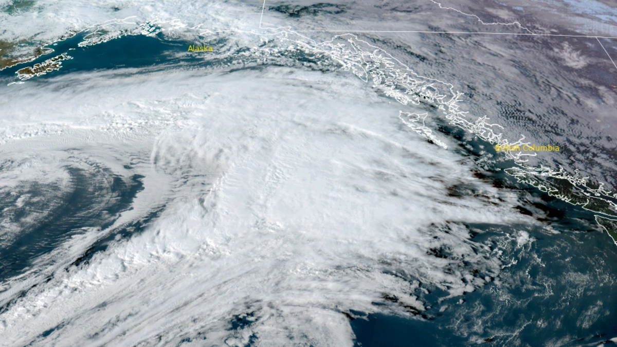
An atmospheric river moving over the U.S. Pacific Northwest at 00:30 UTC on October 18, 2025. Credit: NOAA/GOES-East, RAMMB/CIRA, The Watchers
The Climate Prediction Center (CPC) has forecast a major atmospheric river (AR) event expected to develop along the West Coast during the last week of October 2025.
The system is forecast to deliver widespread heavy rain, strong coastal winds, and substantial high-elevation snowfall across northern California, Oregon, Washington, and parts of the northern Rockies.
According to CPC, there is over a 60% chance of heavy rainfall from northern California to southern Oregon from October 25 to 31, with the strongest moisture transport focused into the Pacific Northwest. Sustained onshore flow is expected to interact with coastal and orographic terrain, enhancing rainfall intensity and extending precipitation inland across the Cascades and northern Sierra Nevada.


Flood potential is elevated across western Washington, Oregon, and northwestern California. CPC’s Probabilistic Hazards Outlook identifies a high risk of heavy precipitation between October 25–26 across northern and central California and southern Oregon, with moderate risk continuing northward through October 28.
Localized flooding, rapid river rises, and urban inundation are possible where soils are saturated or drainage is limited.
Heavy snowfall is forecast at higher elevations of the northern Sierra Nevada, the Cascades, and the northern Rockies.
Early-season accumulations are expected to exceed typical October values in parts of the Sierra crest and Washington Cascades, initiating the 2025–26 winter snowpack.
There is a moderate (40–60 %) probability for high winds along the coastal corridor from Washington to northern California and inland across portions of Montana, Wyoming, and the Four Corners region. Gusts may locally exceed 60 km/h (37 mph) along exposed ridges and coastal headlands, posing additional travel and infrastructure hazards.

For October 23–31, CPC’s 6–10-day and 8–14-day outlooks maintain a strong signal for above-normal precipitation across most of the western United States. Northern California, Oregon, and Washington have forecast probabilities of above 70 % for wetter-than-average conditions. In contrast, drier-than-average conditions are likely across the Southeast and Gulf Coast.

Meanwhile, a quick-moving moderate-to-strong AR with integrated vapor transport (IVT) values exceeding 600 kg m⁻¹ s⁻¹ is forecast to move over the Pacific Northwest on October 18, bringing heavy rainfall to coastal areas of Washington and Oregon, United States.
This event is expected to last just over 14 hours, producing significant precipitation within a short period before moving eastward.

I am an Assistant Editor and Severe Weather & Science Journalist at The Watchers, specializing in real-time severe weather coverage, geophysical event reporting, and research-driven scientific analysis. You can reach me at rishav(at)watchers(.)news.
Commenting rules and guidelines
We value the thoughts and opinions of our readers and welcome healthy discussions on our website. In order to maintain a respectful and positive community, we ask that all commenters follow these rules.