
Severe storms produce tornadoes near De Roche, Arkansas, and southwest of Yazoo City, Mississippi
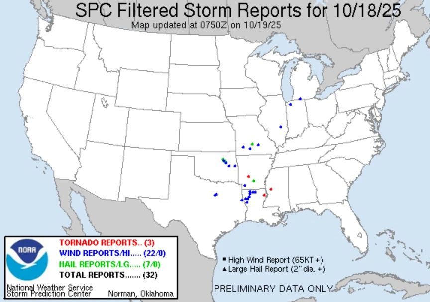
Several tornadoes were reported across Arkansas, Louisiana, and Mississippi on the evening of October 18, 2025, including a radar-confirmed tornadic debris signature 3 km (2 miles) southwest of Yazoo City, Mississippi, at 21:34 LT. Earlier, a tornado caused structural damage in Hot Spring County, Arkansas, near De Roche, while another debris signature was detected near Warsaw, Louisiana, as supercells moved east across the Lower Mississippi Valley.
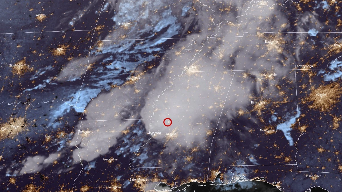
Satellite image centered over Yazoo City, MS at 02:30 UTC on October 19, 2025. Credit: NOAA/GOES-East, RAMMB/CIRA, The Watchers
The Storm Prediction Center’s preliminary storm reports list a tornadic debris signature detected on radar at 21:34 LT on October 18 (02:34 UTC, October 19), approximately 3 km (2 miles) southwest of Yazoo City in Yazoo County, Mississippi.
The signature was associated with a strong, likely long-track supercell moving northeast across Yazoo County.
At this stage, no official information on path length, width, or damage assessment has been released by the NWS. Preliminary radar analysis indicates debris was lofted several kilometers into the atmosphere, consistent with a strong tornado.

Yazoo City and its surroundings have a well-documented history of violent tornadoes, most notably the EF-4 event of April 24, 2010, that caused catastrophic damage and multiple fatalities.
The October 2025 circulation tracked in close proximity to that historical path, but any overlap or comparative intensity will remain unconfirmed until post-storm surveys are completed.
Earlier in the outbreak sequence, the SPC received multiple reports of a tornado on the ground in Hot Spring County, Arkansas, near Highway 128 and Hickory Grove in the New De Roche area at 15:57 LT (20:57 UTC). Images posted by storm chasers show damaged homes and downed trees south of De Roche.
Another radar-confirmed tornadic debris signature was detected near Warsaw in Madison Parish, Louisiana, at 19:49 LT (00:49 UTC) before the Yazoo County storm developed further east.
Residents across central Mississippi remained under several tornado warnings through the evening as rotating supercells advanced from Louisiana into Mississippi. Local power outages and scattered structural damage were reported in parts of Yazoo and Madison counties, but comprehensive damage mapping is still underway.

Teo Blašković founded The Watchers in 2011 and edited it until 2026, covering seismic and volcanic activity, extreme weather, space weather and near-Earth objects. Articles on this page are his archive.
Earlier reporting
Nothing on Watchers was published in the last 24 hours. These are older articles.
- 2 atmospheric rivers to bring heavy Sierra snow and California flood risk
- On October 22, 2017, a single flash of lightning stretched 515 miles from eastern Texas to near Kansas City, a distance that takes eight hours to drive, and nobody realized how far it had gone until scientists went back through the satellite data years later Epicenter
- CPC posts a slight risk of heavy rain from the Gulf Coast to the Northeast urban corridor November 25-29, and a moderate risk of West Coast wind and Sierra snow on November 25
- Florida's east coast faces a moderate flash flood risk Wednesday through Friday, with 4 to 8 inches of rain forecast and the St. Johns River near Cocoa already in major flood at 17.13 feet
