
Major winter storm to impact Christmas travel in Plains and Midwest with heavy snow, blizzard conditions and ice
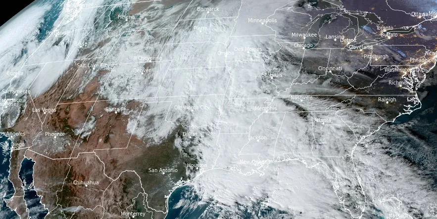
Image credit: NOAA/GOES-East, RAMMB/CIRA, The Watchers. Acquired at 20:50 UTC on December 24, 2023
The NWS Weather Prediction Center warns of heavy snow, blizzard conditions, and freezing rain across the Northern Plains, Central Plains, and Upper Midwest, significantly impacting holiday travel through December 26, 2023.
As the holiday season peaks, a major winter storm is set to create dangerous travel conditions across the Northern Plains, Central Plains, and Upper Midwest. The National Weather Service (NWS) Weather Prediction Center has issued key messages, highlighting the potential for heavy snow, blizzard conditions, and freezing rain through Tuesday, December 26, 2023.
This impactful winter storm is expected to develop tonight, December 24, 2023. The NWS anticipates significant snowfall, with rates of 25 – 50 mm (1 – 2 inches) per hour, especially in parts of South Dakota and Nebraska. Regions such as south-central South Dakota into central Nebraska are likely to experience more than 30 cm (12 inches) of snow, while most of Nebraska, South Dakota, and northern Kansas could see over 10 cm (4 inches) of accumulation.
The storm’s intensity will result in dangerous blizzard conditions due to the combination of heavy snowfall and strong winds, with gusts reaching up to 90 km/h (55 mph). These conditions are expected to create near-impossible travel scenarios, with snow-covered roads and whiteout conditions. Moreover, the strong winds pose a risk of causing tree branch and power line damage.
In addition to snow, parts of the Upper Midwest are set to experience a wintry mix of sleet and freezing rain starting Monday afternoon. The likelihood of accumulating 2.5 mm (0.1 inches) or more of ice across regions like southwest Minnesota, eastern Dakotas, and towards the Arrowhead of Minnesota is high. This could result in slippery roads and walkways, and isolated power outages are a possibility.
The storm is anticipated to have widespread travel impacts, affecting road and air transportation significantly. With the forecast indicating heavy snow enveloping areas from central Kansas to northern Minnesota, drivers and travelers are advised to exercise extreme caution.
As the storm moves eastward into the central High Plains on December 26, the weather conditions are expected to gradually weaken. However, the Red River Valley of the North and northern Minnesota will continue to grapple with icy conditions.
Simultaneously, a new potent Pacific storm system is predicted to bring heavy coastal rain and wintry precipitation to the Cascades by Monday night and into Tuesday morning. This could lead to hazardous travel conditions in regions like the Columbia River Valley and Basin.
References:
1 Key Messages for Christmas Winter Storm – NWS WPC – December 24, 2023
2 Short Range Forecast Discussion – NWS Weather Prediction Center College Park MD – 256 PM EST Sun Dec 24 2023
I'm a dedicated researcher, journalist, and editor at The Watchers. With over 20 years of experience in the media industry, I specialize in hard science news, focusing on extreme weather, seismic and volcanic activity, space weather, and astronomy, including near-Earth objects and planetary defense strategies. You can reach me at teo /at/ watchers.news.
Commenting rules and guidelines
We value the thoughts and opinions of our readers and welcome healthy discussions on our website. In order to maintain a respectful and positive community, we ask that all commenters follow these rules.