
Increasing risk of wind, coastal flooding, and rain for New England and Atlantic Canada due to Hurricane “Lee”
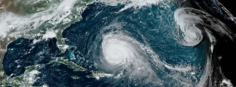
Featured image: Image credit: NOAA/GOES-East, RAMMB/CIRA, The Watchers. Acquired at 19:50 UTC on September 12, 2023
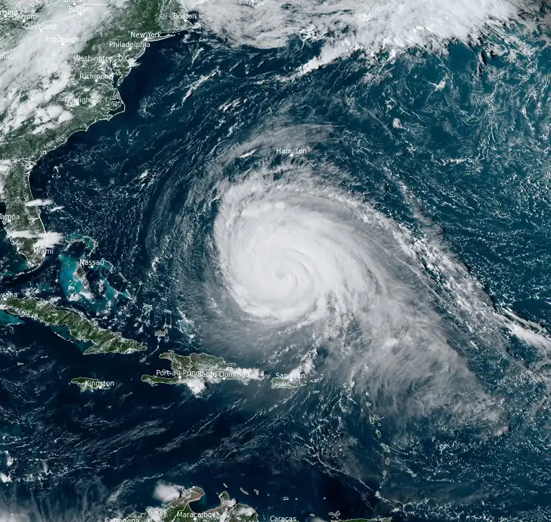
As of 5:00 AM AST (9:00 UTC), Hurricane “Lee” — a Category 3 storm on the Saffir-Simpson Hurricane Wind Scale, is intensifying and poses an increasing threat to portions of New England and Atlantic Canada.
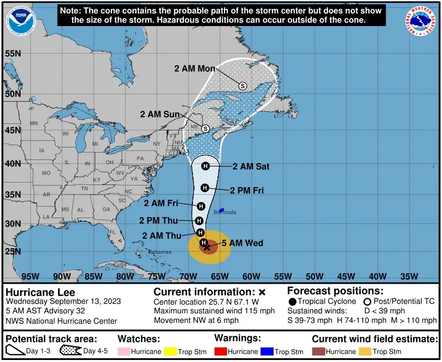
The hurricane is currently located approximately 765 km (475 miles) south-southwest of Bermuda. It had maximum sustained winds of 185 km/h (115 mph) and is moving northwest at a speed of 9 km/h (6 mph). The hurricane’s minimum central pressure was recorded at 948 hPa.
Currently, a Tropical Storm Warning is in effect for Bermuda, indicating expected tropical storm conditions within the next 36 hours. Residents and interests in the northeastern United States and Atlantic Canada are advised to closely monitor Hurricane Lee’s progress. Additional watches may be issued for these regions later today or tonight.
Lee is anticipated to shift towards the north-northwest later today. This will be followed by a northward turn and an acceleration in its speed on Thursday and Friday, September 14 and 15. Based on current projections, the hurricane’s center will bypass Bermuda to the west on Thursday and Thursday night. By the end of the week, it is expected to approach the coastlines of New England or Atlantic Canada.
While some weakening of the hurricane is forecasted over the next few days, Lee is projected to remain a large and dangerous hurricane into the weekend. Hurricane-force winds extend up to 185 km (115 miles) from its center, with tropical storm-force winds reaching out to 390 km (240 miles).
Hazards affecting land
Bermuda is bracing for tropical storm conditions starting tonight or early Thursday. Swells produced by Hurricane Lee are currently impacting regions including the Lesser Antilles, the British and U.S. Virgin Islands, Puerto Rico, Hispaniola, the Turks and Caicos Islands, the Bahamas, and Bermuda. These swells pose a significant risk, likely causing life-threatening surf and rip current conditions. The southeastern U.S. coast is already experiencing these dangerous conditions, which are forecasted to extend northward along much of the U.S. East Coast and Atlantic Canada in the coming days.
In terms of rainfall, Bermuda can expect to receive between 25 to 50 mm (1 to 2 inches) from Lee’s outer rain bands from Thursday to early Friday.
Residents in the affected areas are urged to stay updated with the latest advisories and to take necessary precautions.
References:
1 Hurricane Lee Advisory Number 32 – NWS National Hurricane Center Miami FL – 500 AM AST Wed Sep 13 2023
The Watchers team and our contributors bring the latest on extreme weather, earthquakes, volcanic eruptions, space weather, and all things science. We're all about making sense of the natural world and keeping you informed on what’s happening. Got a tip or a question? Hit us up using the form at newstips!
Commenting rules and guidelines
We value the thoughts and opinions of our readers and welcome healthy discussions on our website. In order to maintain a respectful and positive community, we ask that all commenters follow these rules.