
Major early spring storm system set to impact millions in the U.S.
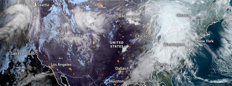
Image credit: NOAA/GOES-East, Zoom Earth, The Watchers. Acquired at 12:50 UTC on March 31, 2023
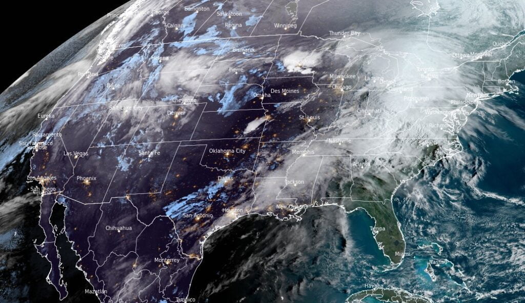
A major early spring storm system is set to impact the central and eastern United States with severe thunderstorms, high winds, and heavy snow from March 31 to April 1, 2023.
A major early spring storm system is expected to bring a wide range of weather hazards across the central and eastern United States from March 31 to April 1, 2023, according to NWS forecaster Snell. The deepening low pressure system will push northeast from the central Plains today and enter the Great Lakes region by tonight.
Severe weather, including damaging wind gusts, large hail, and several tornadoes (some strong), is expected between the Midwest and Lower Mississippi Valley. The Storm Prediction Center has issued a Moderate Risk (level 4/5) of severe thunderstorms across parts of southeast Iowa, northwest Illinois, and northeast Missouri, as well as a separate area from northeast Arkansas to far western Kentucky.
“Residents are advised to remain weather-aware and have multiple ways to receive weather alerts,” Snell said, adding that along with the severe weather threat, storms may also contain intense rainfall rates that could last long enough to produce isolated-to-scattered areas of flash flooding.
The greatest risk for flooding resides across the Ohio, Tennessee, and Lower Mississippi valleys through tonight. By Saturday, April 1, a trailing secondary cold front could lead to forming thunderstorms capable of containing damaging wind gusts across the northern Appalachians and Interior Northeast.
In addition to severe weather, high winds are expected to impact a widespread area of the country, with wind gusts up to 100 km/h (60 mph) causing tree damage and power outages across the Great Plains, Middle/Lower Mississippi Valley, Tennessee, and Ohio valleys. Wind gusts up to 72 km/h (45 mph) are expected farther east into the Mississippi and Tennessee valleys.
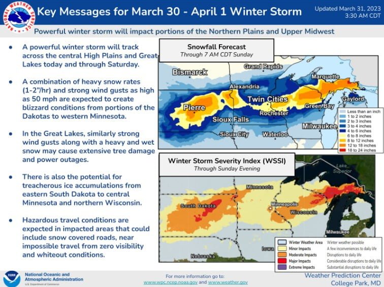
Heavy snow and patches of freezing rain are likely from South Dakota to the Upper Peninsula of Michigan through Saturday morning, with blizzard conditions expected for parts of South Dakota and southwestern Minnesota. Heavy snowfall rates and gusty winds as high as 80 km/h (50 mph) could lead to snow-covered roads and near-zero visibility at times.
Meanwhile, heavy mountain snow and lower elevation rain are forecast to hit the Pacific Northwest between tonight and the first day of April, with several feet of snow anticipated throughout the Cascades. This system will move into the Plains on Sunday, bringing scattered thunderstorms and potential flash flooding from the Arklatex to central Mississippi.
References:
1 Short Range Forecast Discussion – NWS Weather Prediction Center College Park MD – 353 AM EDT Fri Mar 31 2023
The Watchers team and our contributors bring the latest on extreme weather, earthquakes, volcanic eruptions, space weather, and all things science. We're all about making sense of the natural world and keeping you informed on what’s happening. Got a tip or a question? Hit us up using the form at newstips!
Commenting rules and guidelines
We value the thoughts and opinions of our readers and welcome healthy discussions on our website. In order to maintain a respectful and positive community, we ask that all commenters follow these rules.