
Coldest wind chills in decades expected in parts of the U.S.
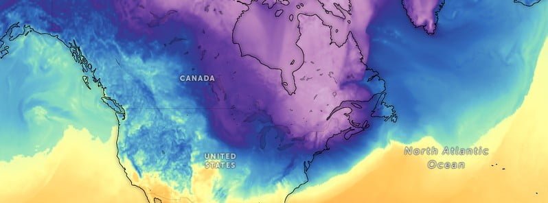
Image credit: GFS/Zoom Earth, The Watchers
A strong Arctic front will race across the Great Lakes on Thursday, February 2, 2023, and then push through the Northeastern parts of the United States tonight, bringing the coldest wind chills in recent memory.
- Gusty northwesterly winds will result in dangerously cold wind chills in the Northern Plains and Upper Midwest, with temperatures between -31 °C to -37 °C (-25 °F to -35 °F).
- Wind chills in New England will be even colder, leading to temperatures between -40 °C to -45 °C (-40 °F to -50 °F). Northern Maine could see wind chills as low as -54 °C (-65 °F), matching some of the coldest weather in decades.
- Wind Chill Warnings have been issued to further highlight the dangerous cold.
- Officials are urging residents to limit time outside during this extreme weather event and dress in layers as frostbite and hypothermia in these conditions can occur in a matter of minutes.
A cold front sweeping southward across the country will continue to bring bitter Arctic temperatures to the Northern Plains, Midwest, and Northeast.
On Friday, February 3, the high temperatures in the Midwest to the Interior Northeast/New England will range from about -17 °C to -12 °C (1 °F to 10 °F), with some areas closer to the Canadian border in New England experiencing temperatures as low as -20 °C (-4 °F).
The I-95 urban corridor along the coast will have higher temperatures, ranging from -12 °C to -6 °C (10 °F to 21 °F).
The cold weather will persist in the Northeast on Saturday, February 4, with potential record-tying/breaking lows of -12 °C to -18 °C (10 °F to -0.4 °F) for New York City and up to -23 °C (-9 °F) for Boston and Providence.
Gusty northwesterly winds of up to 50 km/h (31 mph) will result in dangerously cold wind chills between -31 °C and -37 °C (-25 °F and -35 °F) for portions of the Northern Plains and Upper Midwest.
The wind chills will be even colder in New England, with gusts of up to 70 km/h (44 mph) leading to wind chills between -40 °C and -45 °C (-40 °F and -50 °F). The wind chill in Northern Maine could reach as low as -54 °C (-65 °F), matching some of the coldest weather in decades.1
Officials are urging residents to limit time outside during this extreme weather event and dress in layers as frostbite and hypothermia in these conditions can occur in a matter of minutes.
In addition to the cold, snow squalls will be possible as the front moves through late Thursday night, bringing quick bursts of heavy, blinding snow and suddenly treacherous travel conditions.
The post-frontal flow over the Great Lakes will also result in moderate to heavy lake-effect snow, especially for the Upper Peninsula of Michigan along Lake Superior and east of Lakes Erie and Ontario in New York.
Southern regions will not experience the same level of cold as further north, but temperatures will still be much below average for this time of year. The high temperatures on Friday and Saturday from the Tennessee Valley to the Carolinas will range from -1 °C to 4 °C (30 °F to 39 °F), with temperatures of 10 °C to 15 °C (50 °F to 59 °F) for the rest of the inland Southeast, and 15 °C to 20 °C (59°F to 68°F) on the Gulf and Atlantic coasts.
Fortunately, the blast of cold air will be short-lived. A subtle ridge aloft moving west to east over the Plains/Midwest from Friday to Saturday will bring more moderate temperatures to the region.
The warm-up will begin on Friday in the High Plains, with temperatures ranging from 7 °C to 15 °C (45 °F to 59 °F). The warmer temperatures will spread eastward on Saturday, with the Northern Plains and Midwest experiencing temperatures of -1 °C to 4 °C (30 °F to 39 °F), temperatures of 7 °C to 15 °C (45 °F to 59 °F) for the Central Plains, and temperatures of 7 °C to 20 °C (45 °F to 68 °F) for the Southern Plains. The East Coast will also experience quick moderation of temperatures after Sunday, February 5.
References:
1 Short Range Forecast Discussion – NWS Weather Prediction Center College Park MD 259 PM EST Thu Feb 02 2023
I'm a dedicated researcher, journalist, and editor at The Watchers. With over 20 years of experience in the media industry, I specialize in hard science news, focusing on extreme weather, seismic and volcanic activity, space weather, and astronomy, including near-Earth objects and planetary defense strategies. You can reach me at teo /at/ watchers.news.
Commenting rules and guidelines
We value the thoughts and opinions of our readers and welcome healthy discussions on our website. In order to maintain a respectful and positive community, we ask that all commenters follow these rules.