
Extremely cold Arctic air to impact much of U.S.
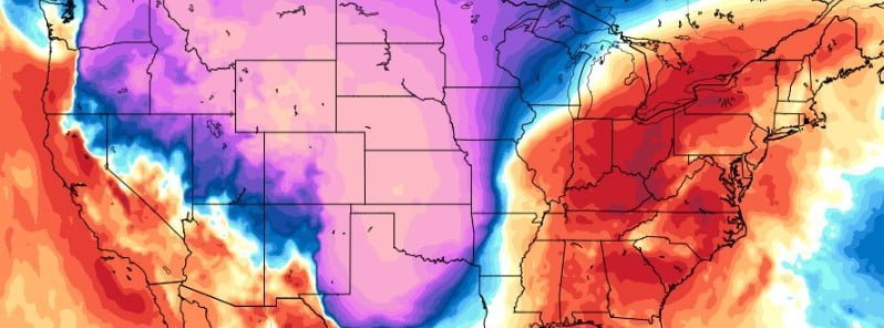
Image credit: GFS, Tropical Tidbits. Model for 00:00 UTC on December 23, 2022
A massive surge of extremely cold Arctic air will consume much of the Lower 48 this week with well below-normal temperatures stretching from the Northwest into the Eastern two-thirds of the U.S.
- Numerous Wind Chill Warnings, Advisories, and Watches have been issued across the northern High Plains that will likely remain in effect for much of the week
- Multiple days of heavy snowfall are expected in the northern Rockies, resulting in a combination of Winter Storm Warnings, Advisories, and Watches
- Confidence continues to grow in a powerful winter storm developing during the second half of the week. Disruptive snowfall accumulations, damaging wind gusts, and bitterly cold temperatures in the storm’s wake are expected
The first half of the week starts off on a chilly note across the majority of the Lower 48, NWS forecaster Mullinax noted.1
This is due to areas of high pressure — one over the eastern half of the continental U.S. and a strong Arctic high over southwestern Canada.
The Arctic front continues to inch its way south through the Northwest and Northern Plains with bitterly cold temperatures associated with the Arctic high located north of the front.
Daytime highs over central and eastern Montana on Monday, December 19 will struggle to get above -17 °C (0 °F) today, while daytime lows ranging from -17 to -26 °C (0 to -15 °F) will be common from eastern Washington to the Upper Mississippi Valley.
By Tuesday, December 20, the core of the exceptionally colder temperatures in the Canadian Prairies pushes even more into the northern High Plains with dangerously cold and windy conditions.
Daytime lows on Tuesday dip as low as -28 to -34 °C (-20 to -30 °F) in parts of Montana, with sub-zero lows bleeding more into the central High Plains.
Blustery winds throughout the region are responsible for bone-chilling wind chills, ranging as cold as -34 °C (-30 °F) to even -51 °C (-60 °F).
This has prompted the issuance of numerous Wind Chill Warnings, Advisories, and Watches across the northern High Plains that will likely be in effect for much of the week.
With such impressively cold temperatures present, wintry precipitation is also expected in some portions of the northern U.S.
In the Northeast, lake-effect snow showers stick around one more day as Lake Effect Snow Warnings are out downwind of Lakes Erie and Ontario with several more inches of snow possible through Monday afternoon.
Northern Maine is also likely to see light snow accumulations from a nearly stationary wave of low pressure off the coast of Nova Scotia.
In the Midwest, a frontal system tracking northeast today will aid in developing periods of light snow from eastern Kansas on, north to northern Minnesota and the Upper Great Lakes.
The heaviest snowfall is set to occur in the northern Rockies where the strong upslope flow from brisk easterly winds will lead to multiple days of heavy snowfall. The heaviest of which comes on Tuesday, when a combination of the upsloping winds and an injection of Pacific moisture running into the bitterly cold air mass in place results in an expansive area of heavy snowfall.
The Latest WPC snowfall probabilities show 60-80% odds for more than 20 cm (8+ inches) of snow in the Cascade Range, the Bitterroots, the Lewis Range, and the Tetons on Tuesday.
A combination of Winter Storm Warnings, Advisories, and Watches have been issued for this multi-day snowfall event.
Farther south, an organizing wave of low pressure will traverse the Gulf of Mexico and produce widespread showers and thunderstorms along the Gulf Coast.
WPC has issued Marginal Risks for Excessive Rainfall for today from eastern Texas to the central Gulf Coast, then from the mouth of the Mississippi River to much of the coastal Southeast.
This storm will be fairly progressive, eventually tracking into the Bahamas by mid-week.
After this storm system exits, attention turns to the Nation’s Heartland where confidence continues to grow in a powerful winter storm developing the second half of the week.
Disruptive snowfall accumulations, damaging wind gusts, and bitterly cold temperatures in the storm’s wake are expected.
References:
1 Short Range Forecast Discussion – NWS Weather Prediction Center College Park MD – 258 AM EST Mon Dec 19 2022
I'm a dedicated researcher, journalist, and editor at The Watchers. With over 20 years of experience in the media industry, I specialize in hard science news, focusing on extreme weather, seismic and volcanic activity, space weather, and astronomy, including near-Earth objects and planetary defense strategies. You can reach me at teo /at/ watchers.news.
Commenting rules and guidelines
We value the thoughts and opinions of our readers and welcome healthy discussions on our website. In order to maintain a respectful and positive community, we ask that all commenters follow these rules.