
Ian forecast to approach Florida as an extremely dangerous major hurricane – life-threatening storm surge, catastrophic winds and flooding expected
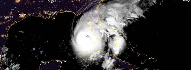
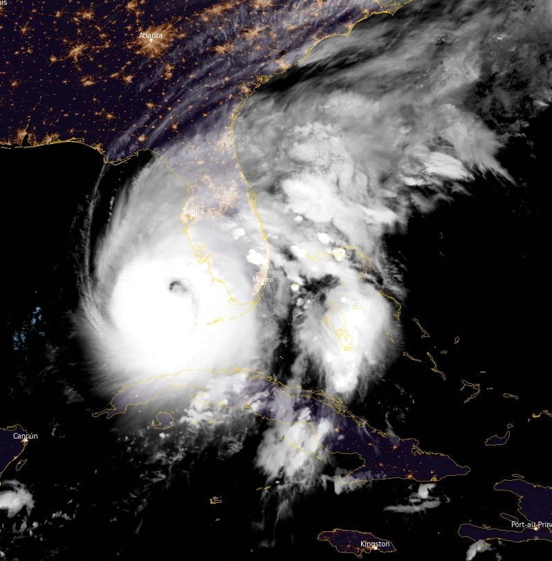
Featured image: Hurricane "Ian" at 07:40 UTC on September 28, 2022. Credit: NOAA/GOES-East, RAMMB/CIRA, The Watchers
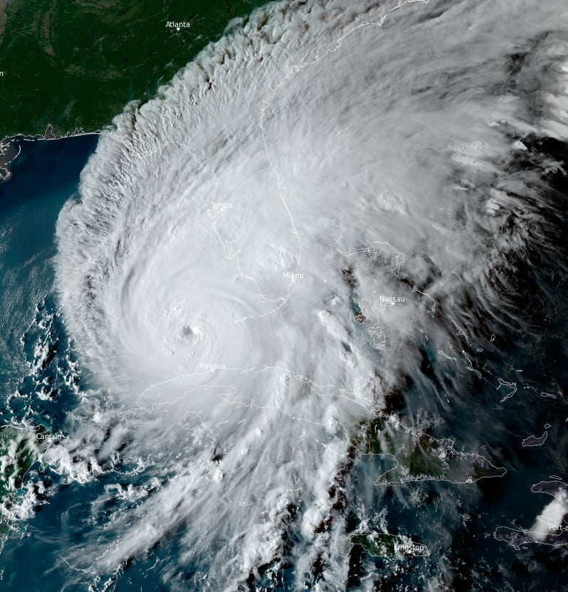
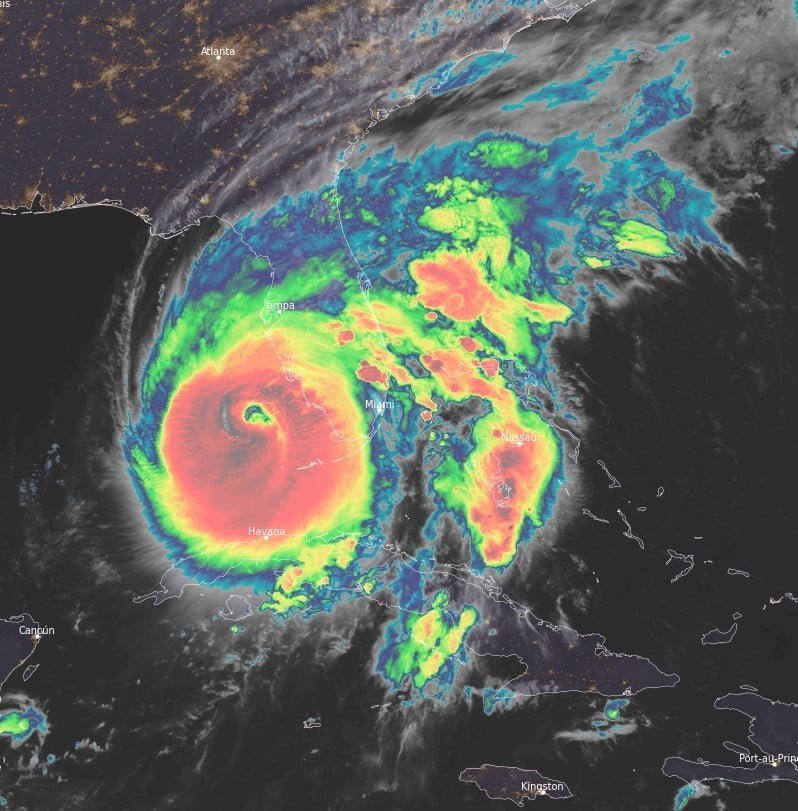
The center of Hurricane “Ian” is expected to approach the west coast of Florida this morning, September 28, 2022 (LT), and make landfall later today. Strengthening is forecast until it makes landfall, and Ian is forecast to approach the west coast of Florida as an extremely dangerous major hurricane.
At 06:00 UTC on September 28, Ian was still a Category 3 hurricane with maximum sustained winds of 195 km/h (120 mph) and minimum central pressure of 953 hPa.
Its center was located about 155 km (95 miles) SW of Naples, Florida; moving NNE at 17 km/h (10 mph). At 07:00 UTC, it was 145 km (90 miles) SW of Naples.
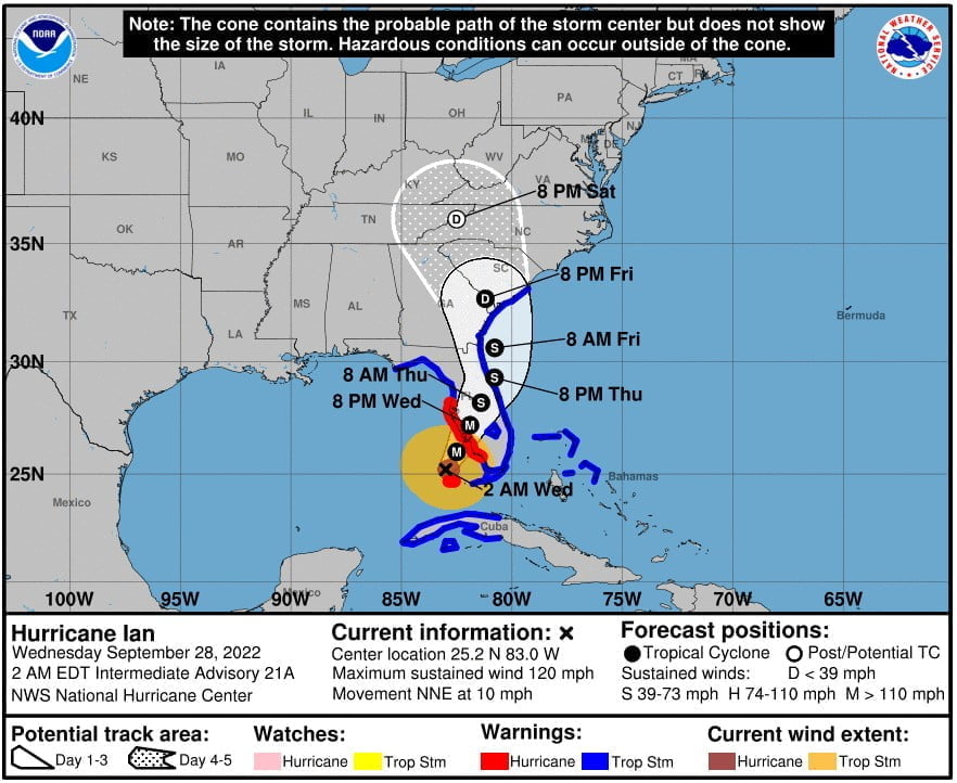
A Storm Surge Warning is in effect for Suwannee River southward to Flamingo; Tampa Bay; Lower Florida Keys from Big Pine Key westward to Key West; Dry Tortugas; Flagler/Volusia Line to the mouth of the St. Mary’s River; St. Johns River.
A Tropical Storm Warning is in effect for Cuban provinces of La Habana, Mayabeque, and Matanzas; Indian Pass to the Anclote River, All of the Florida Keys; Flamingo to South Santee River; Flamingo to Chokoloskee, Lake Okeechobee; Florida Bay; Bimini and Grand Bahama Islands.
A Storm Surge Watch is in effect for Florida Keys from the Card Sound Bridge westward to east of Big; Pine Key; Florida Bay; Mouth of St. Mary’s River to South Santee River.
On the forecast track, the center of Ian is expected to approach the west coast of Florida this morning (LT) and make landfall later today.
Strengthening is forecast until the hurricane makes landfall, and Ian is forecast to approach the west coast of Florida as an extremely dangerous major hurricane.
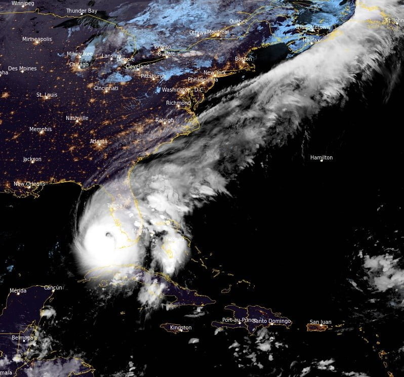
The center of Ian is forecast to move over central Florida Wednesday night, September 28, and Thursday morning and emerge over the western Atlantic by late Thursday.
Key messages issued by NWS National Hurricane Center in Miami, Florida:
1. Life-threatening storm surge is expected along the Florida west coast and the Lower Florida Keys where a storm surge warning is in effect, with the highest risk from Naples to the Sarasota region. Residents in these areas should listen to advice given by local officials and follow any evacuation orders for your area.
2. Hurricane-force winds are expected in the hurricane warning area in southwest and west-central Florida beginning Wednesday morning with tropical storm conditions expected overnight. Devastating wind damage is expected near the core of Ian. Residents should rush all preparations to completion.
3. Heavy rainfall will spread across the Florida peninsula through Thursday and reach portions of the Southeast later this week and this weekend. Catastrophic flooding is expected across portions of central Florida with considerable flooding in southern Florida, northern Florida, southeastern Georgia and coastal South Carolina. Widespread, prolonged moderate to major river flooding expected across central Florida.
Mandatory Evacuation Orders have been issued for coastal communities, mobile homes and low-lying areas in the following Florida counties:
- Charlotte
- Citrus
- Collier
- Hernando
- Hillsborough
- Lee
- Levy
- Manatee
- Pasco
- Pinellas
- Putnam
- Sarasota
Following Governor DeSantis’ authorization, a total of 5 000 Florida Guardsmen were activated and equipped with assets including high-wheeled vehicles, helicopters, boats, generators, and more.
In addition, 2 000 Guardsmen from Tennessee, Georgia and North Carolina are also being activated to assist.
References:
1 Hurricane Ian Intermediate Advisory Number 21A – NWS National Hurricane Center Miami FL – 200 AM EDT Wed Sep 28 2022
2 Hurricane Ian Special Discussion Number 21 – NWS National Hurricane Center Miami FL – AM EDT Wed Sep 28 2022
I'm a dedicated researcher, journalist, and editor at The Watchers. With over 20 years of experience in the media industry, I specialize in hard science news, focusing on extreme weather, seismic and volcanic activity, space weather, and astronomy, including near-Earth objects and planetary defense strategies. You can reach me at teo /at/ watchers.news.
Commenting rules and guidelines
We value the thoughts and opinions of our readers and welcome healthy discussions on our website. In order to maintain a respectful and positive community, we ask that all commenters follow these rules.