
Dangerous swells produced by Hurricane “Larry” to affect much of the western Atlantic beaches
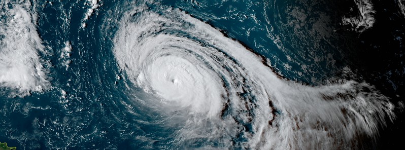
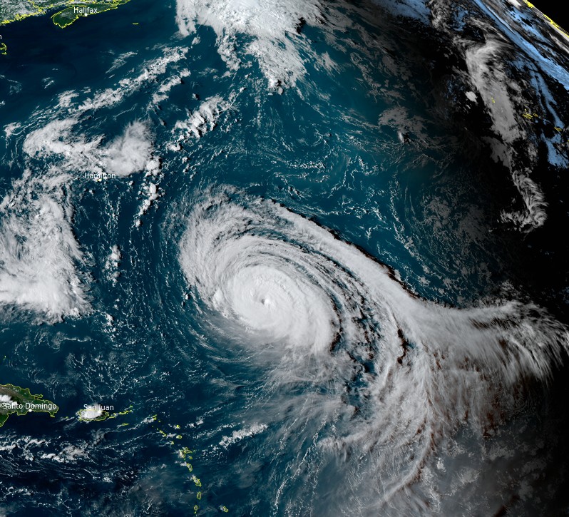
Featured image: Hurricane "Larry" at 20:10 UTC on September 8, 2021. Credit: NOAA/GOES-East, RAMMB/CIRA, TW
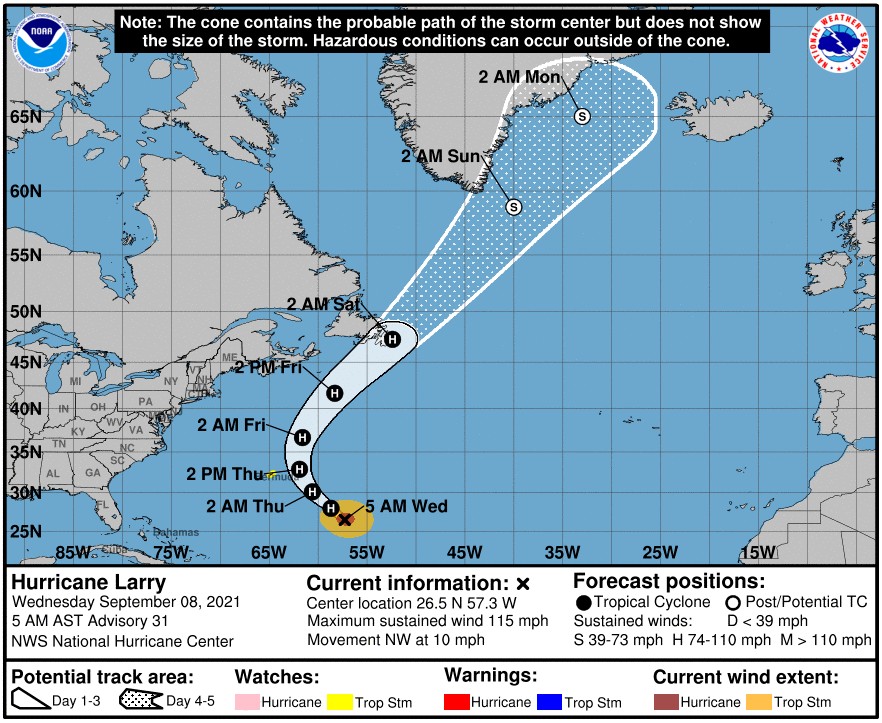
Hurricane "Larry" is forecast to pass east of Bermuda on Thursday, September 9, 2021, and then near or over portions of southeastern Newfoundland late Friday and Friday night, September 10 (LT) as it transitions to a hurricane-force post-tropical cyclone. A Tropical Storm Watch is in effect for Bermuda.
Larry is a Category 3 hurricane on the Saffir-Simpson Hurricane Wind Scale with maximum sustained winds of 185 km/h (115 mph) and a minimum central pressure of 967 hPa, as of 09:00 UTC on September 8.1 Its center is located about 970 km (605 miles) and the system is moving NW at a speed of 17 km/h (10 mph).
This general motion is expected to continue through today, followed by a turn toward the NNW and N with an increase in forward speed on Thursday and a faster NE motion by Friday.
Large swells generated by Larry will continue to affect the Leeward Islands, portions of the Greater Antilles, and the Bahamas today, NHC forecaster Brown noted.2
Significant swells will begin to reach the east coast of the United States and Atlantic Canada later today and continue affecting these shores through the end of the week.
These swells will likely cause life-threatening surf and rip current conditions, and beachgoers and other interests along these coasts are urged to follow the guidance of lifeguards and local officials this week, NHC said.
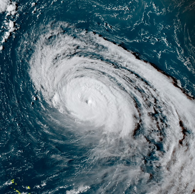
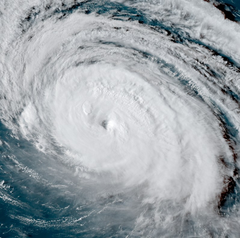
Hurricane "Larry" at 20:10 UTC on September 8, 2021. Credit: NOAA/GOES-East, RAMMB/CIRA, TW
The center of Larry is forecast to pass east of Bermuda on Thursday, September 9 but given Larry's large size, tropical storm conditions are possible there Thursday, along with a risk of heavy rainfall and coastal flooding. A Tropical Storm Watch is in effect for Bermuda, and interests there should closely monitor the latest forecast updates.
Larry is forecast to move near or over portions of southeastern Newfoundland late Friday and Friday night as it transitions to a hurricane-force post-tropical cyclone. There is a risk of impacts from high winds, rainfall, and storm surge in portions of Newfoundland, and interests there should monitor the progress of Larry and updates to the forecast.
This is a large system with hurricane-force winds extending up to 110 km (70 miles) from the center and tropical-storm-force winds up to 295 km (185 miles).
Larry is the 12th named storm, 5th hurricane, and the 3rd major hurricane of the 2021 Atlantic hurricane season.
It strengthened into a Category 3 hurricane on September 3, making 2021 only the 4th Atlantic season to produce 3 major hurricanes by September 3 (1969, 2004, 2005, and 2021).
References:
1 BULLETIN – Hurricane Larry Advisory Number 31 – NWS National Hurricane Center Miami FL AL122021 – 500 AM AST Wed Sep 08 2021
2 Hurricane Larry Discussion Number 31 – NWS National Hurricane Center Miami FL AL122021 – 500 AM AST Wed Sep 08 2021
I'm a dedicated researcher, journalist, and editor at The Watchers. With over 20 years of experience in the media industry, I specialize in hard science news, focusing on extreme weather, seismic and volcanic activity, space weather, and astronomy, including near-Earth objects and planetary defense strategies. You can reach me at teo /at/ watchers.news.
Commenting rules and guidelines
We value the thoughts and opinions of our readers and welcome healthy discussions on our website. In order to maintain a respectful and positive community, we ask that all commenters follow these rules.