
Early season snowfall, way below average temperatures in United States
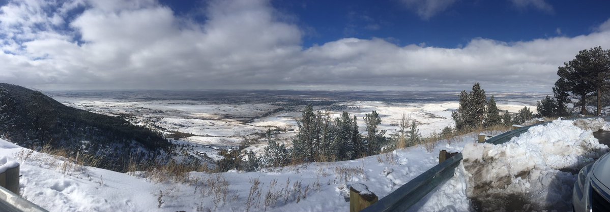
Featured image: Casper Mountain lookout, Central Wyoming on October 14, 2018. Credit: Matt Grant
Cold Canadian air is plunging much of the United States below to much below normal temperatures, especially across the High Plains, NWS forecasters said October 15, 2018. Meanwhile, heavy rains continue across the South Plains as moist air rides over this cold front.
First snow of the season was reported from the Rocky Mountains to the Great Plains and Upper Midwest on October 14, way ahead of the schedule.
The heaviest snowfall occurred in the mountains and higher elevations of Wyoming, Colorado, and New Mexico, the Weather Nation reports. However, a few inches of snow also coated the ground in states such as Kansas, Nebraska, South Dakota, Iowa, Minnesota, and Wisconsin.
Heavy rain is possible over parts of the Southern Plains on October 15 and rain/freezing rain over Southwestern Texas into New Mexico, NWS forecasters warned. Temperatures will be 10 – 20 °C (20 to 35 °F) below average over parts of the Southern/Central Plains into parts of the Southern Rockies.
"A front extending from the Lower Great Lakes southwestward to the Western Gulf Coast will move eastward off the Northeast/Northern Mid-Atlantic Coast by Tuesday morning, October 16," NWS meteorologist Ziegenfelder said. "The southern half of the boundary will linger over the Southeast to the Central Gulf Coast by Wednesday."
Showers and thunderstorms will develop along and ahead of the front from parts of the Ohio Valley/Central Appalachians southwestward to the Lower Mississippi Valley into parts of the Southern Plains/Western Gulf Coast that will move eastward to the Mid-Atlantic southwestward to the Western Gulf Coast by Monday evening.
The showers and thunderstorms will move off the Mid-Atlantic Coast by Tuesday morning while continuing over the Southeast to the Central Gulf Coast through Tuesday evening.
Rain will also develop over parts of the Lower/Middle Mississippi Valley into parts of the Great Lakes/Ohio Valley into the Mid-Atlantic that will move eastward into the Northeast/Northern Mid-Atlantic into parts of the Ohio Valley by Monday evening.
The rain will move off the Northeast/Northern Mid-Atlantic Coast by Tuesday afternoon.
Along the northwestern edge of the precipitation shield, snow and rain will develop over parts of the Upper Great Lakes/Upper Mississippi Valley on Monday that will move into Canada by Monday evening.
Wet snow will also develop over parts of Northern New England early Tuesday morning ending by Tuesday afternoon.
Meanwhile, upper-level energy over Southern California into parts of the Great Basin/Central Rockies will form an upper-level low over the Southwest overnight Monday becoming quasi-stationary over the region through Wednesday.
Cold high pressure over the Central Rockies will sink southeastward to the Southern High Plains by Tuesday evening into Wednesday.
The energy will aid in producing rain and snow over parts of the Southern Rockies that will change over to all rain over the Southwest overnight Monday.
The clockwise circulation around the high pressure will aid in producing rain over parts of the Southern Plains on Monday afternoon into Tuesday morning.
Overnight Monday rain with pockets of rain/freezing rain will develop over Southwestern Texas becoming mostly rain over the area by Tuesday evening.
On Tuesday, rain and areas of rain/freezing rain will develop over parts of New Mexico into Wednesday.
A second front over South-Central Canada will move southeastward to the Great Lakes/Middle Mississippi Valley into the Northern Plains by Tuesday evening into Wednesday.
Light snow and rain will develop over parts of the Northern Plains/Upper Mississippi Valley on Monday evening. The rain and snow will move into the Upper Great Lakes overnight Monday into Tuesday evening.
Elsewhere, high pressure over the Northern/Central Rockies will aid in producing high wind over parts of Southern California Monday into Monday evening.
I'm a dedicated researcher, journalist, and editor at The Watchers. With over 20 years of experience in the media industry, I specialize in hard science news, focusing on extreme weather, seismic and volcanic activity, space weather, and astronomy, including near-Earth objects and planetary defense strategies. You can reach me at teo /at/ watchers.news.
Commenting rules and guidelines
We value the thoughts and opinions of our readers and welcome healthy discussions on our website. In order to maintain a respectful and positive community, we ask that all commenters follow these rules.