
Tropical Storm “Pilar” near the west coast of Mexico
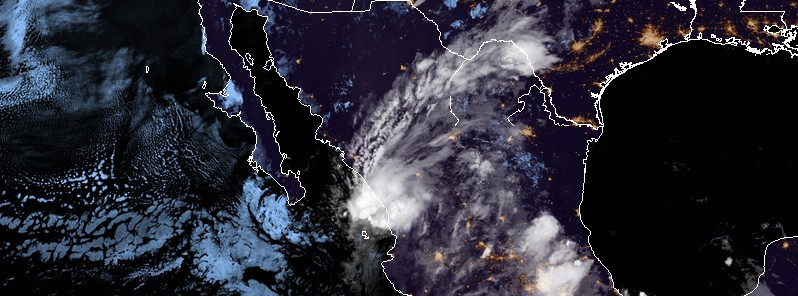
Featured image: Tropical Storm "Pilar" at 07:45 UTC on September 25, 2017. Credit: NOAA/GOES-16 (preliminary and non-operational)
A newly formed tropical cyclone – Tropical Storm "Pilar" – is producing heavy rain along portions of the western coast of Mexico for the past 2 days. The storm was named 03:00 UTC on September 23, thus becoming the 16th named storm of the 2017 Pacific hurricane season. Rain produced by Pilar could cause life-threatening flash floods and mudslides over the western portions of the Mexican states of Nayarit and southern Sinaloa through Monday night (local time).
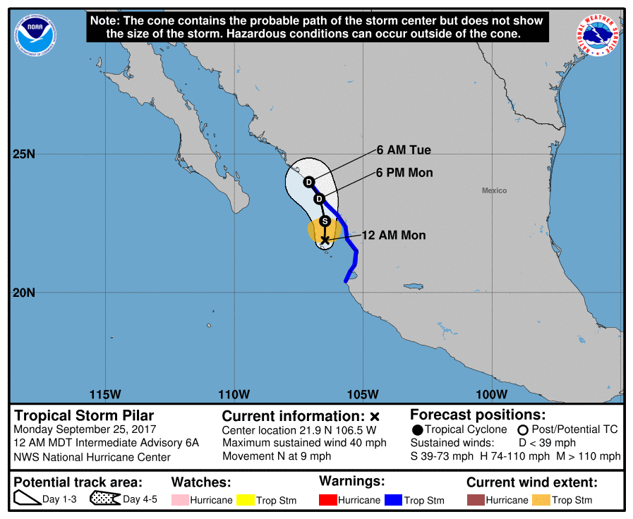
At 06:00 UTC on Monday, September 25, the center of Tropical Storm "Pilar" was located about 45 km (30 miles) NNW of Las Islas Marias and 145 km (90 miles) S of Mazatlan, Mexico. The system is heading north at 15 km/h (9 mph) with maximum sustained winds of 65 km/h (40 mph) and minimum estimated central pressure of 1 003 hPa.
A slower northward or north-northwestward motion is expected during the next day or so, NHC noted. On the forecast track, the center of Pilar is expected to move along or just west of the coast of the Mexican states of Nayarit and Sinaloa during the next 48 hours.
Gradual weakening is forecast, and Pilar is expected to become a tropical depression on Monday and dissipate on Tuesday.
Tropical-storm-force winds extend outward up to 95 km (60 miles) from the center.
A Tropical Storm Warning is in effect for the coast of Mexico from Cabo Corrientes northward to Bahia Tempehuaya, including Las Islas Marias.
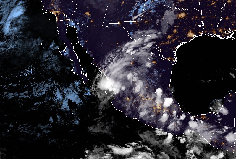
Tropical Storm "Pilar" at 05:00 UTC on September 25, 2017. Credit: NOAA/GOES-16 (preliminary and non-operational)
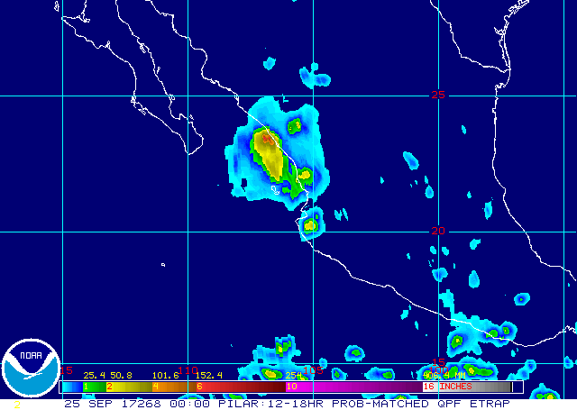
Pilar is expected to produce total rain accumulations of 76.2 to 177.8 mm (3 to 7 inches) with possible isolated maximum amounts of 254 mm (10 inches) over the western portions of the Mexican states of Nayarit and southern Sinaloa through Monday night. This rainfall could cause life-threatening flash floods and mudslides.
Tropical storm conditions are occurring in a portion of the warning area. These conditions will gradually spread northward along the Mexican coast on Monday.
I'm a dedicated researcher, journalist, and editor at The Watchers. With over 20 years of experience in the media industry, I specialize in hard science news, focusing on extreme weather, seismic and volcanic activity, space weather, and astronomy, including near-Earth objects and planetary defense strategies. You can reach me at teo /at/ watchers.news.
Commenting rules and guidelines
We value the thoughts and opinions of our readers and welcome healthy discussions on our website. In order to maintain a respectful and positive community, we ask that all commenters follow these rules.