
Snowstorm to hit the Northeast, more rain for the Northwest
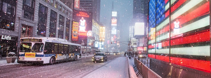
Image credit: MTA (2015) (CC-Flickr)
A low pressure area is forecast to develop into a coastal storm and bring significant impacts from portions of the Middle Atlantic to New England late Wednesday into Thursday, February 9, 2017. The potential exists for heavy snow and dangerous travel conditions including the major Interstate 95 cities from Philadelphia to New York City and Boston. At the same time, yet another strong low pressure system will move towards the Pacific Northwest over the next few days, bringing another surge of moisture to much of the region.
NWS forecasters warn that an active pattern will remain in place across the eastern US today and tomorrow. A strong low pressure system will continue to push northeast of the Great Lakes Region and New England throughout the day, with a cold front expected to sweep through much of Southeast US through tonight.
A secondary low will develop along this front tonight, increasing the surge of moisture inland along the Atlantic Coast. Much of the southeast and Mid Atlantic will see heavy rains and thunderstorms today and tonight, with portions of the Eastern Gulf Coast currently under a Marginal to Slight Risk Area from the Storm Prediction Center.
Behind the front, colder air will interact with the precipitation.
Much of the Great Lakes region will see snow today, transitioning across the Northeast Thursday as the secondary system increases in strength. A transition zone between the rain and snow will result in a wintry mix of rain, snow and ice across portions of the northern Ohio Valley and northern Mid Atlantic Regions during this time.
The NE is about to board a wx roller coaster. Shorts & tees today, but by tmw night, you'll need snow boots. More on #Niko now on @AMHQ. pic.twitter.com/Cej03L7PK8
— AMHQ (@AMHQ) February 8, 2017
A winter storm will gust through the Northeast with heavy snow and strong winds this week: https://t.co/FFKY3CEzWF pic.twitter.com/Xzey8s7sMA
— AccuWeather (@breakingweather) February 8, 2017
The Weather Channel named the storm Niko. For now, this doesn't appear to be a blockbuster Northeast snowstorm, but it will likely disrupt travel on Thursday, they said.
"As virtually always is the case, there are uncertainties on the exact track and forward speed of Niko. The latest forecast guidance is suggesting a track favorable for widespread accumulating snow, with the heaviest amounts from eastern Pennsylvania and the New York City Tri-State area into southern New England."
Over the next few days, another strong low pressure system will move towards the Pacific Northwest, NWS said. This will bring another surge of moisture to much of the region, which has already been heavily impacted by heavy rains and high snow amounts.
More heavy rain is expected across much of northern California and coastal regions of Washington and Oregon starting this afternoon. Rainfall amounts of 50 – 152 mm to (2 to 6 inches) are expected in these regions.
Another gusty system will drench the West Coast this week, bringing more flooding and snow: https://t.co/EevIaa27mT pic.twitter.com/HukcpFM04N
— AccuWeather (@breakingweather) February 8, 2017
Furthermore, warmer temperatures will cause melting of large amounts of snow, which will lead to flooding concerns. Flood warnings and watches are in effect for much of northern California, Oregon, and even northern Nevada and southern Idaho.
Along the northern periphery of this system, a wintry mix of snow, rain, and ice is expected, with Winter Storm Warnings and Watches stretching from Washington to western Montana.
The Watchers team and our contributors bring the latest on extreme weather, earthquakes, volcanic eruptions, space weather, and all things science. We're all about making sense of the natural world and keeping you informed on what’s happening. Got a tip or a question? Hit us up using the form at newstips!
Commenting rules and guidelines
We value the thoughts and opinions of our readers and welcome healthy discussions on our website. In order to maintain a respectful and positive community, we ask that all commenters follow these rules.