
Intense thunderstorms and flash floods expected over central US
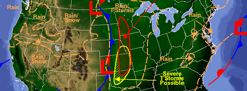
Featured image: Weather forecast for October 4, 2016. Image credit: DOC/NOAA/NWS/NCEP/Weather Prediction Center
A severe storm system, responsible for heavy rain and snowfall across the Intermountain West during October 3, 2016, is expected to pass over the central US by the middle of the week. Intense thunderstorms and flash flooding are forecast across the affected areas.
Torrential downpours accompanied by thunderstorms will spread from the eastern Dakotas to central Oklahoma during the late afternoon of October 4 (local time). The weather system will bring strong winds and hail while the greatest threat for severe thunderstorms will be concentrated in the region of the central Plains, according to Brett Rathbun, an AccuWeather Meteorologist. Tornadoes will generally pose no threat, although isolated events may occur.
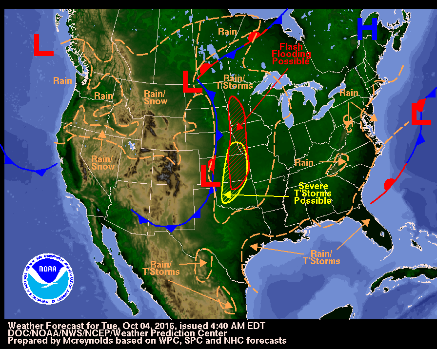
Weather forecast for October 4, 2016. Image credit: DOC/NOAA/NWS/NCEP/Weather Prediction Center
Residents of Omaha, Nebraska, Wichita, Kansas, Kansas City, Missouri, and Oklahoma City are advised to remain on alert for severe weather warnings.
Because the grounds are still saturated from abundant precipitation during this September, the risk of flooding across the affected areas is enhanced. Numerous rivers in southeastern Iowa are currently in a moderate to major flood state, and heavy rains could cause them to overflow the banks and flood the region.
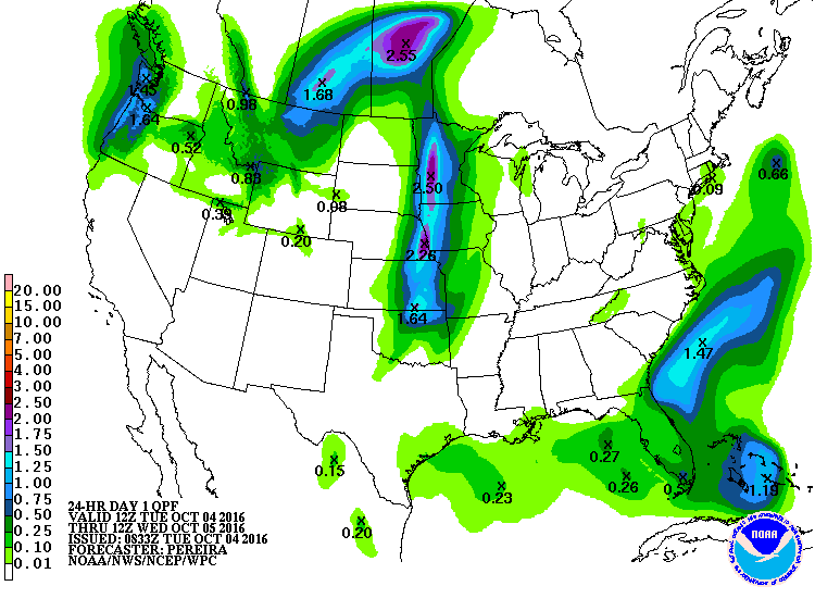
24-hr precipitation forecast, valid for October 4/5, 2016. Image credit: NOAA/NWS/NCEP/WPS
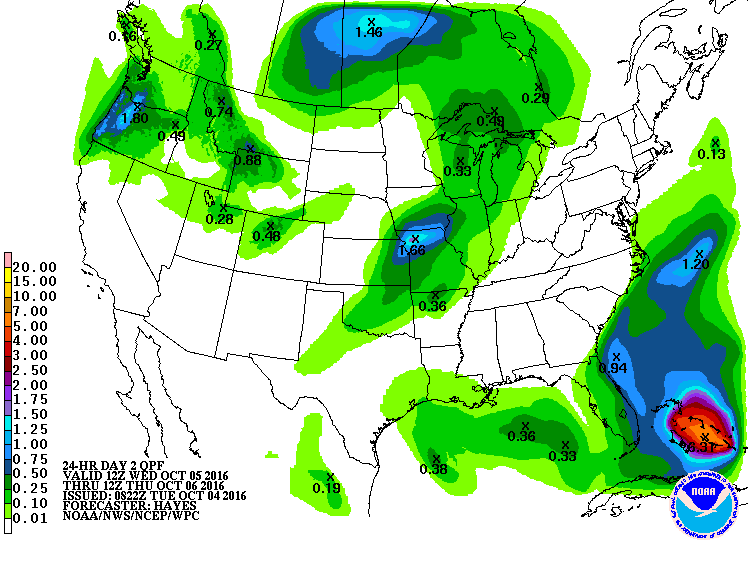 24-hr precipitation forecast, valid for October 5/6,2016. Image credit: NOAA/NWS/NCEP/WPS
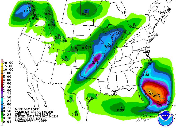 24-hr precipitation forecast, valid for October 6/7, 2016. Image credit: NOAA/NWS/NCEP/WPS
Intense rainstorms will continue to move eastward into the upper Great Lake and the Missouri Valley throughout October 5, although the risk for severe weather will be lower.
As the weather system loosens its grip, a new storm is expected to set in and bring more rainstorms across the central US during the second half of the week. The storm will intensify on October 6 and 7 across the Great Lakes to the southern Plains. Flash floods and strong, damaging winds are possible along the affected region.
Commenting rules and guidelines
We value the thoughts and opinions of our readers and welcome healthy discussions on our website. In order to maintain a respectful and positive community, we ask that all commenters follow these rules.