
Tropical Storm “Chanthu” hits Japan
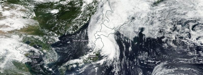
Image credit: NASA/NOAA/DoD Suomi NPP / VIIRS
Tropical Storm "Chanthu" made the first landfall in Japan's Chosi, Chiba prefecture around 18:30 UTC on August 16 (03:30 JST on August 17) and the second near Cape Erimo on the southern tip of the main island of Hokkaido around 08:30 UTC on August 17, 2016.
Maximum winds at Chosi, Chiba at the time of landfall were near 93 km/h (57.8 mph). Half an hour later, Tokyo saw wind gusts of 85 km/h (52.8 mph). Some people were reported injured as the storm moved northward toward Hokkaido, intensifying.
At around 10:30 UTC, some two hours after the second landfall, Chanthu was packing winds of up to 144 km/h (90 mph) with an atmospheric pressure of 982 hPa at its center.
Video courtesy WestPacWx
The storm brought heavy rainfall and gusty winds, disrupting traffic in extensive areas. Some 1 500 homes in Ibaraki prefecture, north of Chiba, have lost power until morning.
TEPCO said Chanthu has also moved over the crippled Fukushima Daichi Nuclear Power Plant, but nothing unusual was reported and activity remains the same today, WestPacWx reported.
Most of the Fukushima prefecture is under a landslide warning.
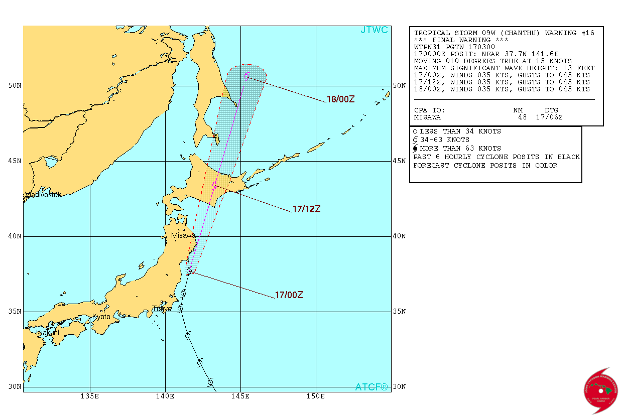
Tropical Storm "Chanthu" forecast track by JTWC at 03:00 UTC on August 17, 2016
Many people in areas facing fears of mudslides and other dangers were ordered or advised to evacuate, including about 2 700 households in Otsuchi, Iwate Prefecture, and about 3 800 households in the city of Hakodate in Hokkaido, The Japan Times reported.
Hourly rainfall of 65.5 mm (2.56 inches) was recorded early Wednesday (JST) in Tsuchiura, Ibaraki Prefecture, and 55.5 mm (2.18 inches) in the city of Fukushima, both the highest on record there.
Rainfall over the 24-hour period through 18:00 JST on Thursday is expected to reach 150 mm (5.90 inches) in some places in Hokkaido, the JMA said.
By Thursday morning local time, the typhoon is likely to weaken to a depression over the Sea of Okhotsk.
At 03:00 UTC on August 17, the JTWC issued their final warning on Chanthu. At that time, the tropical storm was located approximately 316 km (196 miles) north-northeast of Yokosuka, Japan. Maximum sustained winds were near 62 km/h (40 mph). Chanthu has tracked northwestward at 27.7 km/h (17.2 mph).
The Watchers team and our contributors bring the latest on extreme weather, earthquakes, volcanic eruptions, space weather, and all things science. We're all about making sense of the natural world and keeping you informed on what’s happening. Got a tip or a question? Hit us up using the form at newstips!
Commenting rules and guidelines
We value the thoughts and opinions of our readers and welcome healthy discussions on our website. In order to maintain a respectful and positive community, we ask that all commenters follow these rules.