
Tropical Storm “Frank” forms, to pass near the coast of Baja California, Mexico
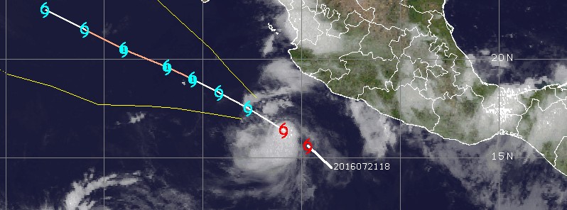
Image credit: UW-CIMSS
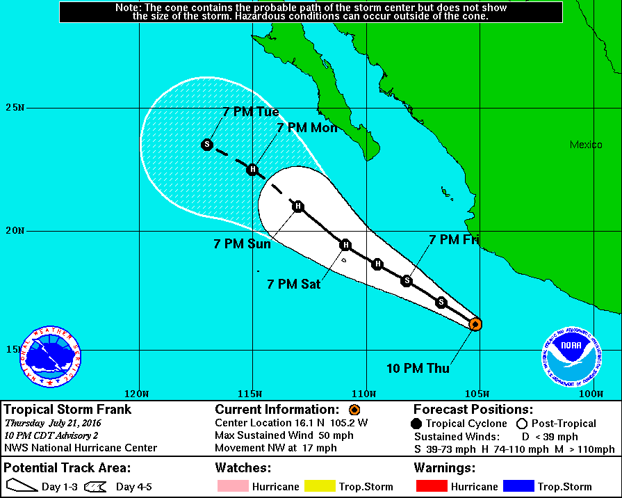
Tropical Storm "Frank" formed late July 21, 2016, about 455 km (285 miles) south of Manzanillo, Mexico, as the sixth named storm of the 2016 eastern Pacific hurricane season. Frank is moving over warm waters and is expected to become a hurricane early on July 23, just south of the southern tip of Baja California.
At 03:00 UTC on July 22, the center of Tropical Storm "Frank" was located about 335 km (210 miles) SSW of Manzanillo, this is about 900 km (560 miles) SE of the southern tip of Baja California. Frank is moving toward the northwest near 28 km/h (17 mph). A general northwestward motion with a decrease in forward speed is expected during the next couple of days.
Maximum sustained winds have increased to near 85 km/h (50 mph) with higher gusts. Additional strengthening is forecast during the next 48 hours, and Frank could become a hurricane on July 23.
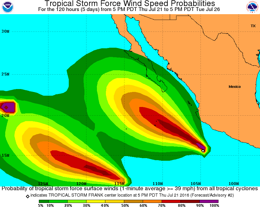
Tropical-storm-force winds extend outward up to 95 km (60 miles) from the center. The estimated minimum central pressure is 1002 hPa.
There are currently no hazards affecting land. However, interests in extreme southern Baja California Sur should monitor the progress of Frank.
The ECMWF model shows a stronger weakness and thus forecasts Frank to move farther north, while the GFS model keeps a stronger ridge and forecasts a more westward motion, NHC said at 03:00 UTC today. "Overall, the guidance envelope has shifted westward away from the coast of Mexico during the later part of the forecast period, and the official forecast follows suit. However, there is still enough uncertainty that interests in the southern portion of the Baja California peninsula should monitor the progress of Frank."
Frank is expected to remain over warm water for the next 3 days or so. However, easterly shear could inhibit intensification, especially if the stronger upper-level winds forecast by the ECMWF verify. Weakening is forecast after 72 hours due to decreasing sea surface temperatures along the forecast track and continued shear.
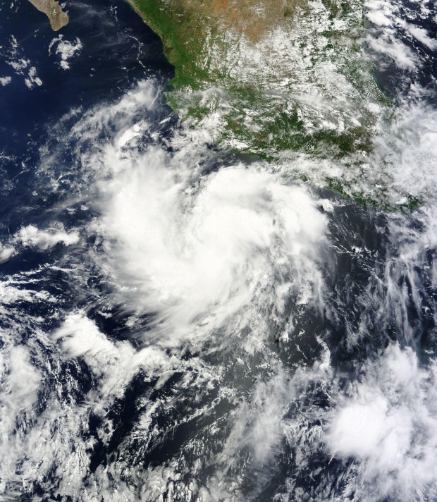
Soon to become Tropical Storm "Frank" on July 21, 2016. Credit: NASA Terra/MODIS
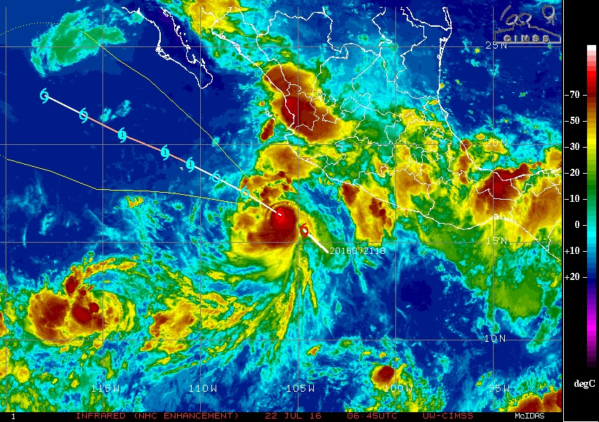
Tropical Storm "Frank" at 06:46 UTC on July 22, 2016. Credit: UW-CIMSS
There are currently 3 named tropical storms in the eastern and central Pacific (Darby, Estelle, and Frank), and one tropical depression (08E), which is expected to become a tropical storm today and receive the name "Georgette". "If it gets named, 2016 would tie 1985 for most July named storms on record with 7," said Philip Klotzbach, CSU Meteorologist specializing in Atlantic basin seasonal hurricane forecasts.
TD 8E has formed in NE Pacific. If it gets named, 2016 would tie 1985 for most July named storms on record with 7. pic.twitter.com/YNA2RzB7Bl
— Philip Klotzbach (@philklotzbach) July 21, 2016
Meanwhile, Darby is expected to bring heavy rains to Hawaii over the coming weekend.
You can see them all in today's GOES-West image below:
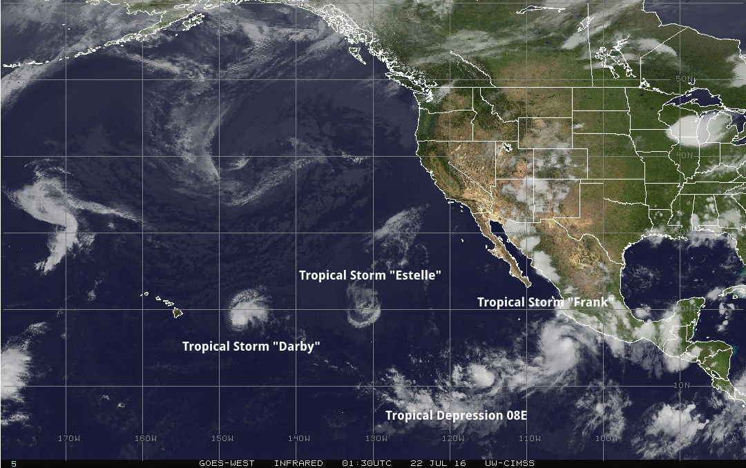
GOES-West image taken at 01:30 UTC on July 22, 2016. Credit: UW-CIMSS. Annotation: TW
The Watchers team and our contributors bring the latest on extreme weather, earthquakes, volcanic eruptions, space weather, and all things science. We're all about making sense of the natural world and keeping you informed on what’s happening. Got a tip or a question? Hit us up using the form at newstips!
Commenting rules and guidelines
We value the thoughts and opinions of our readers and welcome healthy discussions on our website. In order to maintain a respectful and positive community, we ask that all commenters follow these rules.