
Tropical Cyclone “Emeraude” forms in the Southern Indian Ocean
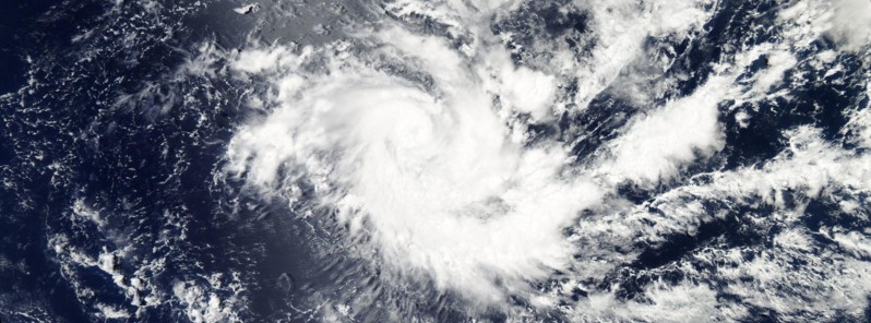
Featured image: Tropical Cyclone "Emeraude" on March 16, 2016. Credit: NASA Aqua/MODIS
Tropical Cyclone "Emeraude" formed in the Southern Indian Ocean late March 15, 2016, and ended a 17-day global tropical cyclones drought. The system will rapidly intensify over the next 24 to 36 hours.
According to JTWC's Tropical Cyclone Warning issued 06:00 UTC on March 16, Tropical Cyclone "Emeraude" (15S/JTWC) was located approximately 1 400 km (870 miles) ESE of Diego Garcia at the time, and has tracked WNW at 9.2 km/h (5.7 mph) over the past six hours. Its maximum sustained winds were 101.8 km/h (63.3 mph), wind gusts to 129.6 km/h (80.5 mph).
TC 15S has formed in the South Indian Ocean – ending a 17-day global TC (>=34 kts) drought. pic.twitter.com/RFxNBueXVr
— Philip Klotzbach (@philklotzbach) March 16, 2016
Animated multispectral satellite imagery depicts a compact, consolidated system with a banding eye feature. Enhanced infrared satellite imagery shows an increase in deep convection wrapping into the low level circulation center.
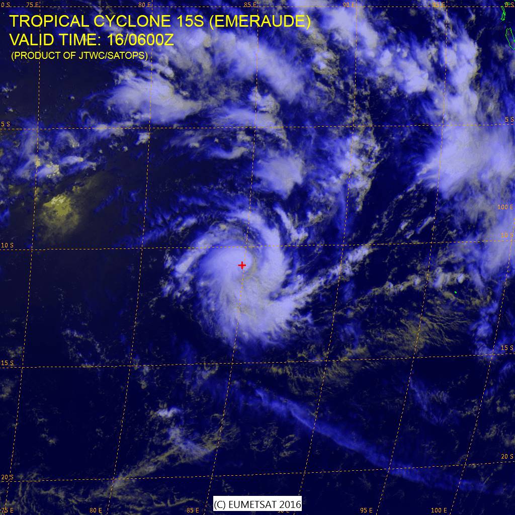
Multispectral satellite image of Tropical Cyclone "Emeraude" on March 16, 2016. Credit: EUMETSAT / JTWC/SATOPS
Emeraude is tracking slowly northwestward in a very conductive environment with low vertical wind shear, strong dual channel outflow, and warm (28 – 29 °C) sea surface temperatures, JTWC said.
These conditions, in addition to moderate ocean heat content, will support a period of rapid intensification over the next 24 to 36 hours. The system will then turn to the SE as a near equatorial ridge builds in northeast of the cyclone and assumes steering.
JTWC forecasters expect the system will continue intensifying over the next 48 hours and reach maximum sustained winds of 194 km/h (120 mph) around 06:00 UTC on March 18. Emeraud will begin a slight weakening trend late March 19 as it encounters decreasing sea surface temperatures and increasing vertical wind shear.
There is a low confidence in the JTWC track forecast due to the complicated steering environment and the poor model agreement.
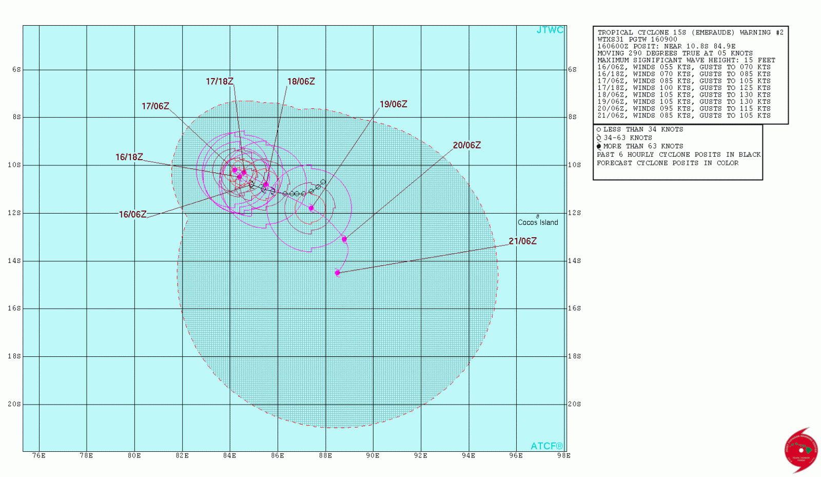
Tropical Cyclone "Emeraude" forecast track by JTWC on March 16, 2016

Tropical Cyclone "Emeraude" on March 16, 2016. Credit: NASA Aqua/MODIS
I'm a dedicated researcher, journalist, and editor at The Watchers. With over 20 years of experience in the media industry, I specialize in hard science news, focusing on extreme weather, seismic and volcanic activity, space weather, and astronomy, including near-Earth objects and planetary defense strategies. You can reach me at teo /at/ watchers.news.
Commenting rules and guidelines
We value the thoughts and opinions of our readers and welcome healthy discussions on our website. In order to maintain a respectful and positive community, we ask that all commenters follow these rules.