
Typhoon “Choi-wan” forms in the western Pacific
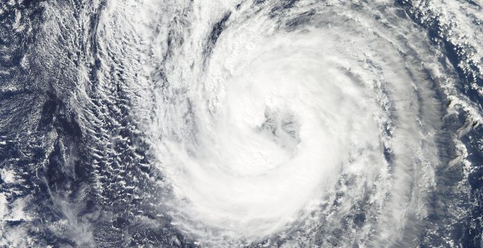
Featured image: Typhoon "Choi-wan", October 6, 2015. Image credit: NASA Aqua/MODIS
Typhoon "Choi-wan", another tropical cyclone of the very active 2015 tropical season, continues to travel across the western Pacific, intensifying. This intensification will last only for the next 12 hours, and the storm strength is expected to ease significantly after that. High waves and strong wind gusts will most likely affect parts of Hokkaido, Japan.
Choi-wan formed as a tropical depression on October 2 then intensified into a tropical storm by October 5. The system continued to strengthen and developed into a typhoon, as of October 6.
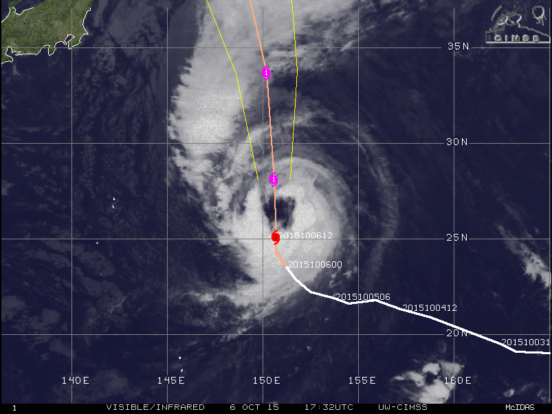
Typhoon "Choi-wan", synoptic situation, October 6, 2015, 17:32 UTC. Image credit: UW-CIMSS
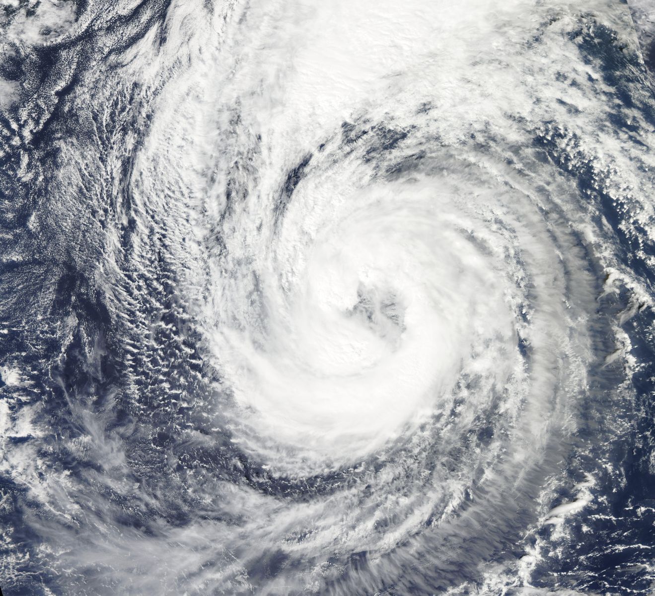 Typhoon "Choi-wan", October 6, 2015. Image credit: NASA Aqua/MODIS
Choi-wan was located about 948 km (589 miles) east of Iwo to on at 15:00 UTC on October 6, according to JTWC, and was moving northward at 14.8 km/h (9.2 mph). The system was packing maximum sustained winds of 129 km/h (80 mph) with wind gusts reaching 148 km/h (92 mph).
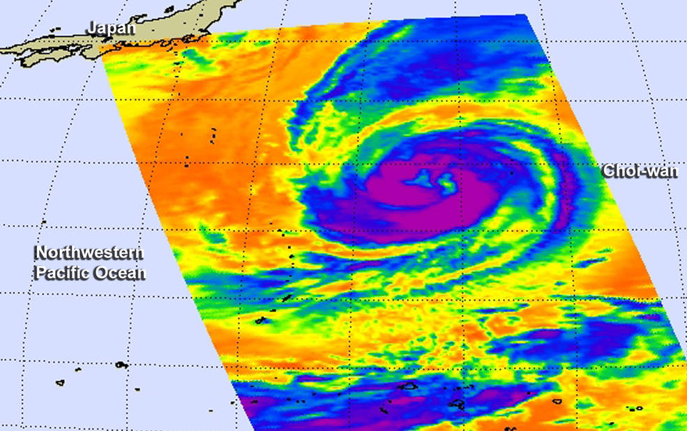
NASA's Aqua satellite passed over Typhoon "Choi-wan" on October 6 at 03:17 UTC and saw powerful thunderstorms (purple) with cloud top temperatures near -63F/-53C circling the open eye. Image credit: NASA JPL, Ed Olsen
Choi-wan has been changing its direction during October 6, Robert Speta reports, as it started to interact with the upper level jet over Japan.
It appears the intensification of the system will be short lived. JTWC reports there is a possibility for the system to slightly intensify over the next 12 hours, but decrease again afterwards as it starts to interact with the baroclinic zone.
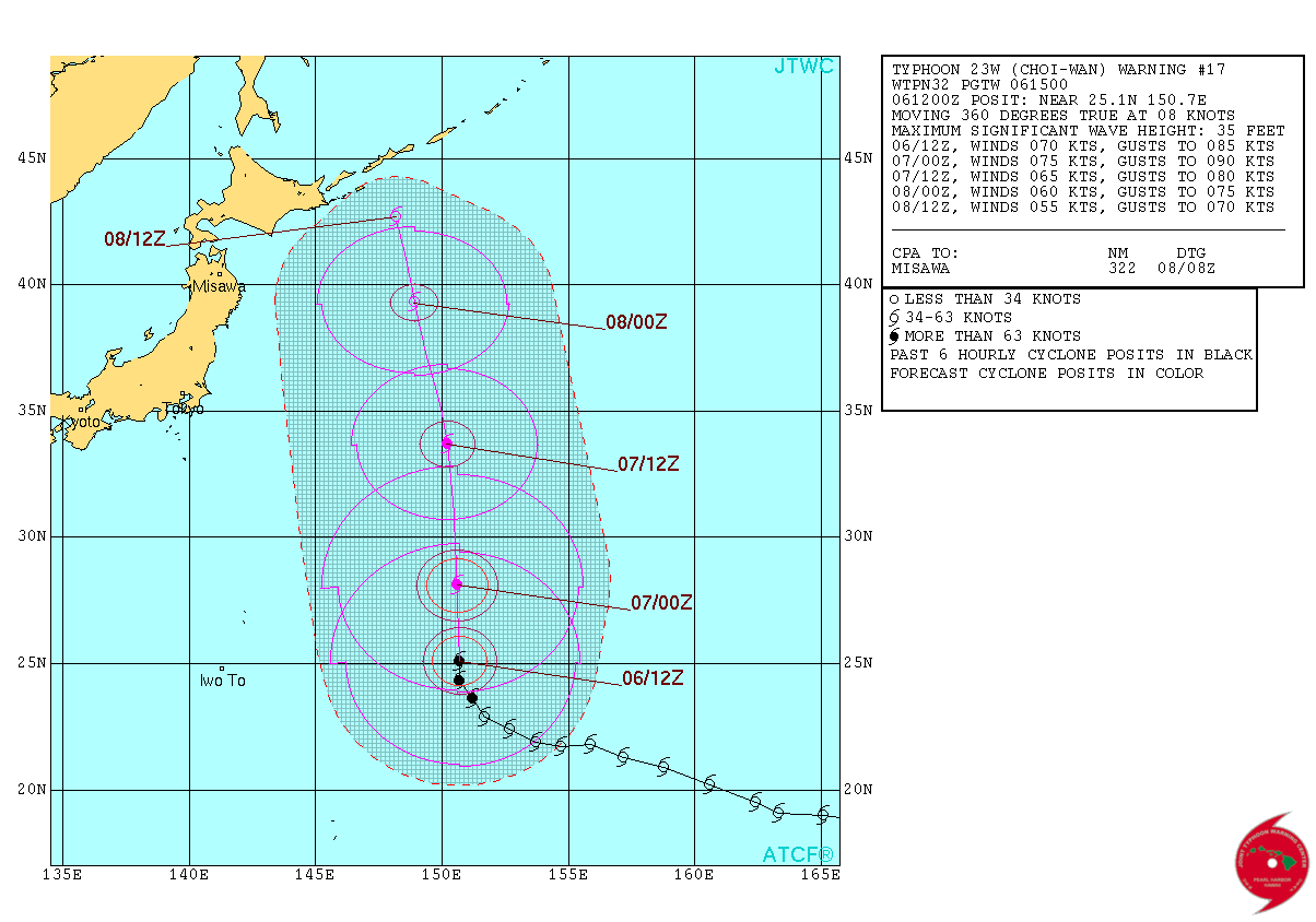
Typhoon "Choi-wan", 2-day forecast track. Image credit: JTWC
Typhoon "Choi-wan" will produce high waves across the entire pacific coast of Japan during this week. The eastern islands, including the Izu Islands and Ogasawara are expected to meet waves of 5 – 6 m (16.4 – 19.7 feet) in height.
The Kushiro prefecture on the main Hokkaido island, and Nemuro, are expected to suffer strong winds up to 70 km/h (43.5 mph). The coastal storm surge is also possible. There is also some likelihood parts of Hokkaido and Niigata mountains will experience some snowfall over the next couple of days.
Commenting rules and guidelines
We value the thoughts and opinions of our readers and welcome healthy discussions on our website. In order to maintain a respectful and positive community, we ask that all commenters follow these rules.