
Tropical Cyclone “Joalane” rapidly intensifies in Southern Indian Ocean

Featured image: Tropical Cyclone "Joalane" on April 7, 2015. Image credit: NASA Terra/MODIS
Tropical Cyclone "Joalane" organized on the morning of April 6, 2015 in the Southern Indian Ocean.
At 15:00 UTC on that day, Joalane was located 743 km (461 miles) northeast of Port Louis, Mauritius and was tracking WSW at 16.6 km/h (10.3 mph). Its maximum sustained winds at the time were near 83.3 km/h (51.7 mph).
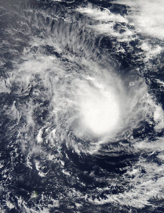
Tropical Cyclone "Joalane" on April 6 at 09:45 UTC. Image credit: NASA Goddard's MODIS Rapid Response Team.
On April 7 at 06:00 UTC, the MODIS instrument aboard NASA's Terra satellite captured visible-light data of the storm. The image showed banding of thunderstorms in the western and eastern quadrants of the storm. Microwave data revealed the storm had developed an eye.
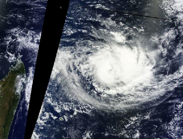
On April 7 the MODIS instrument captured this visible-light image of Tropical Cyclone "Joalane" in the Southern Indian Ocean, over 1 126 km (700 miles) east of Madagascar (left). Image credit: NASA Goddard MODIS Rapid Response Team.
By 15:00 UTC on April 7, Joalane's maximum sustained winds had increased to 148.2 km/h (92 mph) which made it a strong Category 1 hurricane on the Saffir-Simpson hurricane wind scale. Its center was near about 868.6 km (539.7 miles) northeast of Port Louis, Mauritius. The system was moving to the SSE at 11.1 km/h (6.9 mph).
Joalane intensified rapidly over the previous 12 hours by as much as 64.8 km/h (40.2 mph).
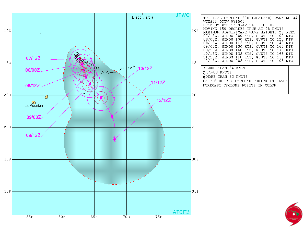
Tropical Cyclone "Joalane" forecast track by JTWC on April 7, 2015.
The JTWC forecast calls for Joalane to intensify and head southeast, moving east of Rodrigues Island on April 10, where no warnings are currently in effect.
The storm's intensity is expected to peak around 185.2 km/h (115 mph) in four days' time. Thereafter, the storm is expected to weaken. (Goddard)
Satellite animations
- Storm-Centered Infrared (Meteosat 7; CIMSS)
- Storm-Centered Enhanced Infrared (Meteosat 7; CIMSS)
- Storm-Centered Water Vapor (Meteosat 7; CIMSS)
- Storm-Centered Visible (Meteosat 7; CIMSS)
- Meteosat 7 Infrared (Meteosat 7; CIMSS)
- Meteosat 7 Infrared (Color Background) (Meteosat 7; CIMSS)
- Meteosat 7 Infrared (NHC Color Enhancement) (Meteosat 7; CIMSS)
- Meteosat 7 Water Vapor (Meteosat 7; CIMSS)

Teo Blašković founded The Watchers in 2011 and edited it until 2026, covering seismic and volcanic activity, extreme weather, space weather and near-Earth objects. Articles on this page are his archive.
Published in the last 24 hours
- Cyclone Akvan weakens after landfall near Gopalpur; more than 300 000 evacuated in Odisha, India
- Male toads abandoned a pond in Italy five days before a deadly 2009 earthquake, while a scientist was counting them Epicenter
- An asteroid was spotted 19 hours before it exploded over Sudan in 2008, and students picked its pieces off the desert Epicenter
- A wave up to 3 m (10 feet) high rose out of Lake Michigan on a sunny June morning in 1954 and swept fishermen off Chicago’s piers, and when a second came 10 days later, warnings had cleared the shore Epicenter



