
10-day Global Fire Map: July 10 – 19, 2013
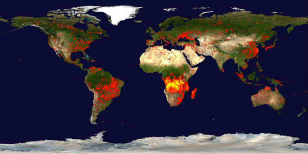
Featured image: Global fire map for June 10-19, 2013 (Credit: LANCE/EOSDIS/FIRMS)
The fire map bellow accumulates the locations of the fires detected by MODIS on board the Terra and Aqua satellites over a 10-day period, from July 10 – July 19, 2013. Each colored dot indicates a location where MODIS detected at least one fire during the compositing period. Color ranges from red where the fire count is low to yellow where number of fires is large. The active fire locations represent the center of a 1km pixel that is flagged by the MOD14/MYD14 Fire and Thermal Anomalies algorithm as containing one or more fires within the pixel.
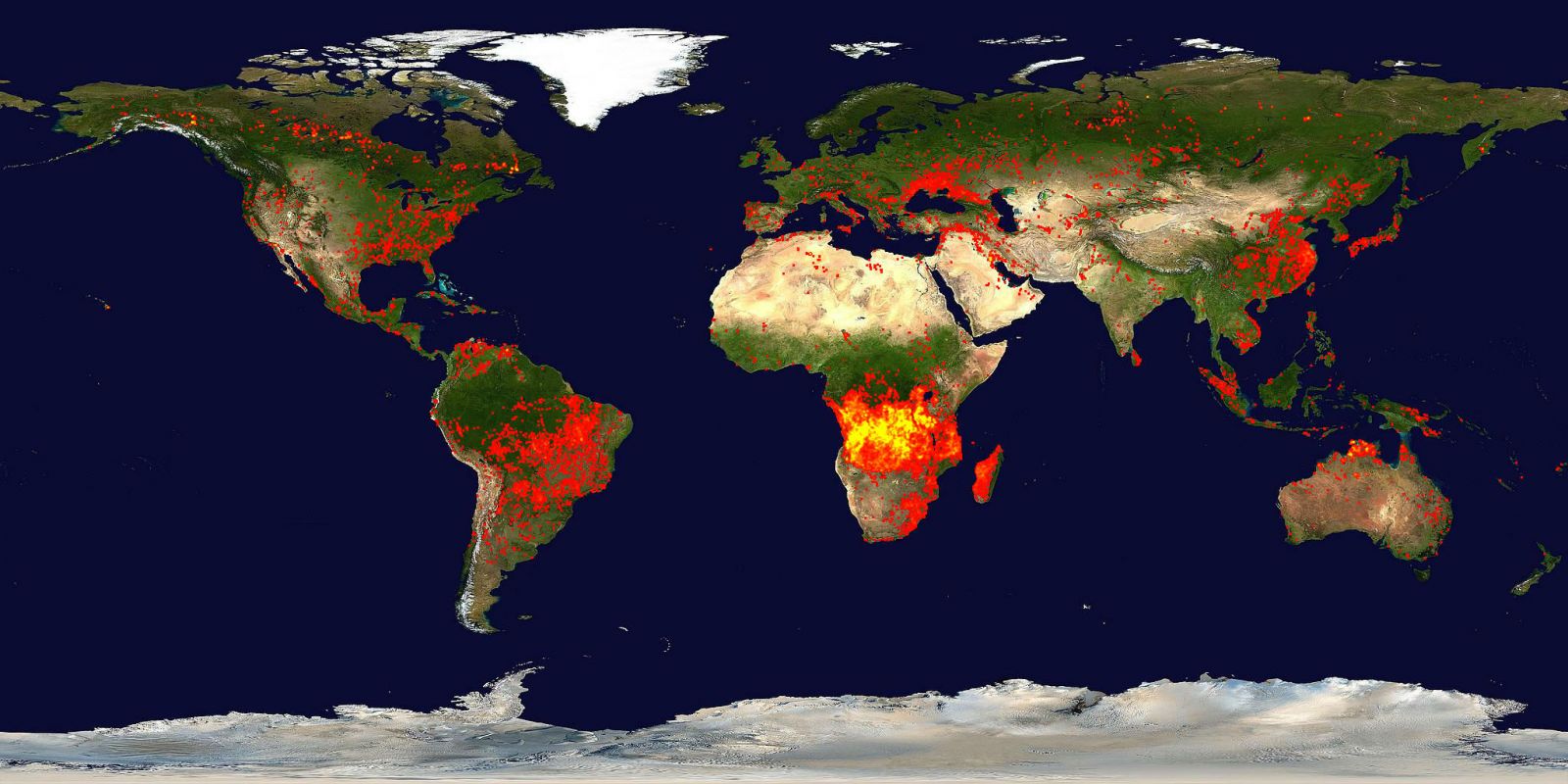
Global 10-day Fire Map: June 30 – July 9, 3013 (Fire maps created by Jacques Descloitres. Fire detection algorithm developed by Louis Giglio. Blue Marble background image created by Reto Stokli/FIRMS)
In the latest 10-day period we can observe increased activity worldwide. For comparison, bellow is the previous fire map for period from June 30 to July 9, 2013.

Global 10-day fire maps are generated using the MODIS fire locations to represent the current fire activity around the world.
Fire Information for Resource Management System (FIRMS)
Source: NASA/LANCE/EOSDIS/MODIS Rapid Response

Earlier reporting
Nothing on Watchers was published in the last 24 hours. These are older articles.
- On October 22, 2017, a single flash of lightning stretched 515 miles from eastern Texas to near Kansas City, a distance that takes eight hours to drive, and nobody realized how far it had gone until scientists went back through the satellite data years later Epicenter
- CPC posts a slight risk of heavy rain from the Gulf Coast to the Northeast urban corridor November 25-29, and a moderate risk of West Coast wind and Sierra snow on November 25
- Florida's east coast faces a moderate flash flood risk Wednesday through Friday, with 4 to 8 inches of rain forecast and the St. Johns River near Cocoa already in major flood at 17.13 feet
- Cyclone Akvan to make landfall between Nellore and Visakhapatnam around noon on November 20, IMD forecasts 120-130 km/h winds gusting to 145
