
M6.4 earthquake – northern Mid-Atlantic Ridge
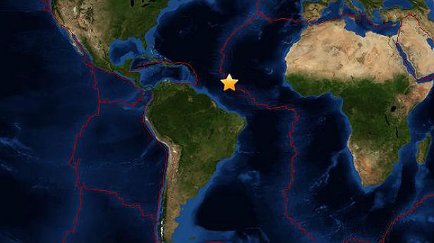
Image credit: Leaflet -Tiles Courtesy of MapQuest - Portions Courtesy NASA/JPL-Caltech and U.S. Department of Agriculture, Farm Service Agency
Strong earthquake registered as M6.4 (USGS) occurred at northern Mid-Atlantic Ridge at 22:04 UTC on June 24, 2013. USGS registered depth of 10.0km (6.2 miles).
The epicenter was located 1248 km (775 miles) ENE of Cayenne, French Guiana and 1 359 km (844 miles) NNE of Salinopolis, Brazil at coordinates 10.726°N 42.616°W.
EMSC registered M6.5 at the same depth.

USGS epicenter map (Powered by Leaflet — Tiles Courtesy of MapQuest — Portions Courtesy NASA/JPL-Caltech and U.S. Department of Agriculture, Farm Service Agency)
The earthquake happened in a transform part of the northern Mid-Atlantic Ridge – new thin oceanic crust where magma creates new land. This was very powerful earthquake for this region, however, it was harmless considering the location. There was no tsunami warning or alert issued.
The Mid-Atlantic Ridge is a mid-ocean ridge, a divergent tectonic plate boundary located along the floor of the Atlantic Ocean, and part of the longest mountain range in the world. It separates the Eurasian Plate and North American Plate in the North Atlantic, and the African Plate from the South American Plate in the South Atlantic.
Although the Mid-Atlantic Ridge is mostly an underwater feature, portions of it have enough elevation to extend above sea level. The section of the ridge which includes the island of Iceland is also known as the Reykjanes Ridge. The average spreading rate for the ridge is about 2.5 cm per year.
Commenting rules and guidelines
We value the thoughts and opinions of our readers and welcome healthy discussions on our website. In order to maintain a respectful and positive community, we ask that all commenters follow these rules.