
Tropical Depression 25W formed near Vietnam
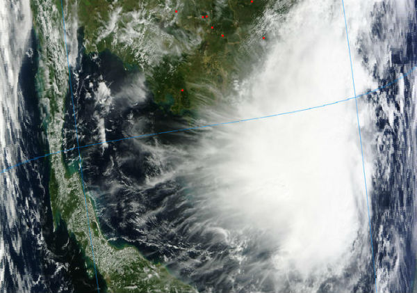
Image credit: MODIS
The twenty-fifth tropical depression of the western-north Pacific Ocean season formed today and is already affecting southern Vietnam before starting to push west over Cambodia and Thailand later today. The depression is expected to remain loosely organized over the next couple of days. TD25W is forecast to move through the Gulf of Thailand, cross southern Thailand and move into the Andaman Sea.
According to latest report by Joint Typhoon Warning Center (JTWC), on November 14 at 12:00 UTC TD25W had maximum sustained winds near 25 knots (28.7 mph/46.3 kph). It was centered near 8.3 N and 106.6 E, about 160 nautical miles (184.1 miles/296.3 km) south of Ho Chi Minh City, Vietnam. TD25W is moving west-northwestward at speed of 14 knots (16.1 mph/26 kph).
 Forecast track by JTWC
NASA’s Aqua satellite passed over Tropical Depression 25W and captured a visible image of the storm that showed its northern quadrant raining over the country. At the time of the image shown bellow, the strongest thunderstorms appeared to be over the Long Khanh District, northwest of Vung Tau and Ho Chi Minh City in Vietnam.
 NASA’s MODIS Aqua satellite passed over newborn Tropical Depression 25W on November 14 at 06:38 UTC as its northern edge was bringing rains and gusty winds over southern Vietnam. (Credit: NASA/NRL)
This system is currently battling moderate wind shear, and its convection has waned during the early morning hours on November 14.
Animated enhanced infrared satellite imagery shows the central convection has diminished over the past few hours but appears to be persisting. The low-level circulation center (LLCC) track has shifted more northward over the past few hours and appears to be maintaining its overall structure. Upper level analysis indicates a subtropical ridge to the northeast of the area has been creating moderate (15 to 20 knots) of vertical wind shear.TD 25w will continue tracking through the Gulf of Thailand towards the Malay Peninsula and finally into the Andaman Sea.

Satellite Animations
- Storm-Centered Infrared (MTSAT2; NOAA/SSD)
- Storm-Centered Infrared (Aviation Color Enhancement) (MTSAT2; NOAA/SSD)
- Storm-Centered Water Vapor (MTSAT2; NOAA/SSD)
- Storm-Centered Visible (MTSAT2; NOAA/SSD)
- Storm-Centered Visible (Colorized) (MTSAT2; NOAA/SSD)
- West Pacific/South China Sea Infrared (MTSAT2; NOAA)
- West Pacific/South China Sea Enhanced Infrared (MTSAT2; NOAA)
- West Pacific/South China Sea Water Vapor (MTSAT2; NOAA)
Commenting rules and guidelines
We value the thoughts and opinions of our readers and welcome healthy discussions on our website. In order to maintain a respectful and positive community, we ask that all commenters follow these rules.