
Tropical Storm Haikui impacting China
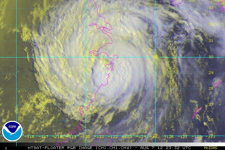
Image credit: TW
Typhoon Haikui is expected to make landfall overnight August 7–8, 2012. Authorities closed schools, grounded flights, and halted passenger train travel in coastal regions of China’s Zhejiang Province. Haikui approached the coast of China in the wake of Damrey and Saola, severe storms that came ashore just days earlier.

In the latest report by U.S. Navy’s Joint Typhoon Warning Center (JTWC), Haikui was located about 135 nautical miles south of Shanghai, China, and was moving northwestward at speed of 11 knots. Haikui had maximum sustained winds of 60 knots with gusts up to 75 knots. The JTWC storm track showed Haikui making landfall south of Shanghai between August 7 and 8, 2012.


Manila, Philippines is experiencing devastating floods. Read more here.
Satellite Animations
- Storm-Centered Infrared (MTSAT; NOAA/SSD)
- Storm-Centered Infrared (Aviation Color Enhancement) (MTSAT; NOAA/SSD)
- Storm-Centered Water Vapor (MTSAT; NOAA/SSD)
- Storm-Centered Visible (MTSAT; NOAA/SSD)
- Storm-Centered Visible (Colorized) (MTSAT; NOAA/SSD)
- Tropical West Pacific Infrared (MTSAT2; NOAA)
- Tropical West Pacific Enhanced Infrared (MTSAT2; NOAA)
- Tropical West Pacific Water Vapor (MTSAT2; NOAA)
- Tropical West Pacific Visible (MTSAT2; NOAA)

Souces: MODIS, JTWC, TRMM, Western Pacific Weather
Commenting rules and guidelines
We value the thoughts and opinions of our readers and welcome healthy discussions on our website. In order to maintain a respectful and positive community, we ask that all commenters follow these rules.