
CME impact generates wonderful auroras

Image credit: TW
As predicted by analysts at the Goddard Space Weather Lab, a coronal mass ejection (CME) hit Earth's magnetic field at approximately 2145 UT on Nov. 28th. The impact was weaker than expected, but it still produced bright auroras around the Arctic Circle.
Planetary K-index
Now: Kp= 4 unsettled
24-hr max: Kp= 4 unsettled
Interplanetary Mag. Field
Btotal: 12.4 nT
Bz: 11.5 nT north
SpaceWeather just released amazing images taken in Abisko in the Finnish Lapland at the Aurora Sky Station. The images below were taken by Chad Blakley from Aurora Sky Station:


Aurora Sky Station live webcam

from Helge Mortensen of Kvaløya, Norway

from Ulf Jonsson of Gussö, Luleå, Sweden
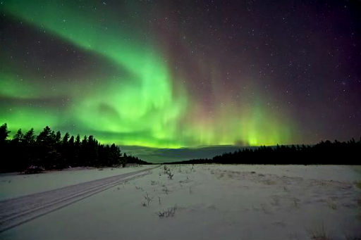
from Andy Keen of Ivalo Region, Finland, Scandinavia

from Antti Pietikäinen of Muonio, Lapland, Finland

from Fredrik Broms of Kvaløya, Norway

from Zoltan Kenwell of Alberta, Canada
Latest picture from the Kiruna All-Sky camera at: 2011-11-29 01:23:00 UTC

NOAA/SWPC Geophysical Activity Forecast: The geomagnetic field is expected to be unsettled to active with a chance for minor storm periods on days 1-2 (29-30 November). Activity is due to a combination of a coronal hole high speed stream (CH HSS) and the coronal mass ejection (CME) from 26/0712Z. On day 3 (01 December) mostly quiet to unsettled conditions are expected.


Conditions:
Active auroral displays will be visible overhead from Barrow to Anchorage and Juneau, and visible low on the horizon from King Salmon and Prince Rupert. Alaska Geophysical Institute Aurora Forecast


Earlier reporting
Nothing on Watchers was published in the last 24 hours. These are older articles.
- On October 22, 2017, a single flash of lightning stretched 515 miles from eastern Texas to near Kansas City, a distance that takes eight hours to drive, and nobody realized how far it had gone until scientists went back through the satellite data years later Epicenter
- CPC posts a slight risk of heavy rain from the Gulf Coast to the Northeast urban corridor November 25-29, and a moderate risk of West Coast wind and Sierra snow on November 25
- Florida's east coast faces a moderate flash flood risk Wednesday through Friday, with 4 to 8 inches of rain forecast and the St. Johns River near Cocoa already in major flood at 17.13 feet
- Cyclone Akvan to make landfall between Nellore and Visakhapatnam around noon on November 20, IMD forecasts 120-130 km/h winds gusting to 145



