
Incoming coronal mass ejection
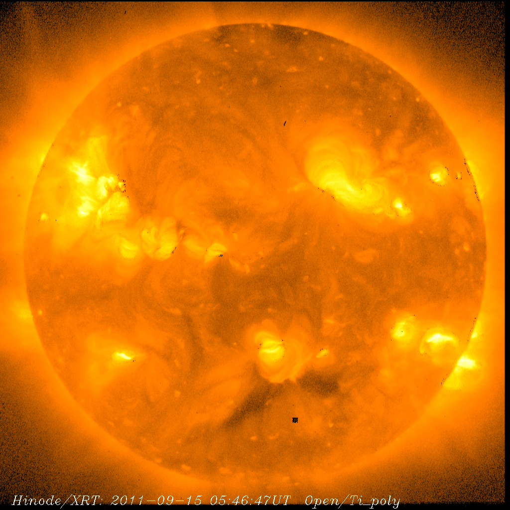
Image credit: TW
As predicted by analysts at the Goddard Space Weather Lab, a coronal mass ejection (CME) hit Earth’s magnetic field at ~03:30 UT on Sept 17th. The impact was not strong. Nevertheless, the arrival of the CME could spark geomagnetic activity around the Arctic Circle. High-latitude sky watchers should be alert for auroras. (SpaceWeather)
Solar wind
speed: 511.5 km/sec
density: 1.1 protons/cm3
The Radio Sun
10.7 cm flux: 143 sfu
Planetary K-index
Now: Kp= 0 quiet
24-hr max: Kp= 1 quiet
Interplanetary Mag. Field
Btotal: 10.5 nT
Bz: 7.0 nT north

C-Class flare activity continues on Friday around Sunspots 1290, 1295, 1296 and 1297. There will remain the chance for M-Class flares throughout the weekend. A new Sunspot group is forming in the southern hemisphere and was numbered 1299 on Friday.


Again because of the amount of sunspot regions on the face of the sun, the official Sunspot number count for Sept 16 is 173. This is another new record for Cycle 24 . Before the past few days, the previous mark of 153 was set on 4/13/2011.
Minor geomagnetic storming may be possible within 48 hours due to a faint incoming Coronal Mass Ejection (CME) that took place late Wednesday night. Be on the lookout for Aurora if you are high in latitude. (SolarHam)
NOAA/SWPC Alerts / Bulletins
Latest Alert: Sep 17 0515 UTC CONTINUED ALERT: Electron 2MeV Integral Flux exceeded 1000pfu
Last Advisory Bulletin: None in last 7 days.


 Significant geomagnetic storming is not expected but periods reaching the G1 (Minor) level are possible. Follow this link for more information on the NOAA Geomagnetic Storm Scales and the associated impacts. (NOAA/SWPC)

Earlier reporting
Nothing on Watchers was published in the last 24 hours. These are older articles.
- On October 22, 2017, a single flash of lightning stretched 515 miles from eastern Texas to near Kansas City, a distance that takes eight hours to drive, and nobody realized how far it had gone until scientists went back through the satellite data years later Epicenter
- CPC posts a slight risk of heavy rain from the Gulf Coast to the Northeast urban corridor November 25-29, and a moderate risk of West Coast wind and Sierra snow on November 25
- Florida's east coast faces a moderate flash flood risk Wednesday through Friday, with 4 to 8 inches of rain forecast and the St. Johns River near Cocoa already in major flood at 17.13 feet
- Cyclone Akvan to make landfall between Nellore and Visakhapatnam around noon on November 20, IMD forecasts 120-130 km/h winds gusting to 145
