
Maria becomes third hurricane of 2011 season
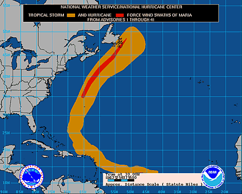
Image credit: TW
Maria, the 13th named storm of the season, has sustained winds of 75 mph (120 kph), just above the hurricane-strength threshold. The storm is currently on a latitude about level with North Carolina and is spinning some 205 miles (330 kilometers) north-northwest of Bermuda, which saw some tropical storm-force winds from Maria as it passed by.
Maria’s projected path is moving towards the northeast and maintaining its hurricane status until it hits Newfoundland on Friday afternoon. Environment Canada has issued a hurricane watch for the Avalon Peninsula of Newfoundland.
Maria’s current wind speeds rate it a Category 1 storm on the Saffir-Simpson scale of hurricane strength. The storm could strengthen somewhat during the night before weakening again on Friday.
Storm surge and destructive waves are possible in the area under watch.
The other two hurricanes that have formed so car this season were Irene and Katia. Irene made multiple landfalls as it swept up the U.S. East Coast late last month. Katia stayed out at see for most of its lifetime, only edging by the outer Caribbean islands and Bermuda, until it arced its way to the British Isles, which it hit as a tropical storm.
The season was predicted to be a doozy, with 14 to 19 named storms (which include tropical storms and hurricanes), seven to 10 hurricanes and three to five major hurricanes (Category 3 or higher). So far there have been 14 named storms (Nate formed shortly after Maria, but dissipated after striking Mexico shortly after it formed), two hurricanes and two major hurricanes (Irene and Katia). (OAP)

| Post-Tropical Cyclone MARIA | |||||||||||||||
| |||||||||||||||
Satellite Animations
- Storm-Centered Infrared (GOES 12; NOAA/SSD)
- Storm-Centered Infrared (Aviation Color Enhancement) (GOES 12; NOAA/SSD)
- Storm-Centered Water Vapor (GOES 12; NOAA/SSD)
- Storm-Centered Visible (GOES 12; NOAA/SSD)
- Storm-Centered Visible (Colorized) (GOES 12; NOAA/SSD)
- Northwest Atlantic Infrared (GOES 12; NOAA/SSD)
- Northwest Atlantic Infrared (Aviation Color Enhancement) (GOES 12; NOAA/SSD)
- Northwest Atlantic Water Vapor (GOES 12; NOAA/SSD)
- Northwest Atlantic Visible (GOES 12; NOAA/SSD)
- Northwest Atlantic Visible (Colorized) (GOES 12; NOAA/SSD)
Commenting rules and guidelines
We value the thoughts and opinions of our readers and welcome healthy discussions on our website. In order to maintain a respectful and positive community, we ask that all commenters follow these rules.