
Geomagnetic storm still in progress but lingering
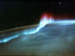
Image credit: TW
A geomagnetic storm is in progress. It began on August 5th around 18:00 UT when a CME struck Earth's magnetic field. At its peak during the hours just after impact, the storm registered 8 on the 0 to 9 "K-index" scale of geomagnetic disturbances, making it one of the strongest magnetic storms in years. The subsiding storm will likely take many more hours to peter out, so high-latitude sky watchers should remain alert for auroras.
The timing of the CME impact favored observers in Europe. "For the first time, I have seen Northern Lights from England," reports Marvin Watson of Whitehaven, who took this picture just after local midnight on Aug. 6th:

Other notable displays occured in Finland, Germany and Poland


Geomagnetic storm lingers
Geomagnetic Storm conditions persist after initially reaching Strong G3 Storm Levels. Ham Radio Ops in North America continue to make aurora contacts on 6 meters (50mhz). The storm is the result of an incoming CME shock that swept past earth Friday evening. The solar wind peaked over 700 km/s and the Bz tilted sharply south (-20 nt) for long periods. Continue to monitor the skies if you are high in latitude and if it is dark outside.

Solar activity as far as Solar Flares and Sunspots go has been fairly quiet over the past 36 hours with only C-Class activity taking place. Sunspot 1260 is now out of direct earth view. Sunspots 1261 and 1263 are stable but may still produce an M-Class flare. A new sunspot numbered 1267 on Friday continues to expand somewhat in the southern hemisphere. (SolarHam)

Earlier reporting
Nothing on Watchers was published in the last 24 hours. These are older articles.
- On October 22, 2017, a single flash of lightning stretched 515 miles from eastern Texas to near Kansas City, a distance that takes eight hours to drive, and nobody realized how far it had gone until scientists went back through the satellite data years later Epicenter
- CPC posts a slight risk of heavy rain from the Gulf Coast to the Northeast urban corridor November 25-29, and a moderate risk of West Coast wind and Sierra snow on November 25
- Florida's east coast faces a moderate flash flood risk Wednesday through Friday, with 4 to 8 inches of rain forecast and the St. Johns River near Cocoa already in major flood at 17.13 feet
- Cyclone Akvan to make landfall between Nellore and Visakhapatnam around noon on November 20, IMD forecasts 120-130 km/h winds gusting to 145
