Tornado Watch issued for Nebraska, Iowa, and Missouri, higher-end threat expected across Kansas and Oklahoma
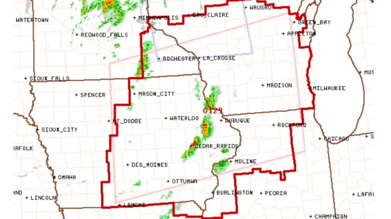
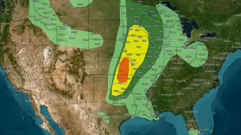
The NWS Storm Prediction Center issued Tornado Watch 134 at 17:00 UTC (12:00 CDT) on April 23, 2026, for eastern Nebraska, western and central Iowa, and northwest Missouri as severe thunderstorms began developing and increasing in coverage along a cold front. The watch includes tornado potential, damaging wind gusts up to 110 km/h (70 mph), and large hail up to 6.4 cm (2.5 inches), while a separate Enhanced Risk area across eastern Kansas and northern Oklahoma is expected to produce more intense severe storms later in the afternoon and evening.