• Catastrophic floods in Valencia, Spain caused by historic rainfall claim over 150 lives, leave dozens missing

    A powerful storm system hit eastern Spain this week, delivering more than a year’s worth of rain in just one day and causing historic flooding in Valencia, where at least 62 people lost their lives on Tuesday, October 29, 2024. The town of Chiva set a new 24-hour rainfall record, reporting 491 mm (19.33 inches) in just eight hours, while several other areas recorded rainfall totals between 100 mm (3.94 inches) and 200 mm (7.87 inches) on the same day.

  • Typhoon “Kong-rey” rapidly intensifying as it moves toward Taiwan

    Typhoon “Kong-rey” is rapidly intensifying as it moves west-northwest toward Taiwan. The current forecast track calls for landfall on Taiwan’s southeastern coast within the next 48 – 60 hours. However, a shift westward could also lead to a direct landfall on Batanes, Philippines. Kong-rey is forecast to significantly strengthen and potentially reach super typhoon status as it approaches Taiwan.

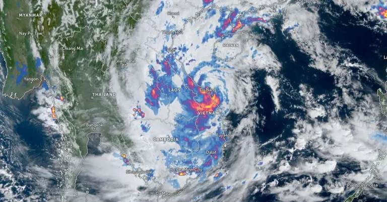
  • Tropical Storm “Trami” hits Vietnam after leaving 126 dead or missing in Philippines

    Severe Tropical Storm “Trami” made landfall in Divalacan, Isabela, Philippines on October 23, 2024, causing widespread flooding and landslides in which at least 90 people died and 36 remain missing. Trami reached Vietnam on October 27 and made landfall in Thua Thien-Hue and Da Nang at around 03:00 UTC, with maximum sustained winds of 88 km/h (55 mph).

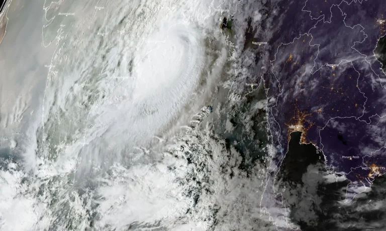
  • 1.5 million evacuating ahead of Severe Cyclonic Storm “Dana” landfall in Odisha, India

    Severe Cyclonic Storm “Dana” has intensified and is expected to make landfall over the north Odisha and West Bengal coasts between Puri and Sagar Island, close to Bhitarkanika and Dhamara, between 18:00 UTC on October 24 and 00:00 UTC on October 25, 2024, with a wind speed of 100 – 110 km/h (62 – 68 mph), gusting to 120 km/h (74.6 mph).

  • Extreme rainfall hits Ardèche Cévennes with up to 700 mm (27.6 inches) in 24 hours, France

    A slow-moving storm brought extremely heavy rains to parts of France on Thursday, October 17, 2024, with the Ardèche Cévennes region experiencing rainfall totals as high as 700 mm (27.6 inches). This led to widespread flooding and approximately 350 rescue operations. Agnès Pannier-Runacher, Minister of Ecological Transition, said the region is facing a situation that is unprecedented in its scale.

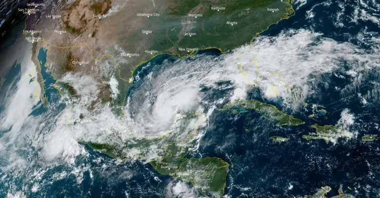
  • Yucatán Peninsula in path of extremely dangerous Category 5 Hurricane “Milton” — Florida braces for major impact on Wednesday

    Hurricane “Milton” rapidly intensified on Monday, October 7, 2024, and is now a major category 4 hurricane on the Saffir-Simpson Hurricane Wind Scale. The National Hurricane Center (NHC) expects Milton to become a Category 5 hurricane today, making it the strongest Gulf of Mexico hurricane this late in the calendar year in the satellite era (since 1966). Milton is forecast to move near or just north of the Yucatán Peninsula today and Tuesday, then cross the eastern Gulf of Mexico and approach the west coast of the Florida Peninsula by Wednesday.