
The fastest wind gust ever measured on Earth, 253 mph, hit an oil island off Australia during Cyclone Olivia in 1996, and nobody noticed for more than a decade, until experts reading old data quietly took the record from New Hampshire’s Mount Washington
A wind gust of 408 km/h (253 mph) was measured on Barrow Island, Western Australia, during Cyclone Olivia on April 10, 1996, exceeding the world-record wind speed set on Mount Washington in 1934. Yet the observation remained outside the internationally recognized record for nearly 14 years, even though scientists had already documented the extraordinary winds and investigated their possible cause.
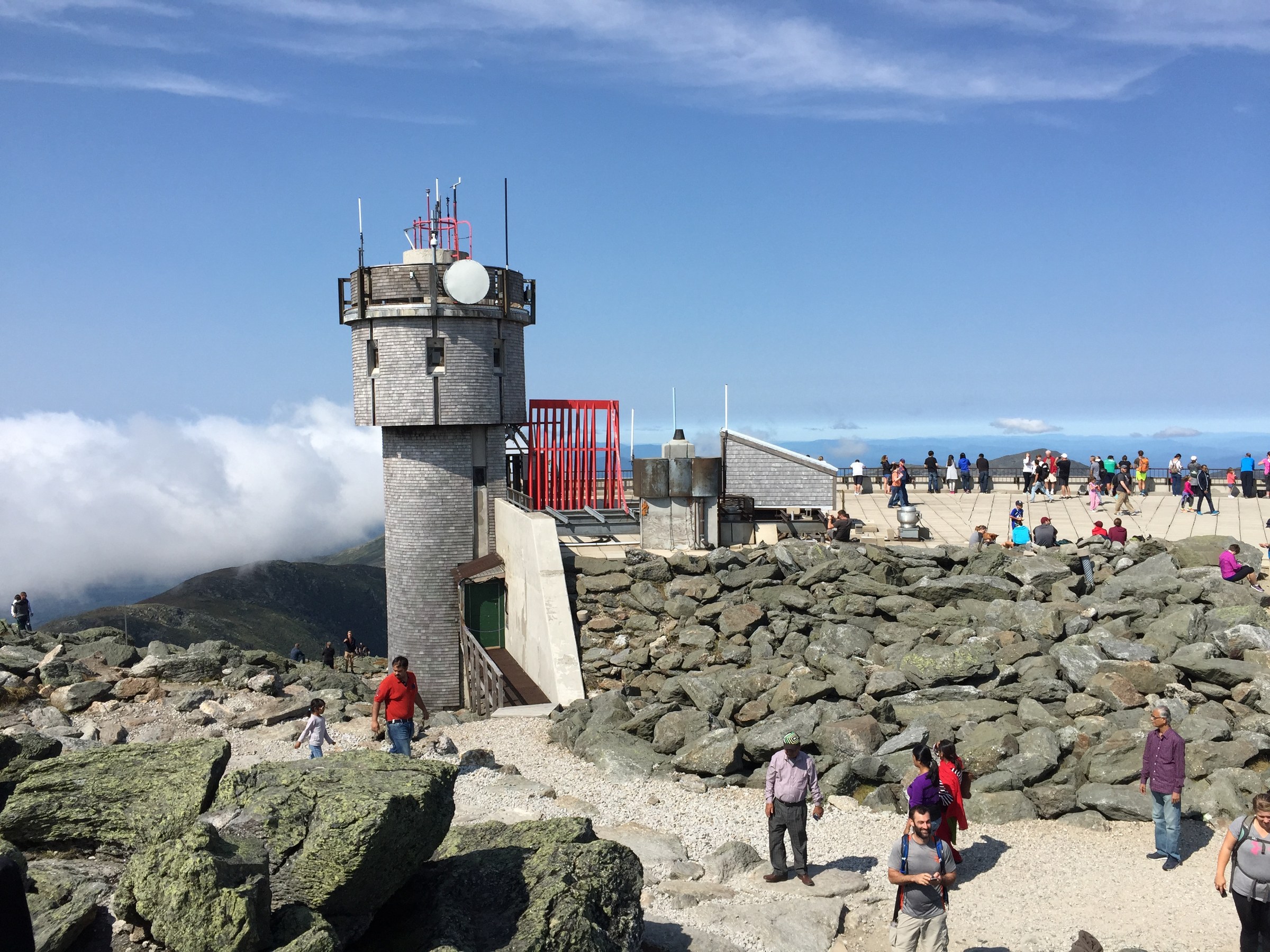
2016-09-03 14 08 03 Observation tower at the Mount Washington Observatory on Mount Washington in Sargent's Purchase Township, Coos County, New Hampshire. Credit: Famartin (CC BY-SA 4.0), via Wikimedia Commons.
The World Meteorological Organization (WMO) lists the Barrow Island observation as the world’s highest three-second surface wind gust outside tornadoes. Its archive gives a speed of 113.2 m/s (253 mph), while the peer-reviewed verification study published by Courtney et al. (2012) reports 113.3 m/s. Both figures describe the same 408 km/h event.
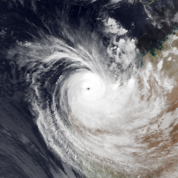
Severe Tropical Cyclone Olivia crossed Western Australia’s Pilbara coast near Mardie on April 10, 1996. The Australian Bureau of Meteorology (BoM) classified Olivia as a Category 4 cyclone, estimating maximum mean winds of 195 km/h (121 mph). The cyclone was close to peak intensity when its eyewall passed Barrow Island and other offshore petroleum facilities.
The record was registered by an automatic weather station fitted with a heavy-duty, three-cup Synchrotac anemometer. The instrument stood 10 m (33 feet) above ground level at a site approximately 64 m (210 feet) above sea level. The station was located inland from Barrow Island’s coast, over relatively level terrain with low vegetation and exposure to winds from the directions that produced the extreme gusts.
The peak reading was recorded at 10:55 UTC (18:55 Western Australian Standard Time) on April 10. According to Courtney et al. (2012), the monitoring system sampled wind speed twice per second and calculated a moving three-second average from six consecutive samples. The reported record was therefore a short-period average, not a single instantaneous sensor reading.
The weather station’s five-minute observations captured several exceptional gusts as Olivia’s eyewall passed. The WMO records successive extreme values of 369 km/h (229 mph), 408 km/h (253 mph) and 374 km/h (232 mph), with later peaks of 347 km/h (216 mph) and 298 km/h (185 mph). The sequence became an important part of the verification because the highest gust was accompanied by other extreme measurements rather than appearing as an isolated spike.

The extreme gusts were substantially stronger than the surrounding mean winds. WMO documentation reports a maximum five-minute mean wind of 176 km/h (109 mph) during the period and gust factors reaching approximately 2.75. These ratios were much higher than the average gust factor recorded during the cyclone, indicating a localized enhancement of wind speed within the broader circulation.
The initial scientific problem was whether the measurements reflected genuine atmospheric winds or a fault in the observation system. BoM had received the data, but the extraordinary values were regarded with skepticism. The station was privately operated, and its exceptional readings had not undergone the same verification process as measurements taken by the bureau’s own observing network.
The later verification reviewed the anemometer’s design, maintenance history, sampling method, data logger and the consistency of the surrounding observations. The instrument had been regularly inspected, and researchers examined whether electrical interference or mechanical behavior might have produced false readings. A WMO evaluation committee ultimately accepted the evidence that the record gust was valid.

Courtney et al. (2012) documented the wind measurements and the committee’s investigation in the Australian Meteorological and Oceanographic Journal. The authors emphasized that accepting the gust as a world record did not require identifying a single, definitively observed atmospheric mechanism responsible for producing it.
One explanation considered by researchers involved an eyewall mesovortex, a compact circulation embedded in the ring of intense thunderstorms surrounding a tropical cyclone’s eye. Such circulations can produce locally enhanced winds over relatively small areas. Earlier analysis of Olivia’s observations proposed that a mesovortex was responsible for the unusually large gusts, but no individual vortex was directly measured at the weather station.
The available radar and satellite imagery also limited the physical interpretation. Courtney et al. (2012) reported that radar observations from Learmonth placed the event near the inner edge of Olivia’s western eyewall, but the observing geometry and resolution did not allow researchers to resolve the small-scale feature that might have produced the strongest gusts. The mesovortex remained a proposed explanation, not a confirmed tornado.
Olivia caused extensive damage along the Pilbara coast and at offshore industrial facilities. BoM reports millions of dollars in damage to the petroleum industry around Barrow Island, along with serious damage at Mardie and nearby cattle stations. Buildings and infrastructure in Pannawonica were also damaged as the cyclone moved inland.
Extreme winds were recorded beyond Barrow Island. Varanus Island registered a gust of 267 km/h (166 mph), while Mardie Station measured 257 km/h (160 mph). Both observations confirmed that Olivia produced destructive winds across a wider area, although neither approached the exceptional value recorded on Barrow Island.
BoM did not revise Olivia’s overall cyclone intensity to match the Barrow Island gust. The Australian tropical cyclone category system is based on sustained winds and associated intensity estimates, rather than the highest localized gust at a single observing site. The bureau retained Olivia’s Category 4 classification and explicitly stated that the Barrow Island measurement was not representative of the cyclone’s overall intensity.
The record was not entirely unknown during the years following the cyclone. Researchers associated with the station’s operators discussed the observations in technical work presented at the Offshore Technology Conference in Houston in 1999. The exceptionally high values had therefore entered the engineering and meteorological literature, but they had not become an internationally accepted weather record.
The WMO began establishing its formal international archive of weather and climate extremes in 2006, a decade after Olivia. The archive introduced a process through which expert committees could investigate exceptional observations, examine instrument reliability and determine whether the available evidence justified an official record.
The Australian readings returned to international attention during investigations of other extreme wind measurements, including observations from Hurricane Gustav in Cuba in 2008. The WMO’s subsequent review of Olivia examined the original Barrow Island data, earlier technical research and the performance of the recording equipment. In January 2010, the organization publicly announced the Australian gust as a new world record.
The delay changed the history of a record long associated with Mount Washington Observatory in New Hampshire, United States. On April 12, 1934, observers on the mountain had measured a gust of 372 km/h (231 mph), establishing a benchmark that remained internationally recognized until the Olivia observation was accepted.
The Mount Washington and Barrow Island measurements came from different observing environments. Mount Washington’s record was obtained at a staffed mountain observatory, where personnel maintained instruments in severe weather. Olivia’s gust came from an automatic industrial weather station exposed to tropical cyclone conditions, with the data subsequently subjected to a detailed international verification.
The distinction between measured surface gusts and winds inferred from tornado observations is also central to the WMO classification. Radar measurements associated with tornadoes can show higher wind speeds, but they are treated separately from the archive’s global record for a directly measured three-second surface wind gust. Olivia’s 408 km/h observation retains that specific distinction in the WMO record.
Courtney et al. (2012) concluded that the measurement demonstrated the potential for very localized gusts to exceed the winds normally associated with tropical cyclone intensity categories. The finding has implications for assessing extreme wind exposure at vulnerable coastal and offshore installations, where a storm’s maximum sustained wind does not necessarily describe the strongest short-duration wind experienced at a particular site.
References:
1 Courtney, J., Buchan, S., Cerveny, R. S., Bessemoulin, P., Peterson, T. C., Rubiera Torres, J. M., Beven, J., King, J., Trewin, B., & Rancourt, K. (2012). Documentation and verification of the world extreme wind gust record: 113.3 m s⁻¹ on Barrow Island, Australia, during passage of tropical cyclone Olivia. Australian Meteorological and Oceanographic Journal, 62(1), 1–9. DOI: 10.1071/ES12001 – OPEN ACCESS.
2 Global; Southern Hemisphere; Eastern Hemisphere: Maximum Surface Wind Gust (3-Second) – World Meteorological Organization – Accessed November 10, 2026.
3 Severe Tropical Cyclone Olivia – Australian Bureau of Meteorology – Accessed November 10, 2026.

I’m a science journalist and researcher at The Watchers, contributing to the Epicenter edition, where I cover peer-reviewed scientific research and emerging discoveries across Earth and space sciences. With a background in astronomy and a passion for environmental science, I’ve worked in shark and coral conservation in Fiji, conducting reef and shark-behavior research, contributing to mangrove restoration, and earning PADI Open Water and Coral Reef Certifications. I bring a blend of scientific rigor and storytelling to illuminate the discoveries shaping our planet and beyond.
Published in the last 24 hours
- The people who pay closest attention to the weather are the ones storms have already cost the most, a study of 946 students found, with one damaging storm making little difference to how much attention a student paid, but two or more making a clear one Epicenter
- A dam above Los Angeles collapsed just before midnight on March 12, 1928, and the flood killed more than 400 people, hours after the engineer who built it had spent two hours looking at a new leak and decided there was no danger Epicenter
- In 1903, 17 coal miners in Frank, Alberta, dug their own way out of a mountain after a rockslide sealed the mine, and came up 13 hours later to find part of their town buried Epicenter
- Brownsville, Texas, on the Mexican border, had not seen measurable snow since 1895, until it fell on Christmas Eve 2004 Epicenter
