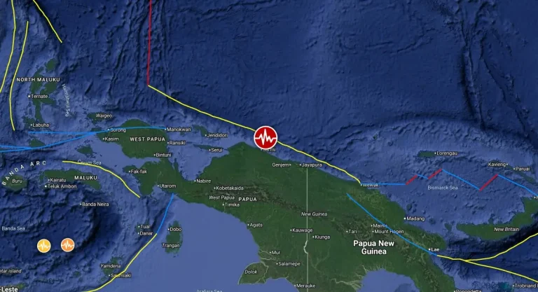
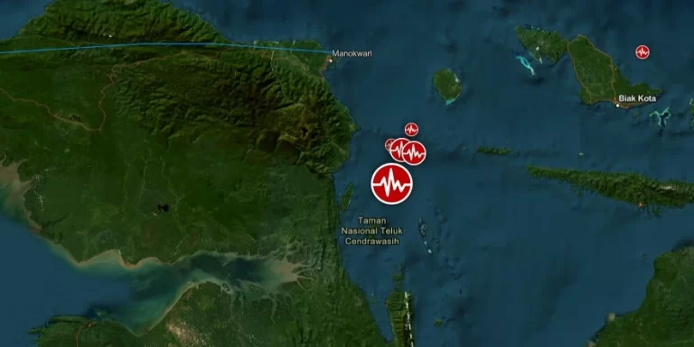
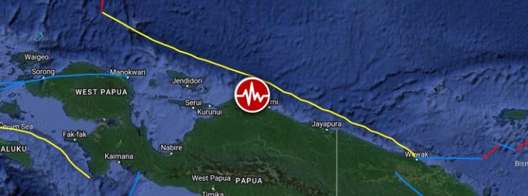
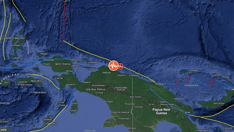
Shallow M6.1 earthquake hits near the north coast of Papua, Indonesia

Shallow M6.1 earthquake hits near the north coast of Papua, Indonesia

A strong and shallow earthquake registered by the BMKG as M6.1 hit near the north coast of Papua, Indonesia at 00:02 UTC (07:02 LT) on April 9, 2024. The agency is reporting a depth of 10 km (6.2 miles). USGS is reporting M6.0 at a depth of 9 km (5.6 miles); EMSC M6.0 at a depth of 10 km (6.2 miles).

Shallow M6.4 earthquake hits near the north coast of Papua, Indonesia

Shallow M6.4 earthquake hits near the north coast of Papua, Indonesia

A strong and shallow earthquake registered by the BMKG as M6.4 hit near the north coast of Papua, Indonesia at 17:16 UTC on December 30, 2023. The agency is reporting a depth of 40 km (25 miles). USGS and EMSC are reporting M6.3 at a depth of 39 km (24 miles).

Two shallow M6.2 earthquakes hit Papua, Indonesia

Two shallow M6.2 earthquakes hit Papua, Indonesia

A series of earthquakes hit Papua, Indonesia on September 9 and 10, 2022. The first quake, registered by the USGS as M6.2 hit at 23:31 UTC on September 9 at a depth of 18 km (11.2 miles). It was followed by M5.9 at 23:44 UTC at a depth of 19.1 km (11.9 miles) and another M6.2 at 00:05 UTC on September 10.

Shallow M6.0 earthquake hits near the south coast of Papua, Indonesia

Shallow M6.0 earthquake hits near the south coast of Papua, Indonesia

A strong and shallow earthquake registered by the USGS as M6.0 hit near the south coast of Papua, Indonesia at 17:46 UTC on November 10, 2021. The agency is reporting a depth of 10 km (6.2 miles). EMSC is reporting M6.0 at a depth of 5 km (3.1 miles). The epicenter…

Strong and shallow M6.1 earthquake hits northern Papua, Indonesia

Strong and shallow M6.1 earthquake hits northern Papua, Indonesia

A strong and shallow earthquake registered by the USGS as M6.1 hit northern Papua, Indonesia at 01:05 UTC (10:05 local time) on June 24, 2019. The agency is reporting a depth of 22 km (13.6 miles). EMSC is reporting M6.1 at a depth of 30 km (18.6 miles). The…

Strong and shallow M6.3 earthquake hits Papua, Indonesia

Strong and shallow M6.3 earthquake hits Papua, Indonesia

A strong and shallow earthquake registered by the USGS as M6.3 hit Papua, Indonesia at 17:24 UTC on June 19, 2019 (02:24 LT, June 20). The agency is reporting a depth of 12.1 km (7.5 miles). EMSC is reporting M6.3 at a depth of 2 km (1.2 miles). The epicenter was…

Magnitude 6.7 earthquake struck near the South Coast of Papua, Indonesia

Magnitude 6.7 earthquake struck near the South Coast of Papua, Indonesia

A very strong earthquake with recorded magnitude of 6.7 struck near the South Coast of Papua, Indonesia on October 12, 2012 at 00:31 UTC according to USGS and EMSC. Epicenter was located 103 km (64 miles) N of Dobo, Indonesia and 173 km (107 miles) ENE of Tual,

Magnitude 6.0 earthquake hit Papua, Indonesia

Magnitude 6.0 earthquake hit Papua, Indonesia

Strong earthquake with recorded magnitude 6.0 hit Papua, Indonesia on September 8, 2012 at 10:51 UTC according to USGS. Epicenter was located 160 km (100 miles) WNW (295°) from Enarotali, Irian Jaya, Indonesia at coordinates 3.199°S, 135.005°E. USGS recorded

Magnitude 6.6 earthquake near north coast of Papua, Indonesia

Magnitude 6.6 earthquake near north coast of Papua, Indonesia

Magnitude 6.6 earthquake struck near the north coast of Papua, Indonesia on April 21st at 01:16:54 UTC according to EMSC and PTWC. The epicenter was located 82 km (51 miles) SSE (168°) from Manokwari, Irian Jaya,  336 km (209 miles) NW (316°) from Enarotali, Irian