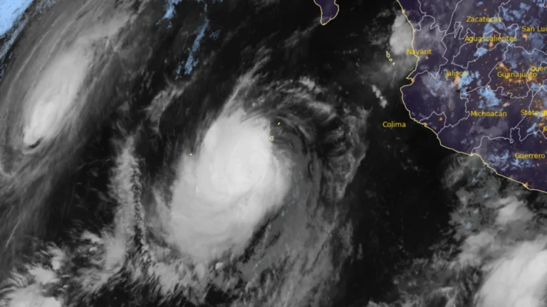
• Hurricane Polo and remnants of Odalys bring heavy rain and flash flood risk across the Four Corners region, U.S.

    Heavy rain is forecast across the Four Corners region through 05:00 PT (12:00 UTC) on September 30, with 50–100 mm (2–4 inches) expected across much of eastern Arizona, western New Mexico, and the San Juan Mountains of southwestern Colorado. Moderate Risk excessive-rainfall outlooks, level 3 of 4, cover much of Arizona and New Mexico and parts of southern Utah and southern Colorado, corresponding to a ≥40% probability of flash flooding.
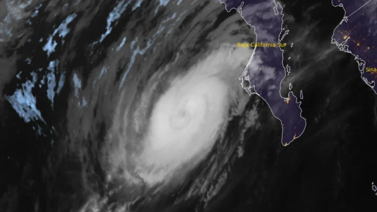
  • Hurricane Polo makes landfall south of Las Barrancas, Baja California Sur, Mexico

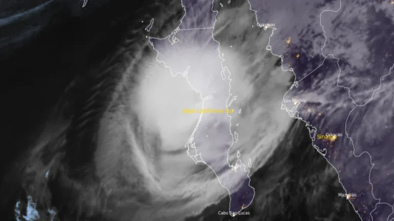
    Hurricane Polo made landfall on the west coast of Baja California Sur just south of Las Barrancas at approximately 23:00 MST on September 28 (06:00 UTC on September 29), with maximum sustained winds of 175 km/h (110 mph), according to the US National Hurricane Center (NHC). Life-threatening winds and flash flooding were ongoing, and Polo was forecast to cross the peninsula before making a second landfall in southern Sonora as a hurricane on Tuesday morning.

  • Hurricane Polo forecast to make two landfalls in Baja California Sur and Sonora, Mexico

    Category 3 Hurricane Polo was approaching Baja California Sur on September 28, 2026, as Hurricane Warnings covered sections of both coasts of the peninsula and mainland Sonora. At 05:00 MST (12:00 UTC), the National Hurricane Center placed Polo 175 km (110 miles) southwest of Cabo San Lázaro with maximum sustained winds of 185 km/h (115 mph), and forecast landfall in Baja California Sur late that afternoon or early evening before the cyclone reached southern Sonora as a hurricane late that night or early September 29.

  • Baja California Sur prepares for Hurricane Polo ahead of Monday landfall, Mexico

    Hurricane warnings covered portions of both coasts of Baja California Sur on September 27, 2026, as Major Hurricane Polo moved north-northwest toward the peninsula, according to the National Hurricane Center (NHC). At 02:00 MST (09:00 UTC), the Category 3 hurricane had maximum sustained winds of 195 km/h (120 mph) and was forecast to approach the western coast on Monday, cross the peninsula Monday night and approach northwestern mainland Mexico early Tuesday.

  • Hurricane Polo brings heavy rain to Mexico, NHC forecasts Baja California approach

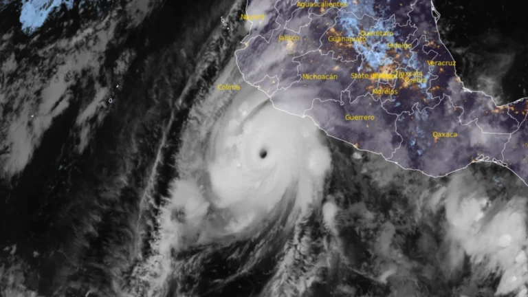
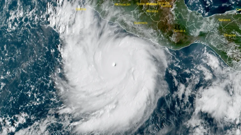
    Hurricane Polo’s outer rainbands brought heavy rain to southwestern Mexico on September 24, 2026, with a Tropical Storm Warning in effect from Tecpan de Galeana to Manzanillo. Mexico had extended the warning westward overnight as the Category 5 hurricane remained offshore, bringing a risk of flooding, mudslides and dangerous coastal conditions.Polo is forecast to approach the Baja California Peninsula as a hurricane early in the week beginning September 28.

  • Hurricane Polo intensifies to Category 5, heavy rainfall threatens southwestern Mexico

    Hurricane Polo intensified to Category 5 south of southwestern Mexico on September 22, 2026, reaching maximum sustained winds of 260 km/h (160 mph) at 12:00 UTC before strengthening further to 270 km/h (165 mph) by 15:00 UTC, according to the US National Hurricane Center (NHC). A Tropical Storm Warning was in effect for part of the southwestern Mexican coast, while heavy rainfall through September 24 threatened life-threatening flooding and mudslides in Guerrero and Michoacán.