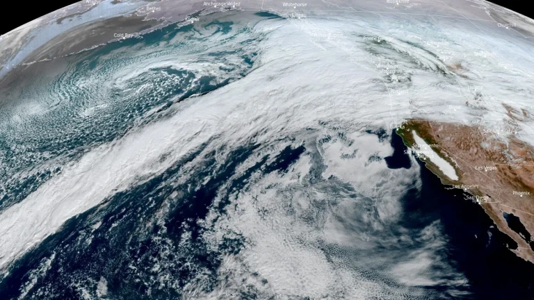
• Back-to-back atmospheric rivers forecast to impact the U.S. West Coast through December 20

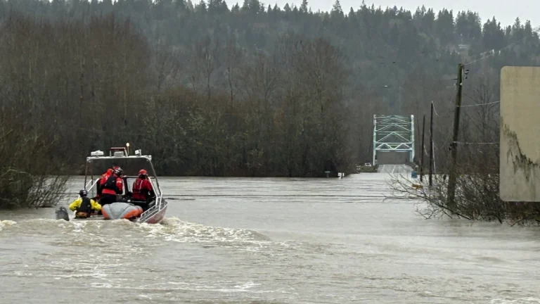
    Two atmospheric rivers are forecast to bring prolonged heavy rain and mountain snow to the Pacific Northwest and northern California through December 20, 2025. The Weather Prediction Center (WPC) forecasts 100–150 mm (4–6 inches) of precipitation across western Washington and 100–200 mm (4–8 inches) across western Oregon, with locally higher totals in the Cascades and coastal ranges.

  • Leavenworth Christmastown festival cancelled as historic flooding and power disruptions hit Washington, U.S.

    The Leavenworth Christmastown festival was cancelled after historic Washington floods triggered widespread power outages across Chelan County. Over 5 000 customers across the county, accounting for more than 11 000 people, were left without power due to the impacts of a major atmospheric river (AR). Power is expected to be restored for most customers by the evening of December 13, 2025, while debris cleanup and recovery efforts are expected to continue until next weekend.

  • After historic flooding in Washington, a new atmospheric river is forecast to impact the U.S. West Coast

    Historic flooding caused by a major atmospheric river earlier this week impacted large parts of western Washington state, prompting evacuations, emergency declarations, and record river levels. As impacts from that event persist, another strong atmospheric river is forecast to reach the Pacific Northwest on Sunday, December 14, 2025, bringing a prolonged period of precipitation to Washington, Oregon, and northern California through mid-week.

  • Major atmospheric river moves into Washington State, triggering widespread and potentially historic riverine flooding

    A major atmospheric river is producing very heavy precipitation across western Washington today into early December 11, 2025, triggering widespread and potentially historic riverine flooding, according to the Center for Western Weather and Water Extremes (CW3E). Forecasts indicate 130–200 mm (5–8 inches) of rain over the central and northern Washington Cascades and 75–130 mm (3–5 inches) over the Olympic Peninsula through 04:00 PST (12:00 UTC) on December 12. CW3E modeling shows 15 river gauges expected to exceed major flood stage and four to surpass record levels within 48 hours.

  • Multi-model forecasts indicate increased atmospheric river activity and transition from West Coast Ridge to Pacific Ridge in late December

    Subseasonal forecasts by CW3E show strong multi-model agreement on above-normal atmospheric river activity across the U.S. West Coast during mid- to late December, with the strongest signals over Northern California. Forecast regime tools indicate a transition from a West Coast Ridge to a Pacific Ridge during this period, altering temperature and precipitation patterns across the region.