
Significant coastal storm forecast to impact East Coast this weekend
A powerful coastal storm is forecast to affect parts of the eastern United States over the coming weekend. The system is forecast to develop off the Southeast Coast on Saturday, January 31, 2026, and track northeastward through Sunday, February 1, bringing the potential for heavy snow, gusty winds, and hazardous travel conditions across portions of the Mid-Atlantic and New England.
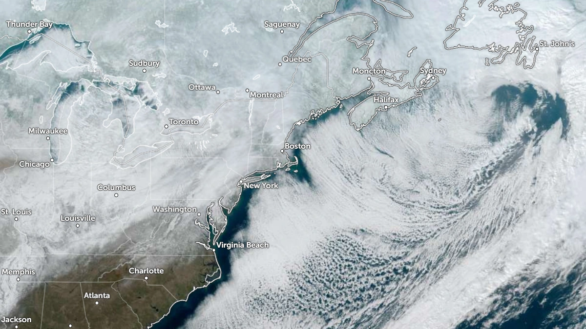
Satellite image of the U.S. East Coast at 17:40 UTC on January 27, 2026. Credit: NOAA/GOES-19, Zoom Earth, The Watchers
Forecast confidence has further increased in the development of a strong surface low-pressure system along the U.S. East Coast, according to the Weather Prediction Center (WPC).
The storm is expected to form over the Southeast Coast on Saturday, January 31, and move off the Mid-Atlantic by Sunday, interacting with a very cold air mass entrenched across the eastern half of the country.
This setup could result in widespread heavy rain, with snow likely across parts of the Carolinas, the Mid-Atlantic, and southern New England.

“This rapidly deepening storm system will produce powerful onshore winds along the Mid-Atlantic Coast from the North Carolina Outer Banks northward,” NWS forecaster Ziegenfelder noted.
“Wind gusts near hurricane-force will coincide with astronomical high tides, producing moderate to locally significant coastal flooding. In addition, near-blizzard conditions are expected across northeastern North Carolina and Southeastern Virginia, with sharply reduced visibilities due to snow and blowing snow, making travel extremely treacherous.”
Hazardous driving conditions, travel disruption, and strong coastal winds are likely across the East Coast. Rough surf, strong gusts, and possible minor flooding are forecast for coastal areas across the region, depending on the low’s track and timing.
However, forecast uncertainty remains high regarding the precise storm track and the rain–snow line location, which will determine where the heaviest snowfall and strongest winds occur.
This event will coincide with another Arctic blast forecast to bring sub-freezing temperatures across much of the region through the end of January into early February.
References:
1 Short Range Forecast Discussion – NWS/WPC – January 29, 2026

I am an Assistant Editor and Severe Weather & Science Journalist at The Watchers, specializing in real-time severe weather coverage, geophysical event reporting, and research-driven scientific analysis. You can reach me at rishav(at)watchers(.)news.
Commenting rules and guidelines
We value the thoughts and opinions of our readers and welcome healthy discussions on our website. In order to maintain a respectful and positive community, we ask that all commenters follow these rules.