
Shallow M5.6 earthquake hits Gilgit-Baltistan region, Pakistan
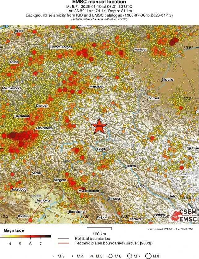
A shallow earthquake registered by the USGS as M5.6 (downgraded from M5.9) struck near Barishal, Gilgit-Baltistan, Pakistan at 06:21 UTC on January 19, 2026. The agency is reporting a depth of 35 km (21.7 miles). EMSC is reporting M5.7 at a depth of 31 km (19.3 miles).
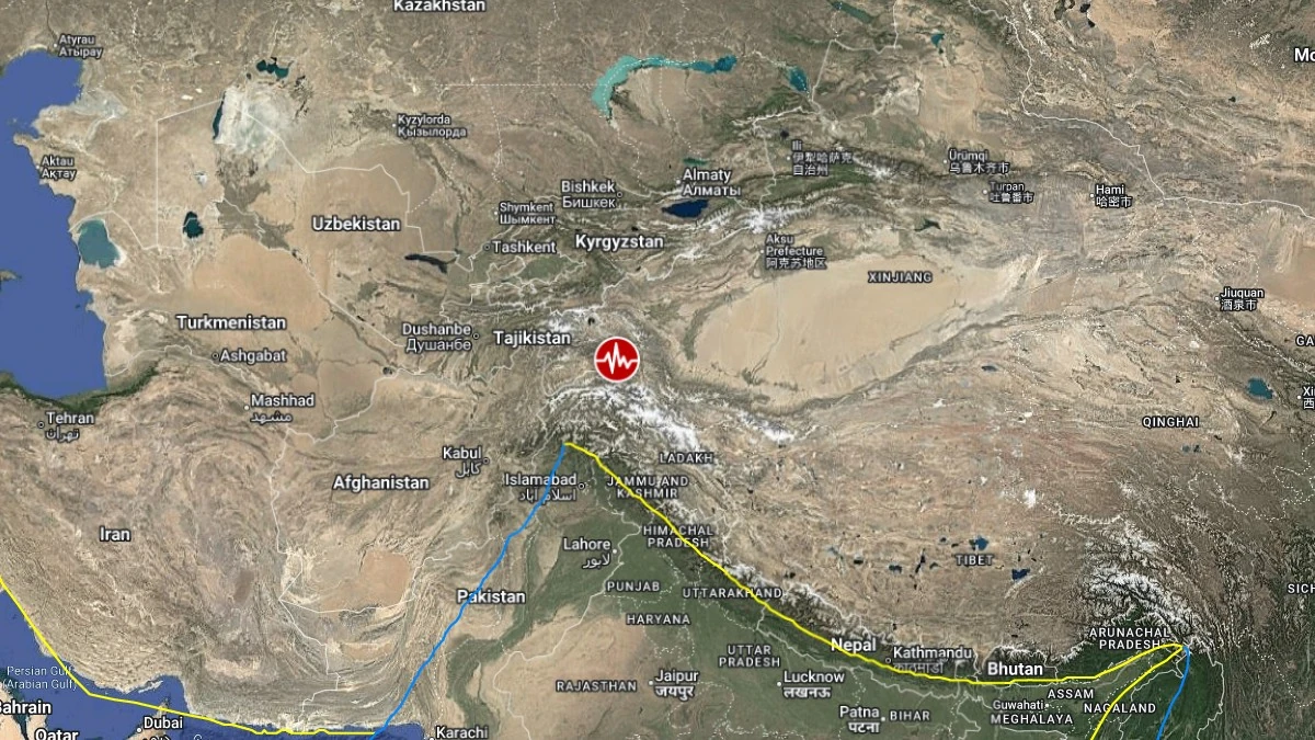
Epicenter of M5.6 earthquake in Barishal, Pakistan on January 19, 2026. Credit: TW/SAM, Google
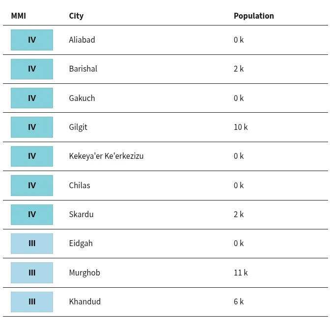
The epicenter was located 50 km (31 miles) NNW of Barishal (population 2 005), 85 km (53 miles) NE of Gahkuch (population 10 000), and 90 km (56 miles) N of Gilgit (population 10 414), Gilgit-Baltistan, Pakistan.
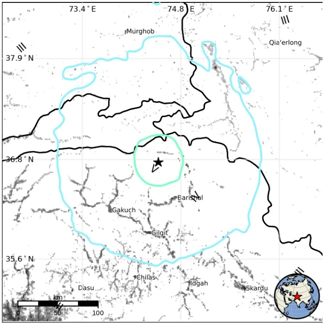
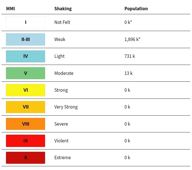
1 896 000 people are estimated to have felt weak shaking, 731 000 light, and 13 000 moderate.
The USGS issued a Green alert for shaking-related fatalities and economic losses. There is a low likelihood of casualties and damage.
Overall, the population in this region resides in structures that are vulnerable to earthquake shaking, though resistant structures exist. The predominant vulnerable building types are adobe block and log construction. Recent earthquakes in this area have caused secondary hazards such as landslides and liquefaction that might have contributed to losses.
Landslides triggered by this earthquake are estimated to be limited in number and spatial extent. Little or no liquefaction is expected, although localized occurrences in highly susceptible areas are possible.
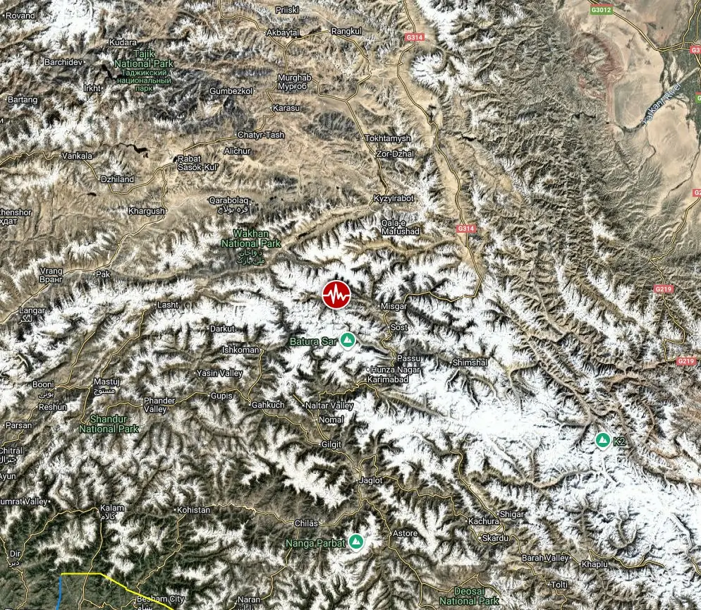
The earthquake occurred within the Hindu Kush–Karakoram–Pamir collision zone, part of the broader India–Eurasia plate convergence system, where the Indian plate continues to underthrust beneath Central Asia at roughly 40 mm (1.6 inches) per year.
This tectonic boundary produces frequent moderate to strong earthquakes, often occurring at depths between 30 and 200 km (19 and 124 miles), involving compressional and oblique-reverse faulting mechanisms.
Recent comparable events include a M6.1 earthquake near Gilgit in May 2021 and a M5.7 quake near Gahkuch in February 2023.
Estimated population exposure to earthquake shaking
Selected cities exposed
Regional seismicity
References:
1 M5.6 earthquake Barishal, Pakistan – USGS – January 19, 2026
2 M5.7 earthquake Northwestern Kashmir – EMSC – January 19, 2026

Teo Blašković founded The Watchers in 2011 and edited it until 2026, covering seismic and volcanic activity, extreme weather, space weather and near-Earth objects. Articles on this page are his archive.
Published in the last 24 hours
- Scientists directly observe how submarine landslides unfold in western Canada Epicenter
- Odisha evacuated 983,642 people before Phailin crossed near Gopalpur on 12 October 2013 with winds of 200-210 km/h gusting to 220, and 44 died, against 9,885 in the 1999 super cyclone. Cyclone Akvan crossed the same coast on 20 November 2026. Epicenter
- Lava fountains reached 1,900 feet (580 m) at Kīlauea Iki in 1959, the highest ever recorded at Kīlauea, as USGS forecasts episode 57 fountaining at Halemaʻumaʻu for November 22-26. Epicenter
- Novarupta in Alaska erupted about 3 cubic miles of magma in roughly 60 hours from 6 June 1912, 30 times Mount St. Helens in 1980, and strong northwesterly winds lifted that same loose ash on 16 November 2026, prompting an NWS SIGMET. Epicenter
