
High Wind Warnings issued for the Rockies, Plains, and Pacific Northwest, U.S.
High Wind Warnings have been issued across much of the western and central United States, effective from early Wednesday, December 17, 2025, through Thursday morning, December 18. Forecasts indicate a rapidly deepening low-pressure system developing east of the Canadian Rockies, producing winds of over 130 km/h (80 mph) in some areas. Power outages, tree damage, and hazardous travel conditions are expected from the Intermountain West to the Great Plains.
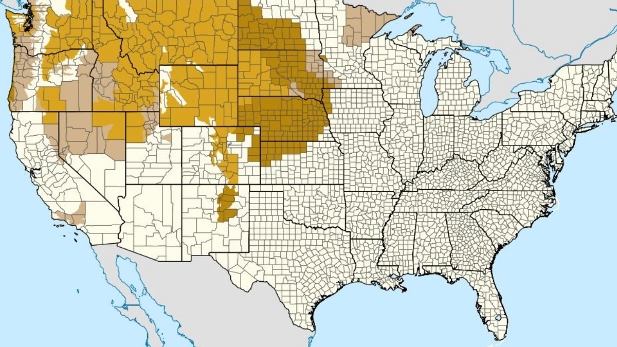
Map of high wind warnings, watches, and advisories for northwestern and central USA. Credit: NWS
A deepening area of low pressure on the lee side of the Canadian Rockies is forecast to generate a high-impact wind event beginning Wednesday morning, December 17.
The system, currently organizing over the Intermountain West, is expected to strengthen rapidly as it tracks eastward, producing wind gusts within the 90–99th percentile of historical observations, according to the National Weather Service (NWS).
High wind warnings are in effect for broad regions of Montana, Wyoming, Colorado, and portions of Nebraska, Utah, and the Pacific Northwest. Forecast gusts range from 95 to 120 km/h (60–75 mph), with localized gusts over 130 km/h (80 mph) possible in the most exposed mountain passes and foothills.
In Montana, the strongest winds are expected along the Rocky Mountain Front and adjacent plains, with gusts up to 160 km/h (100 mph) possible, resembling the January 2021 windstorm.
In Wyoming, sustained west winds of 65 to 90 km/h (40–55 mph) with gusts up to 145 km/h (90 mph) are expected across the Laramie Range, Snowy Range foothills, and adjacent basins.
Colorado’s Front Range and high mountain zones are also under warnings, with winds of 50 to 80 km/h (30–50 mph) and gusts up to 145 km/h (90 mph) forecast through early Thursday.
The damaging winds may down trees and power lines, leading to widespread power outages in the affected regions.

Travel will be difficult, particularly for high-profile vehicles along I-25 and I-80, where strong crosswinds are likely. In addition, the combination of high winds and light snow may create blowing snow and temporary whiteout conditions across the northern Plains and Dakotas late Wednesday into Thursday.
As the storm system progresses eastward toward the Ohio and Tennessee Valleys on Thursday, atmospheric instability and moisture return from the Gulf of Mexico will support a Marginal Risk for severe thunderstorms capable of producing damaging wind gusts. In the Northeast, showers and melting snow may lead to localized flooding by Friday.
Residents in affected regions are advised to secure outdoor objects, avoid unnecessary travel during warning periods, and remain in lower levels of buildings during the strongest winds.

I am an Assistant Editor and Severe Weather & Science Journalist at The Watchers, specializing in real-time severe weather coverage, geophysical event reporting, and research-driven scientific analysis. You can reach me at rishav(at)watchers(.)news.
Commenting rules and guidelines
We value the thoughts and opinions of our readers and welcome healthy discussions on our website. In order to maintain a respectful and positive community, we ask that all commenters follow these rules.