
Above-normal atmospheric river activity forecast for Northern and Central California in late December
The Center for Western Weather and Water Extremes (CW3E) at UC San Diego forecasts above-normal precipitation for Northern and Central California between late December 2025 and early January 2026. The latest subseasonal outlook, issued on December 16, indicates high confidence in enhanced atmospheric river (AR) activity and persistent Pacific Ridge conditions during the period from December 22 to January 11, 2026.
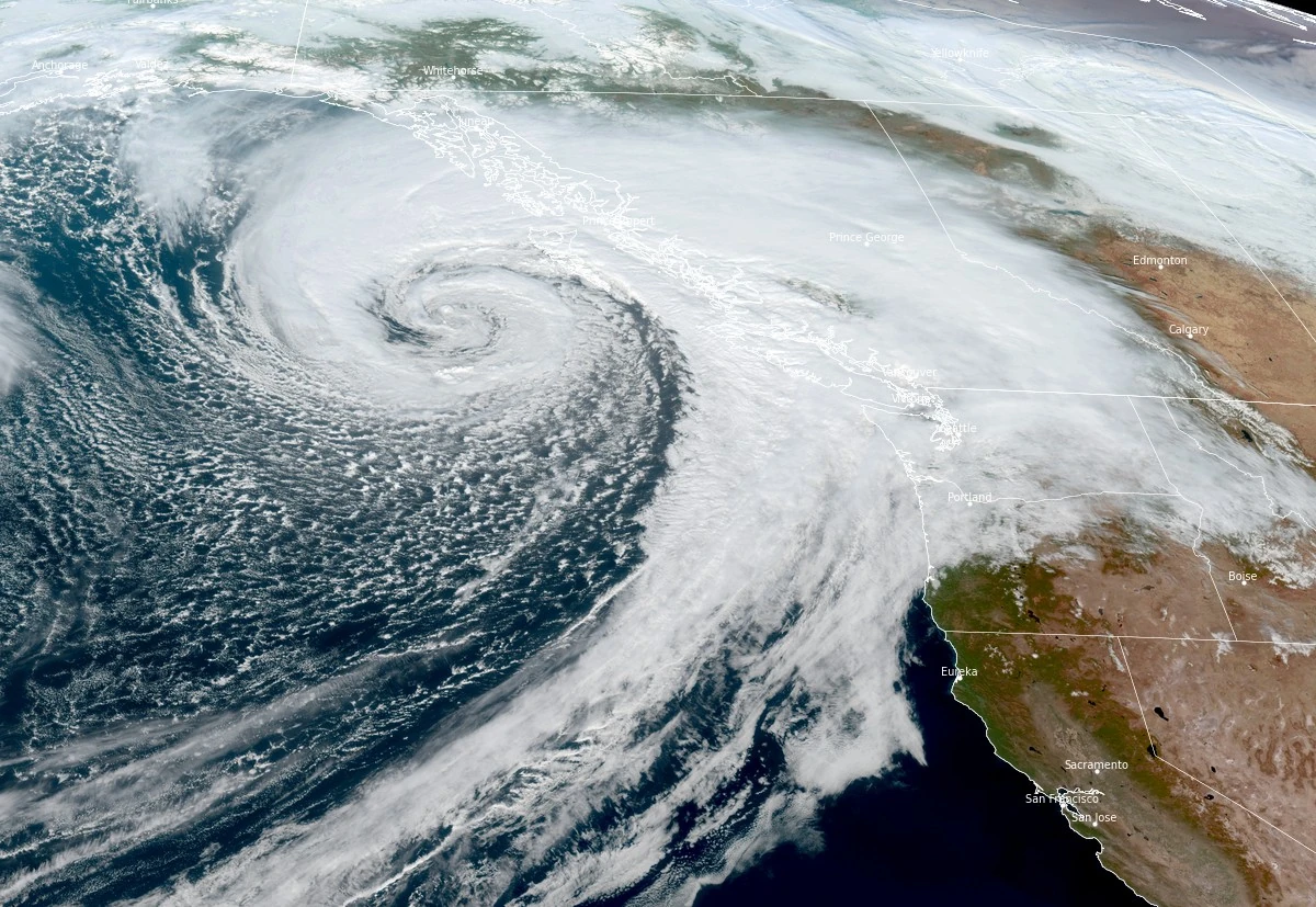
Satellite image of atmospheric river impacting Canada and United States at 21:10 UTC on October 28, 2025. Credit: NOAA/GOES-West, RAMMB/CIRA, The Watchers
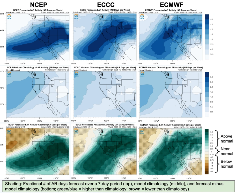
Above-normal AR activity if forecast across most of California during December 22–28. The CW3E multimodel analysis indicates the strongest wet signal over Northern California, extending into Central California with moderate confidence.
According to the Canadian (ECCC) and European (ECMWF) models, above-normal precipitation outlook is forecast over Northern and Central California during December 29–January 4.
Meanwhile, the U.S. model (NCEP) forecasts slightly weaker AR activity, but the ensemble consensus continues to favor wetter-than-normal conditions in the northern regions.
For early January 2026 (January 5–11), ECCC and ECMWF again align on a wetter-than-normal pattern for much of the state, with the highest confidence over the northern half of California. However, NCEP forecasts near-normal precipitation for the same period.
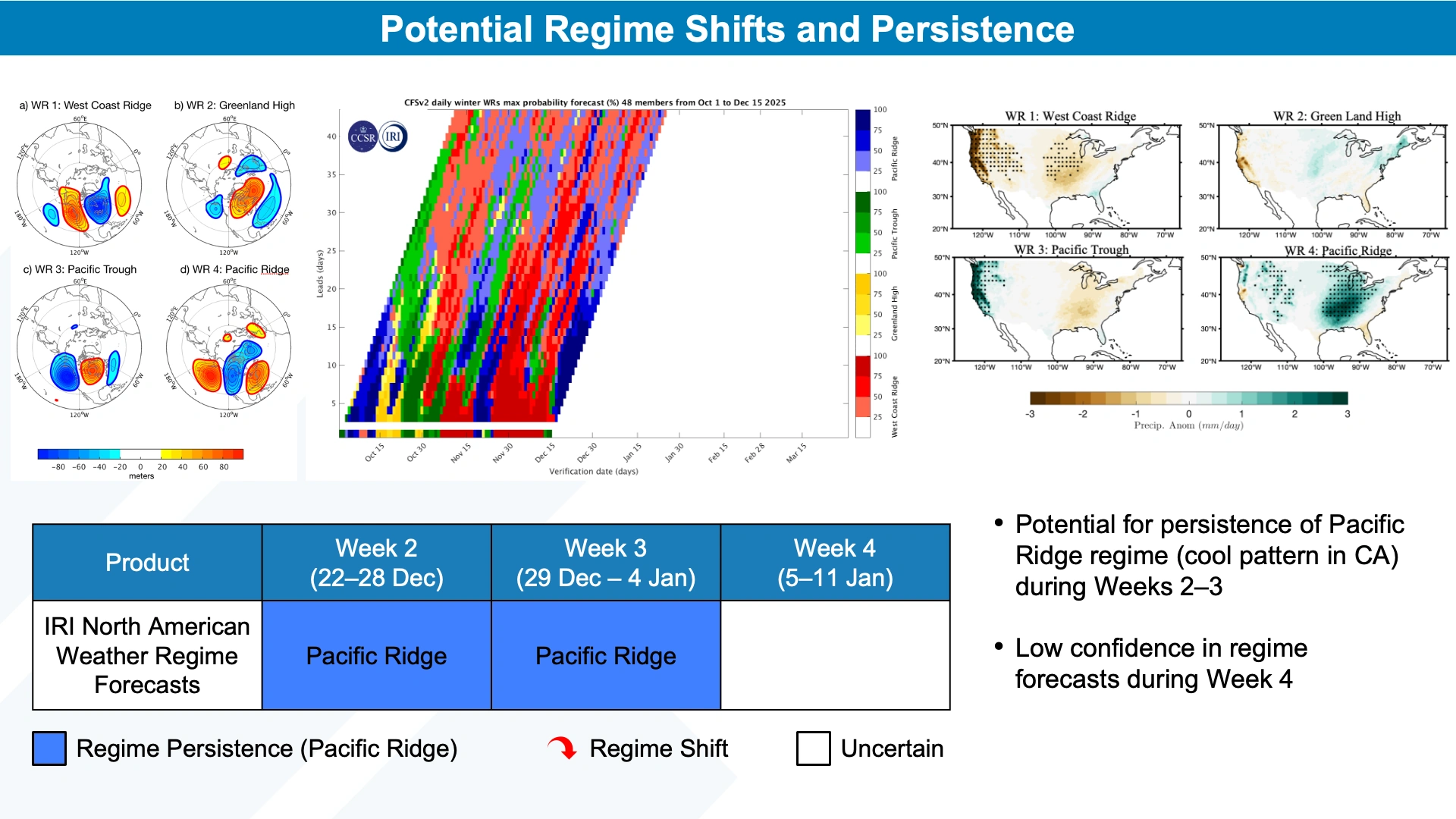
The IRI North American Weather Regime tool forecasts the persistence of a Pacific Ridge regime through late December, typically associated with near-normal precipitation and below-normal temperatures in California. CW3E’s hybrid regime analysis identifies trough and ridge patterns (WR9 and WR12) consistent with above-normal precipitation in Central California during the last week of December.
Madden–Julian Oscillation (MJO) activity remains strong over the central Pacific and Western Hemisphere (Phase 8), while the Quasi-biennial Oscillation (QBO) is in its easterly phase.
Historically, this MJO configuration correlates with increased extreme precipitation across Central and Southern California at 1–2 week lag times. NCEP projects MJO weakening toward late December, which aligns with the observed subseasonal precipitation signal.
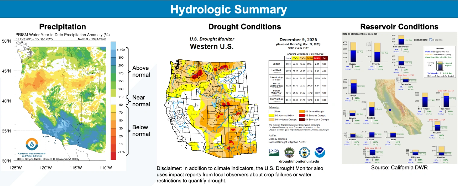
As of December 15, water-year-to-date precipitation was between 50–110% of normal in Northern California and exceeded 150% of normal in Central and Southern regions. The U.S. Drought Monitor indicates no drought over most of the state, with only isolated abnormally dry areas in the south. Major reservoirs are operating at or above 50% capacity, with storage levels near or above seasonal norms.
CW3E’s probabilistic outlook based on MJO–QBO interactions indicates a moderate likelihood (>40%) of below-normal AR occurrence in Central and Northern California during late December to early January.
However, the overall dynamical model consensus remains for enhanced precipitation during the same period, reflecting uncertainty in subseasonal atmospheric patterns and their regional impacts.
References:
1 Subseasonal Outlook – CW3E – December 16, 2025

I am an Assistant Editor and Severe Weather & Science Journalist at The Watchers, specializing in real-time severe weather coverage, geophysical event reporting, and research-driven scientific analysis. You can reach me at rishav(at)watchers(.)news.
Commenting rules and guidelines
We value the thoughts and opinions of our readers and welcome healthy discussions on our website. In order to maintain a respectful and positive community, we ask that all commenters follow these rules.