
Multi-day lake-effect rain event forecast to bring up to 50 mm (2 inches) along the I-90 corridor
A multi-day lake-effect rain event is forecast to unfold over the Great Lakes starting Thursday, October 23, 2025. The event is forecast to drop 25–50 mm (1–2 inches) of rainfall along the I-90 corridor between Buffalo, New York, and Cleveland, Ohio, through the weekend.
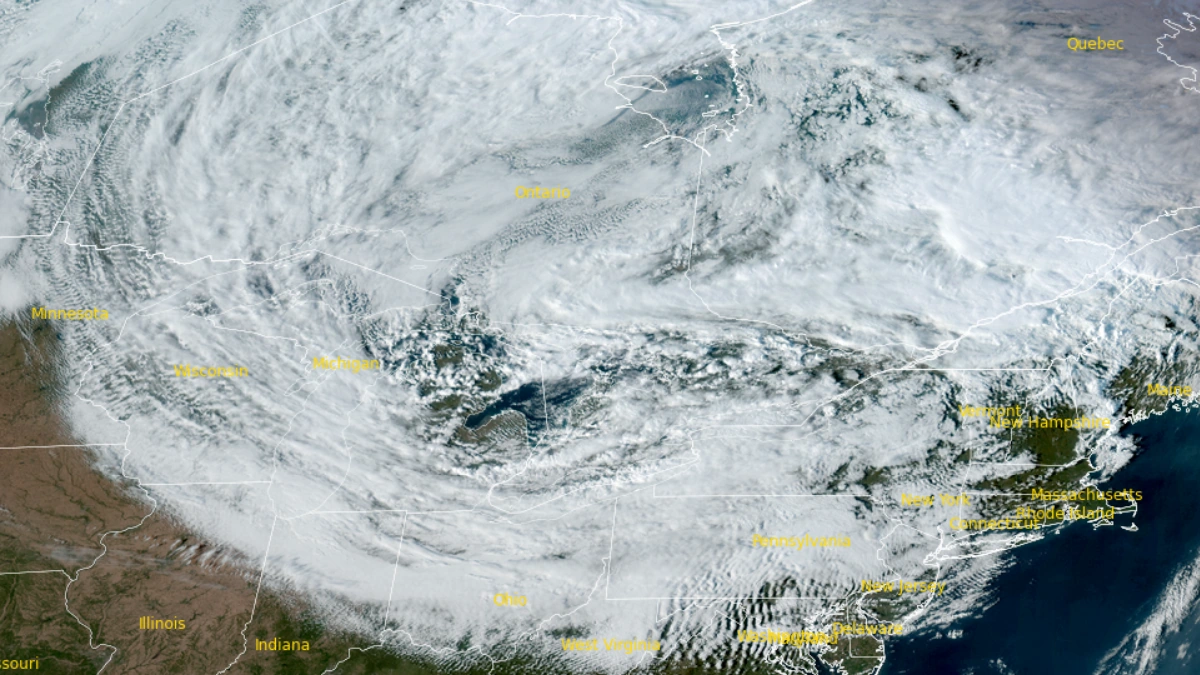
Satellite image of Great Lakes Region as of 20:30 UTC on October 22, 2025. Credit: NOAA/GOES-19, RAMMB/CIRA, The Watchers
A broad low-pressure system centered over the Great Lakes is forecast to drive a multi-day lake-effect rain event from late Thursday through the end of the week. Cold air passing over relatively warm lake waters will promote instability and trigger organized rain bands downwind of the lakes.
The most persistent precipitation is forecast along the eastern sides of Lakes Michigan, Erie, and Ontario, and the southern shore of Lake Superior. Rainfall totals of around 25–50 mm (1–2 inches) are forecast for the affected regions, with locally higher accumulations possible within the most intense bands.
Winds of 48–64 km/h (30–40 mph) are expected along with the rain bands, especially near lakeshores. Localized flooding is possible, particularly for motorists along the I-90 corridor.
Lake-effect rain occurs when cold air masses move over warm lake surfaces, with heat and moisture transferring from the water to the air, enhancing convection and cloud development. During early autumn, surface air temperatures remain above freezing, resulting in rain rather than snow.
Currently, Lake-surface temperatures across the Great Lakes remain around 4°C (7°F) above the long-term average, favoring lake effect rain through the weekend.
Although widespread flooding is not anticipated, localized floods are likely in urban areas with poor drainage.
1 Area Forecast Discussion- NWS – October 23, 2025

Rishav Kothari is Editor-in-Chief of The Watchers, where he runs the newsroom and covers earthquakes, volcanoes, severe weather and space weather.
Earlier reporting
Nothing on Watchers was published in the last 24 hours. These are older articles.
- 2 atmospheric rivers to bring heavy Sierra snow and California flood risk
- Florida's east coast faces a moderate flash flood risk Wednesday through Friday, with 4 to 8 inches of rain forecast and the St. Johns River near Cocoa already in major flood at 17.13 feet
- El Niño floods kill 2 in Guayaquil as 172.8 mm of rain swamps Milagro, Ecuador's toll rises to 14
- Southern Thailand braces for heavy rain, 15 provinces on flood and landslide alert for November 18-22
