
Multi-hazard storm system expected to bring tornadoes, flash floods, and snow to central and eastern U.S.
Life-threatening flash floods and severe weather are forecast to impact large parts of the Plains, Mississippi Valley, and Midwest starting on Tuesday, April 1, 2025, as a multi-hazard storm moves over the region.
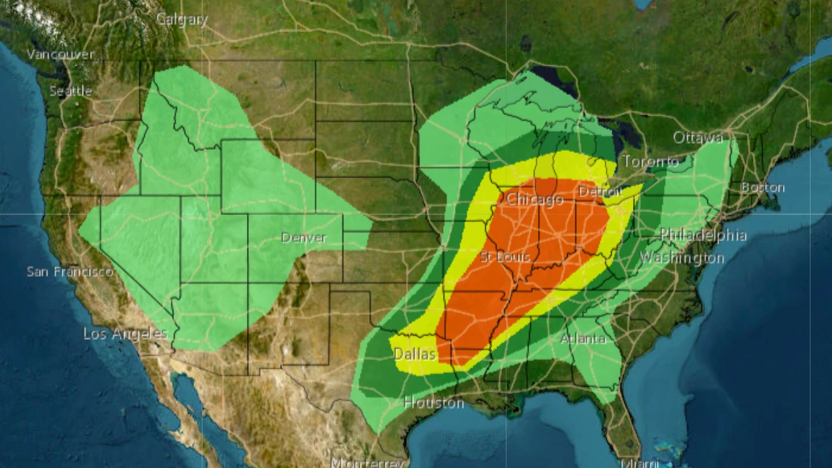
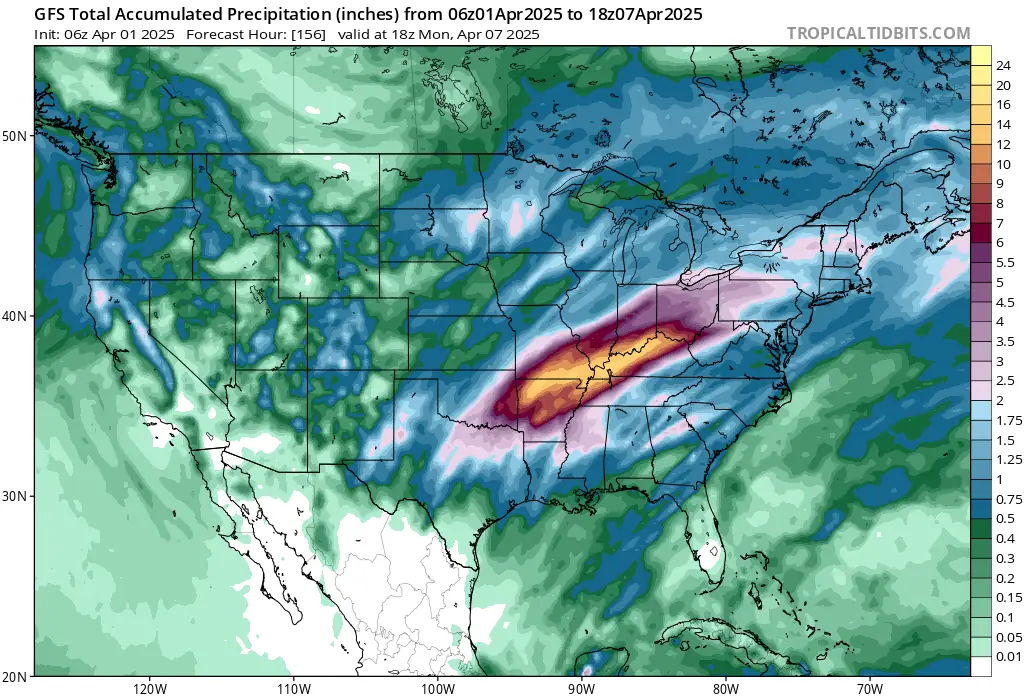
Convective outlook for U.S. ending at 17:00 EDT on April 3, 2025. Image credit: NWS
The National Weather Service (NWS) warns that this system marks the start of a multi-day, life-threatening flash flood event, particularly across parts of the Lower Ohio Valley and Mid-South, where storms are expected to cluster and repeat over the same areas as the cold front slows.
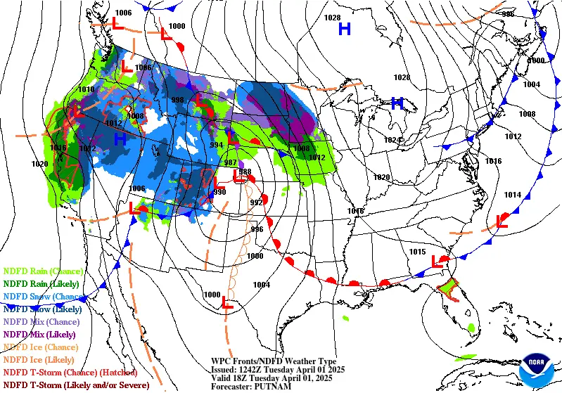
An energetic upper-level trough is forecast to deepen over the western and central United States, accompanied by a strengthening surface low-pressure system in the lee of the Rockies through Tuesday.
Thunderstorms are likely ahead of a lifting warm front and an eastward-moving cold front over the central and southern Plains as moist southerly return flow intensifies, particularly later on Tuesday.
Heavy rainfall associated with the storm may lead to isolated flash floods on Tuesday night. The Storm Prediction Center (SPC) has issued an Enhanced Risk (level 3/5) for the threat of very large hail, damaging winds, and several tornadoes, some of which could be strong, particularly during the evening across much of the region.
The system’s progression is expected to slow on Wednesday, April 2, as it moves into the Midwest and Mississippi Valley, particularly toward the south, due to the development of an upper-level ridge over the southeastern United States.
Heavy rainfall totals of up to 254 mm (10 inches) are forecast for some areas through the week. Widespread severe weather is also expected across much of the Midwest and Ohio Valley southwest through the Mid-South and ArkLaTex on Wednesday. An Enhanced Risk has been issued for the region due to threats of very large hail, significant damaging winds, and strong tornadoes.
Widespread storms are expected in the warm sector ahead of the cold front, with the SPC issuing a Moderate Risk of Heavy Rainfall for multiple areas.
The NWS described the event as the beginning of a “multi-day significant, life-threatening flash flood event.”
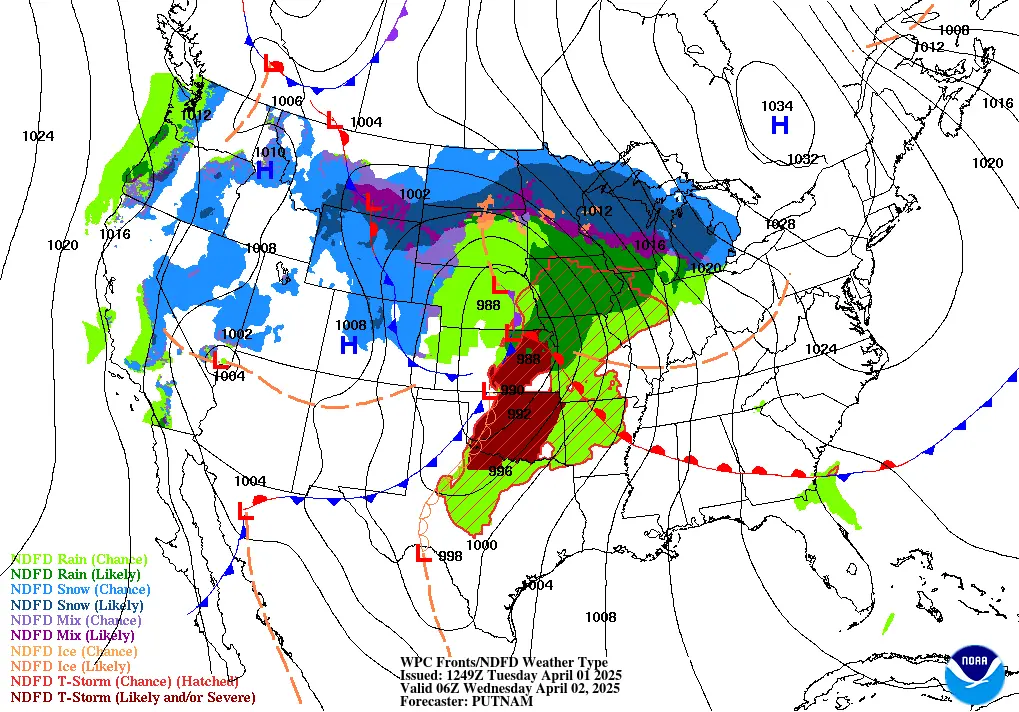
Multiple storms are expected to cluster and pass over the same region through Wednesday evening as the cold front slows, likely along an axis from the Lower Ohio Valley southwestward through the Mid-South. Increasing moisture pooling ahead of the front will also lead to more intense downpours following continued return flow.
A late-season winter storm is forecast to move across portions of the Northern Plains and Upper Midwest from Tuesday through Wednesday. Snowfall began in some areas early Tuesday morning and is expected to continue through Wednesday night as the system intensifies and tracks northeastward through the region.
An axis of heavy snowfall is forecast along and north of the surface low track from the eastern Dakotas east through central and northern Minnesota and into northern Wisconsin.
Total snowfall of 10–20 cm (4–8 inches), with locally higher amounts, is expected. Gusty winds may cause areas of blowing snow and hazardous travel conditions. A wintry mix of sleet and freezing rain is expected southeast of the heaviest snow, from central Minnesota and Wisconsin east into parts of lower Michigan.
A leading shortwave ahead of the system will also bring a wintry mix to the interior Northeast and New England on Wednesday, with precipitation beginning as snow or freezing rain before transitioning to mostly rain as warmer air moves into the region. Light to moderate snow and ice accumulations are possible in higher elevations and northern Maine.
Most of Michigan is expected to experience additional tree damage due to this system, following recent storms over the weekend that left 7 people dead and nearly 1.2 million people without power.
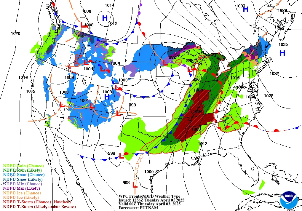
The system is forecast to begin moving out of the region late on Wednesday, shifting into the interior Northeast and northern New England from Wednesday night into Thursday, April 3.
References:
1 Short Range Forecast Discussion – NWS/WPC – April 1, 2025
2 Severe storms claim 7 lives across Midwest, leave nearly 1.2 million people without power – The Watchers – April 1, 2025

I am an Assistant Editor and Severe Weather & Science Journalist at The Watchers, specializing in real-time severe weather coverage, geophysical event reporting, and research-driven scientific analysis. You can reach me at rishav(at)watchers(.)news.
Commenting rules and guidelines
We value the thoughts and opinions of our readers and welcome healthy discussions on our website. In order to maintain a respectful and positive community, we ask that all commenters follow these rules.