Very strong and shallow M6.0 earthquake hits near the coast of Bejaia, Algeria
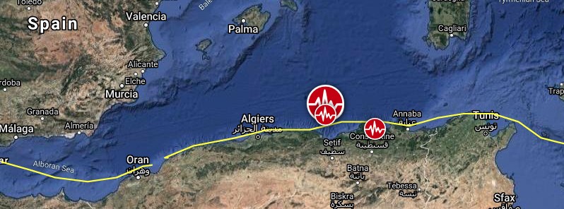
A strong and shallow earthquake registered by the USGS as M6.0 hit near the coast of Algeria at 00:04 UTC (01:04 LT) on March 18, 2021. The agency is reporting a depth of 8 km (5 miles). EMSC is reporting M6.0 at a depth of 10 km (6.2 miles).
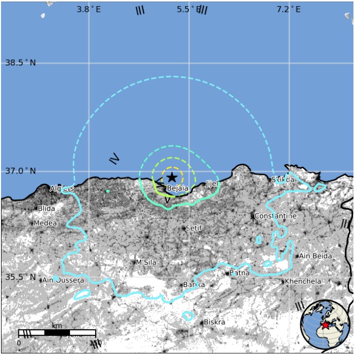
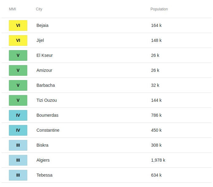
The epicenter was located 20.4 km (12.7 miles) NNE of Bejaia (population 164 103), 40.3 km (24 miles) NE of El Kseur (population 26 050), and 40.4 km (25.1 miles) NE of Amizour (population 25 825), Algeria.
There are about 4 300 000 people living within 100 km (62 miles).
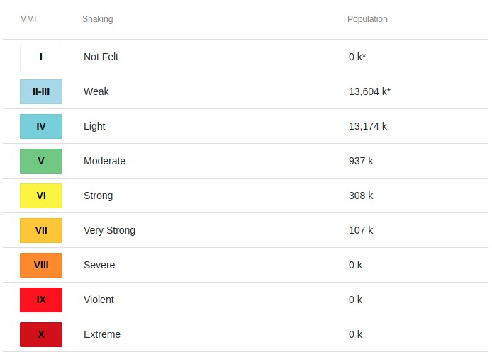
107 000 people are estimated to have felt very strong shaking, 308 000 strong, 937 000 moderate, and 13 174 000 light.
The USGS issued a Yellow alert for shaking-related fatalities and economic losses. Some casualties and damage are possible and the impact should be relatively localized. Past yellow alerts have required a local or regional level response.
Estimated economic losses are less than 1% of the GDP of Algeria.
Overall, the population in this region resides in structures that are highly vulnerable to earthquake shaking, though some resistant structures exist. The predominant vulnerable building types are rubble/fieldstone with mud and low-rise non-ductile concrete frame with infill construction.
Recent earthquakes in this area have caused secondary hazards such as landslides and liquefaction that might have contributed to losses.
The quake was followed by M5.2 at 00:17 UTC and M4.7 at 00:33.
The General Directorate of Algerian Civil Protection in Bejaia reported panic as residents fled their homes, cracked walls of buildings, and partial collapse of an old unoccupied building.
There have been no reports of serious injuries or casualties.
The video shows the damage caused by the strong magnitude 6.0 #earthquake in the city of Béjaia, northern #Algeria. #زلزال #Bejaia #Algerie @LastQuake @EarthQuakesTime pic.twitter.com/Ykm9MrDnbJ
— Xhildinho Z (@xhildinho) March 18, 2021
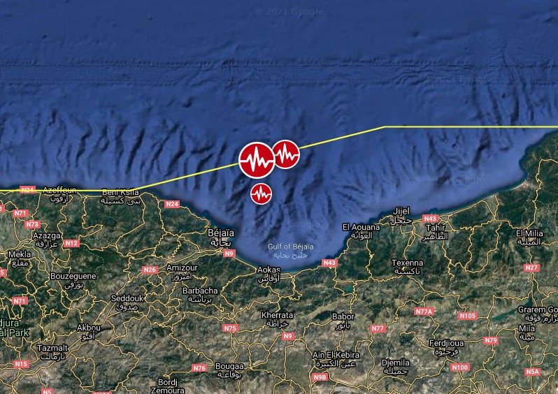
Image credit: TW/SAM, Google
Algeria has experienced many destructive earthquakes during the last few centuries Bezzeghoud et al.
The city of El Asnam (formerly Orléanville, today Chlef) was severely damaged in 1954 and 1980 by magnitude 6.7 and 7.3 earthquakes, respectively. On October 10, 1989, a magnitude 5.9 earthquake struck the Mont Chenoua-Tipasa coastal area approximately 150 km (93 miles) west of Zemmouri, which is where the M6.8 May 21, 2003 earthquake occurred.
Many other large historical and instrumental earthquakes have severely damaged the coastal cities of Algeria over the last few centuries (i.e., around Algiers, Oran, Mascara, Djidjelli, Constantine and Bejaia).
These earthquakes suggest active deformation of the margin in conjunction with the clear offshore extent of active coastal faults.
Estimated population exposure to earthquake shaking
Selected cities exposed
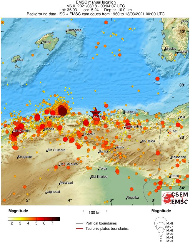
Regional seismicity
Featured image credit: TW/SAM, Google
any injured or lost in this earthquake?