
Tropical Depression “Butchoy” makes landfall in Quezon, Philippines — expected to strengthen into tropical storm as it heads toward China

Featured image: Tropical Depression "Butchoy" at 23:20 UTC on June 11, 2020. Credit: JMA/Himawari-8, RAMMB/CIRA
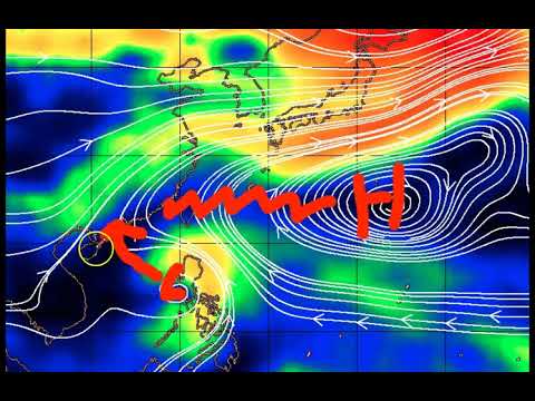
Tropical Depression "Buchoy" made landfall over Polillo, Quezon at 09:30 UTC and Infanta at 10:00 UTC on June 11, 2020. The depression formed on June 10, off the coast of Samar, and is expected to strengthen into a tropical storm — Nuri, the second named storm of the 2020 Pacific typhoon season — as it heads toward China. The storm caused widespread flooding across the Philippines as it passed the landmass and enhanced the southwest monsoon.
The combination of the system and prevailing southwesterly winds brought showers and thunderstorms across the Philippines, causing widespread flooding. Heavy rainfall in Albay led to the activation of disaster risk management officials and other emergency assets.
At 23:00 UTC on June 11, the center of the storm was located about 50 km (31 miles) west of Iba, Zambales. It had maximum sustained winds of 45 km/h (28 mph) near the center and gusts up to 70 km/h (44 mph).
Tropical Cyclone Wind Signal No. 1 is in effect for Visayas, Southern Luzon, and the western portion of Mindanao, as of 00:00 UTC on June 12.

Tropical Depression "Butchoy" at 23:20 UTC on June 11, 2020. Credit: JMA/Himawari-8, RAMMB/CIRA
Moderate to heavy rainfall, intense at times is expected today over Zambales, Bataan, Pampanga, the northern portion of Palawan including Calamian and Cuyo Islands, and Occidental Mindoro. Light to moderate, heavy at times is expected over Visayas, Caraga, Davao Region, and the rest of Luzon.
Flooding and rain-induced landslides may occur during heavy or prolonged rainfall especially in areas that are highly or very highly susceptible to these hazards, PAGASA warned.
The public and disaster risk reduction and management offices are advised to take appropriate measures and monitor the Rainfall or Thunderstorm Advisories or Heavy Rainfall Warnings of PAGASA Regional Services Divisions.
Areas under Tropical Cyclone Wind Signal #1 may experience occasional gusts associated with the tropical depression and the Southwest Monsoon.
Moderate to rough seas (1.2 to 3.4 m / 4 – 11 feet) is expected over the seaboards of Luzon and Visayas. Those with small seacrafts are advised not to venture out to sea while larger sea vessels must take precaution against rough seas.

Forecast models

Teo Blašković founded The Watchers in 2011 and edited it until 2026, covering seismic and volcanic activity, extreme weather, space weather and near-Earth objects. Articles on this page are his archive.
Published in the last 24 hours
- High Risk of excessive rainfall covers Florida’s Space Coast as St. Johns River near Cocoa reaches 5.67 m
- A broad low over southeastern Florida and the northwestern Bahamas has a 30 percent chance of subtropical or tropical development within 48 hours and a 50 percent chance within 7 days, the National Hurricane Center says
- Male toads abandoned a pond in Italy five days before a deadly 2009 earthquake, while a scientist was counting them Epicenter
- An asteroid was spotted 19 hours before it exploded over Sudan in 2008, and students picked its pieces off the desert Epicenter
