
Slow-moving winter storm brings significant snowfall to drought-hit California, up to 1.8 m (6 feet) of snow possible, U.S.
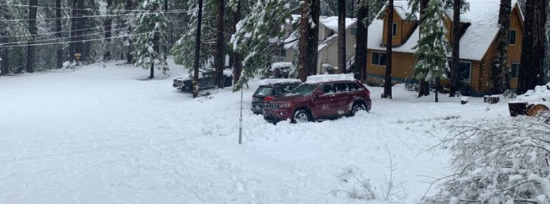
Image credit: @Fred_Page/Twitter
A large and slow-moving late-season winter storm started dumping significant heavy snow on California's Sierra Nevada on Saturday, March 14, 2020. Up to 1.8 m (6 feet) of snow is expected in the following days, replenishing the mountains following the state's driest February on record.
An upper-level low will slowly move southward along the West Coast through Tuesday into Wednesday morning, March 17 into 18, pushing a slow-moving cold front ahead of it through California as a stalled front remains across the Intermountain West.
The upper-level low will aid in streaming a plume of moisture into Southern/Central California through Tuesday afternoon.
These features are expected to lead to persistent precipitation for the Great Basin into California.
"Heavy snow will develop over higher elevations of the Sierra Nevada, producing snow measured in multiple feet," NWS forecaster Tate noted.
In lower elevations of coastal California, the rain will continue through Tuesday morning, with over 50 mm (2 inches) likely, which may cause scattered flooding and flash flooding in some locations.
"Urban areas and burn scars could particularly have these problems," Tate said, adding that a secondary surge of moisture will move into parts of Central California as rain returns to the Coastal Northern/Central California by Tuesday evening.
The rain and snow are coming after California's driest February on record and drier-than-average January.
The Sierra snowpack is below 50% of its usual amount for the time of year, while 48% of California is in moderate drought.
MAJOR SNOW STORM: A mid-March storm is bringing heavy snow to California’s Sierra Nevada, with the dangerous driving conditions forcing some road closures. @tomllamasABC reports. https://t.co/bRnxN3m83V pic.twitter.com/8XSjllhR4r
— World News Tonight (@ABCWorldNews) March 16, 2020
Future cross country storm spinning off the California coast bringing much needed rain and FEET of snow in the Sierra Nevada. #CAwx @StormHour @spann pic.twitter.com/8UBfW2S0gt
— Collin Gross (@CollinGrossWx) March 15, 2020
The Sierra Nevada Mountain range in #California was pummeled with heavy #snow on Saturday with more to come!! The town of Truckee, California see could see up to 3 feet of snow by Monday!#CAwx #WinterStorm pic.twitter.com/j7iHCi8XJi
— WeatherNation (@WeatherNation) March 15, 2020
On Saturday, significant snowfall hit the higher elevations around Mendocino County, including on U.S. Route 101 at the Ridgewood Summit. In addition, more than 22.9 cm (9 inches) of snow was reported in the county's mountainous areas such as Bell Springs Road in Laytonville.
The storm also resulted in power outages, with about 1 115 customers affected in Covelo on Sunday morning.
As of early Monday, the Interstate-80 through the Sierra was shut in both directions as zero visibility was reported over Donner Summit.
From Saturday to early Sunday morning, March 15, the Tahoe Donner Ski Resort registered 111.8 cm (44 inches) of snow in a 24-hour period. Blue Canyon, on the other hand, received 104.1 cm (41 inches) of snow on the ground as of Sunday.
My cousin’s house at Carnelian Bay on the shore of Lake Tahoe – elevation 6,325’ pic.twitter.com/OMZRVfl9QW
— Crystal Egger (@crystalegger) March 15, 2020
Be careful what you wish for
We needed snow but …2+ feet overnight & still dumping #SierraNevada #California pic.twitter.com/AberOKwJsj— Heidi (@caputmundiHeidi) March 15, 2020
Greenville, California this morning. Credit S.Norman
❄ #snow#CAWX #SierraNevada pic.twitter.com/sJSfY7vmis— saunie (@saunieindiego) March 15, 2020
Thank you @CaltransDist3 , your employee is doing a great job here in Kyburz! Much needed since we’re still without power. #snow #SierraNevada pic.twitter.com/If2IkUFUh0
— Fred Page (@Fred_Page) March 15, 2020
Winter Storm Warning for the Southern Sierra Nevada above 4,000 feet valid until 5 PM PDT Tuesday afternoon. Heavy snow is not expected in the Tulare County portion of the Southern Sierra Nevada until Monday afternoon. Road closures and travel delays are likely. #CAwx pic.twitter.com/U06Mg91Zl6
— NWS Hanford (@NWSHanford) March 15, 2020
Winter storm warnings have been issued for elevations above 915 m (3 000 feet) in the Sierra through Tuesday morning, with up to 1.8 m (6 feet) of snow possible at higher elevations.
According to the NWS, snow is also possible over the mountains enveloping Napa Valley, as well as to the east and south of the Bay Area on Monday, at elevations as low as 762 m (2 500 feet).
The Tehachapi Mountains may also see some heavy snow that will affect travel, as well as above 1 524 m (5 000 feet) in the Southland mountains of the L.A. Basin and San Diego County.
The baby sitting days has ended now that the Big Man is here, I see, nice yellow ty World leaders.