
Metis Shoal volcano starts erupting, Aviation Color Code Orange, Tonga
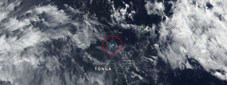
Image credit: NASA/NOAA SuomiNPP/VIIRS. Acquired October 14, 2019. Annotation: TW
A white plume was observed rising up to 5 km (17 000 feet) above sea level over underwater Metis Shoal volcano, Tonga at 22:06 UTC on October 14, 2019. The last eruption of this volcano took place in 1995 (VEI 2).
The Aviation Color Code was raised to Orange – the volcano is exhibiting heightened unrest with an increased likelihood of eruption / a volcanic eruption is underway with no or minor ash emission.
There is no evidence of ash in the plume, the Wellington VAAC said late October 14.
"An intermittent smoke eruption towering to 4.6 – 5.2 km (15 000 – 17 000 feet) above the summit of the Metis Shoal Volcano, Ha'apai, this morning, has an increased likelihood of an eruption, with an aviation VONA alert now increased to Orange," the Tonga Meteorological Service advised at 10:20 LT on October 15, as reported by the MatangiTonga.
An intermittent smoke eruption towering up to 17000ft over Metis Shoal submarine #volcano, Tonga, has an increased likelihood of an eruption. An Orange VONA aviation alert by Tonga Met Service at 10:20am today was based on Real Tonga pilots' observations. https://t.co/DKYjjTfo3h pic.twitter.com/Xswia4HC08
— Matangi Tonga Online (@TongaNews) October 14, 2019
There have been no earthquakes detected in the area, the service said.
First reports of eruption came from the Town Office of Fotuha'a Island at 20:30 LT, October 14. However, the met service couldn't verify until this morning's Real Tonga flight when the above image was taken.
Tonga Met Director, 'Ofa Fa'anunu said they will issue a new Volcano Observatory Notice for Aviation (VONA) this evening (LT), after domestic flights come in and any other shipping reports or observations are received.
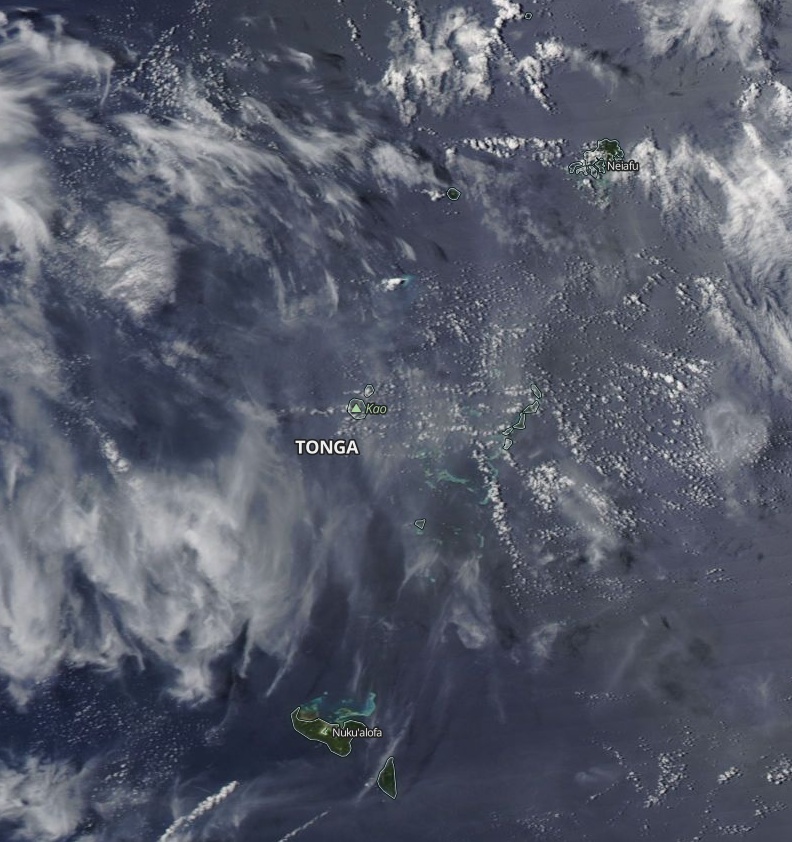
Image credit: NASA Aqua/MODIS. Acquired October 15, 2019
The last eruption of this volcano (VEI 2) started on June 6, 1995, and ended on June 23 (± 2 days).
Geological summary
Metis Shoal, a submarine volcano midway between the islands of Kao and Late, has produced a series of ephemeral islands since the first confirmed activity in the mid-19th century.
An island, perhaps not in eruption, was reported in 1781 and subsequently was eroded away.
During periods of inactivity following 20th century eruptions, waves have been observed to break on rocky reefs or sandy banks with depths of 10 m (33 feet) or less. Dacitic tuff cones formed during the first 20th century eruptions in 1967 and 1979 were soon eroded beneath the sea surface.
An eruption in 1995 produced an island with a diameter of 280 m (920 feet) and a height of 43 m (140 feet) following growth of a lava dome above the surface.
I'm a dedicated researcher, journalist, and editor at The Watchers. With over 20 years of experience in the media industry, I specialize in hard science news, focusing on extreme weather, seismic and volcanic activity, space weather, and astronomy, including near-Earth objects and planetary defense strategies. You can reach me at teo /at/ watchers.news.
Commenting rules and guidelines
We value the thoughts and opinions of our readers and welcome healthy discussions on our website. In order to maintain a respectful and positive community, we ask that all commenters follow these rules.