
Photos show Tonga covered in ash, ‘all agriculture ruined’ after tsunami impact
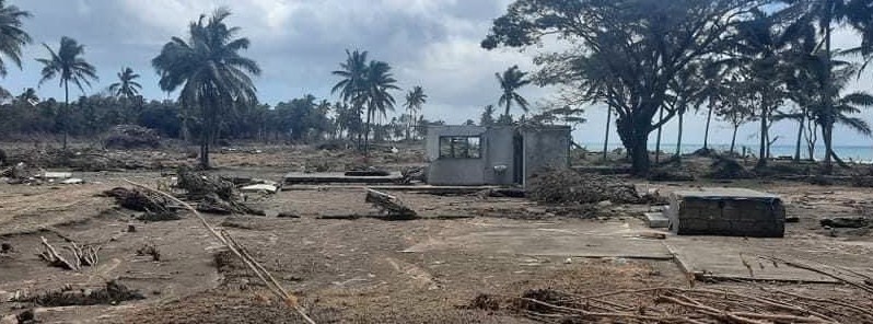
Image credit: My Tongan
Photos from the Kingdom of Tonga show streets and buildings covered in heavy ash after the massive eruption at Hunga Tonga-Hunga Ha'apai on January 15, 2022.
While streets and roofs can be cleared, tsunami waves, up to 15 m (49 feet) in some places, and heavy ash have totally ruined all agriculture, raising fears the country will be facing food shortage.
"All agriculture is ruined and I hear the farmers have been reassured by the Prime Minister that they will be taken care of, but it’s very sad to hear, so on top of the water that we need in Tonga, it seems that we’ll be facing a food shortage," Tonga's Speaker of the House Lord Fakafanua said after the latest update from his homeland.1
According to the United Nations, at least three people have died have died in Tonga, and many people are still missing.2
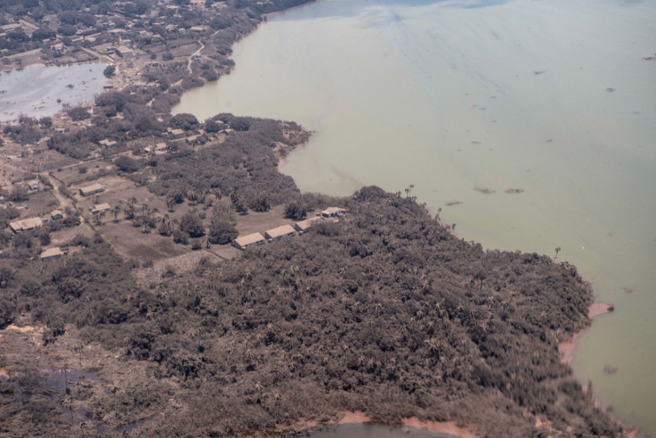
At least 90 people have been evacuated in evacuation centres located in the Island of Eua, 17 km (10 miles) south-east of Tongatapu, the most affected island where around 50 houses have been destroyed, and 50 damaged.
Many other displaced people fled to the homes of friends and family.
Damage has been also reported across the islands of Mango and Fonoi.
Furthermore, the affected undersea telecommunications cable connecting Tonga to the rest of the world will take at least a month to be repaired.
The first aerial pictures were acquired on January 17 by surveillance planes sent by Australia and New Zealand.3
View of Nomuka, Tonga during a reconnaissance flight on January 17, 2022. Credit: New Zealand Defence Force
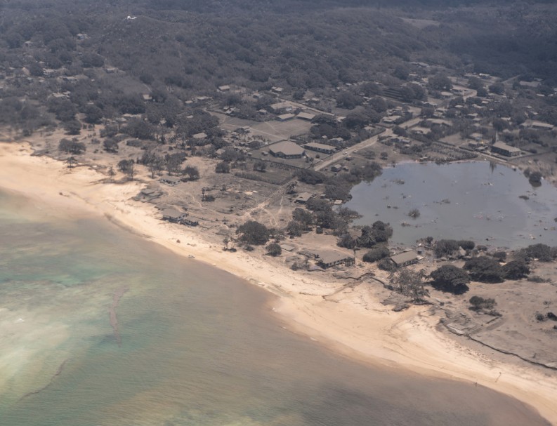
Image credit: New Zealand Defence Force
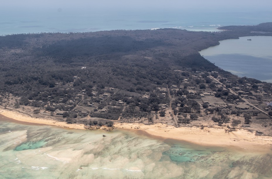
Image credit: New Zealand Defence Force
Satellite imagery acquired by Sentinel-2 satellite on January 17 showed the island created during the eruption in 2014/15 was completely destroyed.
Hunga Tonga-Hunga Ha'apai volcano on December 18, 2021, January 2, 2022 and January 17, 2022. Credit: Copernicus EU/Sentinel-2, Sentinel Hub, TW
The animation below shows the island of Kelefesia. Before the eruption, it was described as the most beautiful stand-alone island in all of Tonga.
Kelefesia Island, Tonga on December 20, 2021, and January 17, 2022. Credit: Copernicus EU/Sentinel-2, Sentinel Hub, TW
References:
1 'All agriculture is ruined' – Tonga facing food shortage after tsunami impact – PMN
2 Tonga – Volcanic eruption and tsunami – DG ECHO – January 19 update
3 First aerial pictures from the disaster zone after massive volcanic eruption in Tonga – The Watchers
I'm a dedicated researcher, journalist, and editor at The Watchers. With over 20 years of experience in the media industry, I specialize in hard science news, focusing on extreme weather, seismic and volcanic activity, space weather, and astronomy, including near-Earth objects and planetary defense strategies. You can reach me at teo /at/ watchers.news.
Commenting rules and guidelines
We value the thoughts and opinions of our readers and welcome healthy discussions on our website. In order to maintain a respectful and positive community, we ask that all commenters follow these rules.