
Potentially catastrophic Category 5 Hurricane “Willa” aims Mexico
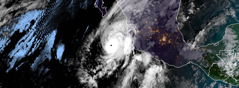
Featured image: Hurricane "Willa" at 13:15 UTC on October 22, 2018. Credit: NOAA/GOES-East
Potentially catastrophic Category 5 Hurricane "Willa" is moving northward and is expected to produce life-threatening storm surge, wind and rainfall over the portions of west-central and southwestern Mexico. This is the 22nd named storm of the 2018 Pacific hurricane season. It comes on the heels of several strong rain producers and deadly landslides.
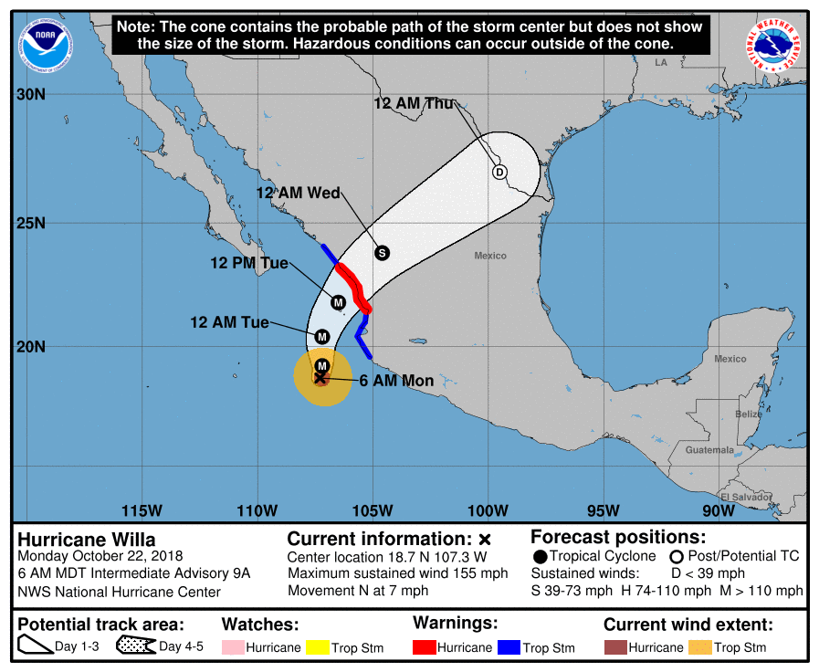
A Hurricane Warning is in effect for San Blas to Mazatlan, including Las Islas Marias and a Tropical Storm Warning is in effect for Playa Perula to San Blas and north of Mazatlan to Bahia Tempehuaya.
Residents should rush preparations to completion to protect life and property and follow any advice given by local officials.
At 12:00 UTC on October 22, the center of Hurricane "Willa" was located about 325 km (200 miles) SSW of Las Islas Marias and 255 km (155 miles) SW of Cabo Corrientes, Mexico.
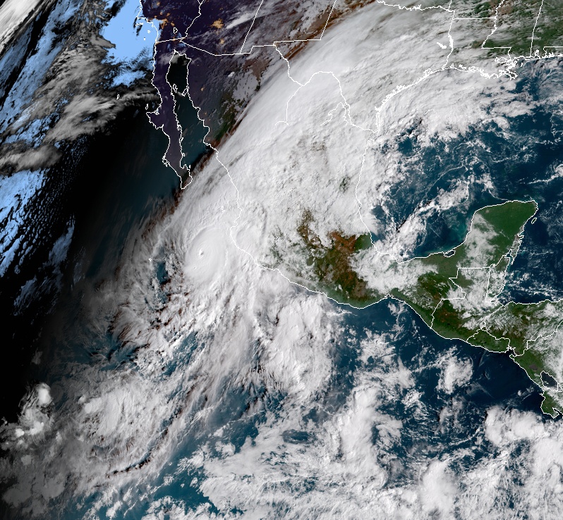
Hurricane "Willa" at 14:15 UTC on October 22, 2018. Credit: NOAA/GOES-East
The storm is moving toward the north at 11 km/h (7 mph) with minimum central pressure of 931 hPa and is expected to accelerate toward the north-northeast and move over or very near the Islas Marias early Tuesday, October 23. Landfall is expected along the southwestern coast of mainland Mexico late Tuesday or Tuesday night.
Willa had maximum sustained winds of 250 km/h (155 mph), making it an extremely dangerous Category 4 hurricane on the Saffir-Simpson Hurricane Wind Scale. Slight strengthening is expected through the rest of the day, and Willa could become a Category 5 hurricane.
While weakening is forecast by tonight (MDT) and during October 23, Willa is expected to remain a dangerous hurricane by the time it reaches the coast of Mexico.
Hurricane-force winds extend outward up to 45 km (30 miles) from the center and tropical-storm-force winds extend outward up to 150 km (90 miles).
A dangerous storm surge is likely along portions of the coast of southwestern Mexico by Tuesday or Tuesday night, especially near and to the south of where the center of Willa makes landfall. Near the coast, the surge will be accompanied by large and destructive waves.
Willa is expected to produce storm total rainfall accumulations of 150 to 300 mm (6 to 12 inches), with local amounts to 450 mm (18 inches), across portions of western Jalisco, western Nayarit, and southern Sinaloa in Mexico.
This rainfall will cause life-threatening flash flooding and landslides.
Farther inland, Willa is expected to produce rainfall amount of 50 to 100 mm (2 to 4 inches) across portions of Zacateca, Durango, southeast Chihuahua, and Coahuila in Mexico, with local amounts to 150 mm (6 inches) possible.
This rainfall could cause life-threatening flash flooding.
Hurricane conditions are expected within the hurricane warning area beginning Tuesday afternoon, with tropical storm conditions expected by Tuesday morning. Tropical storm conditions are expected within the tropical storm warning areas tonight and Tuesday.
Large swells generated by Willa will continue to affect portions of the coast of southwestern and west-central Mexico during the next few days.
These swells are likely to cause life-threatening surf and rip current conditions.
Update:
At 15:00 UTC, the center of Hurricane "Willa" was located about 280 km (175 miles) SSW of Las Islas Marias and 215 km (135 miles) SW of Cabo Corrientes, Mexico.
The storm reached Category 5 with maximum sustained winds of 260 km/h (160 mph).
I'm a dedicated researcher, journalist, and editor at The Watchers. With over 20 years of experience in the media industry, I specialize in hard science news, focusing on extreme weather, seismic and volcanic activity, space weather, and astronomy, including near-Earth objects and planetary defense strategies. You can reach me at teo /at/ watchers.news.
Commenting rules and guidelines
We value the thoughts and opinions of our readers and welcome healthy discussions on our website. In order to maintain a respectful and positive community, we ask that all commenters follow these rules.