
Tropical Storm “Helene” forms near West Africa, Hurricane Watch issued for parts of Cabo Verde Islands
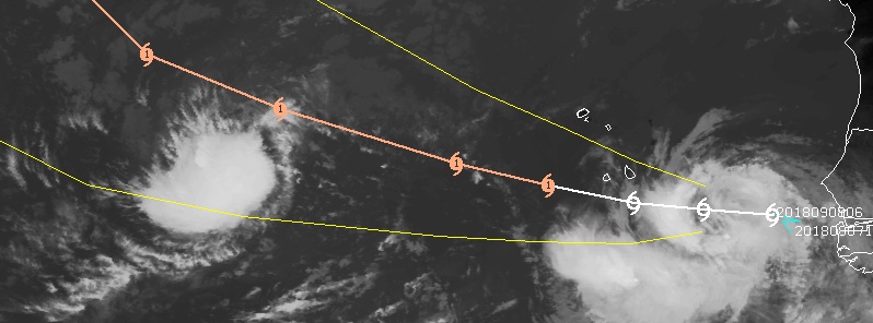
Image credit: UW-CIMSS
Tropical Storm "Helene" formed 03:00 UTC on September 8, 2018, near the coast of West Africa as the 8th named storm of the 2018 Atlantic hurricane season. The cyclone is moving westward toward the southern Cabo Verde Islands where tropical storm conditions are expected by the end of the day. The government of the Cabo Verde Islands has issued a Hurricane Watch for the southern islands of Santiago, Fogo and Brava.
At 12:00 UTC on September 8, the center of Tropical Storm "Helene" was located 465 km (290 miles) of the southernmost Cabo Verde Islands. The storm was moving W at 20 km/h (13 mph) and had maximum sustained winds of 75 km/h (45 mph) and minimum central pressure of 1 001 hPa.
On the forecast track, the center of Helene will pass very close to the southern Cabo Verde Islands late September 8 and early September 9 (AST).
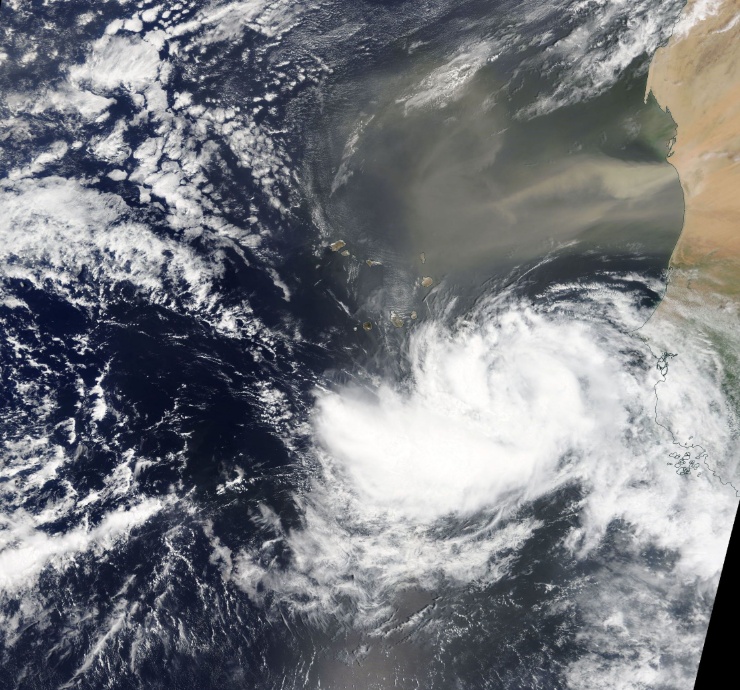
Tropical Storm "Helene" on September 8, 2018. Credit: NASA/NOAA Suomi NPP/VIIRS
A Hurricane Watch is in effect for the Cabo Verde islands of Santiago, Fogo, and Brava. A Hurricane Watch means that hurricane conditions are possible within the watch area in this case within the next 24 to 36 hours.
A Tropical Storm Warning is in effect for the Cabo Verde islands of Santiago, Fogo, and Brava. A Tropical Storm Warning means that tropical storm conditions are expected somewhere within the warning area in this case within the next 24 to 36 hours.
A general turn toward the WNW with an increase in forward speed is expected early next week.
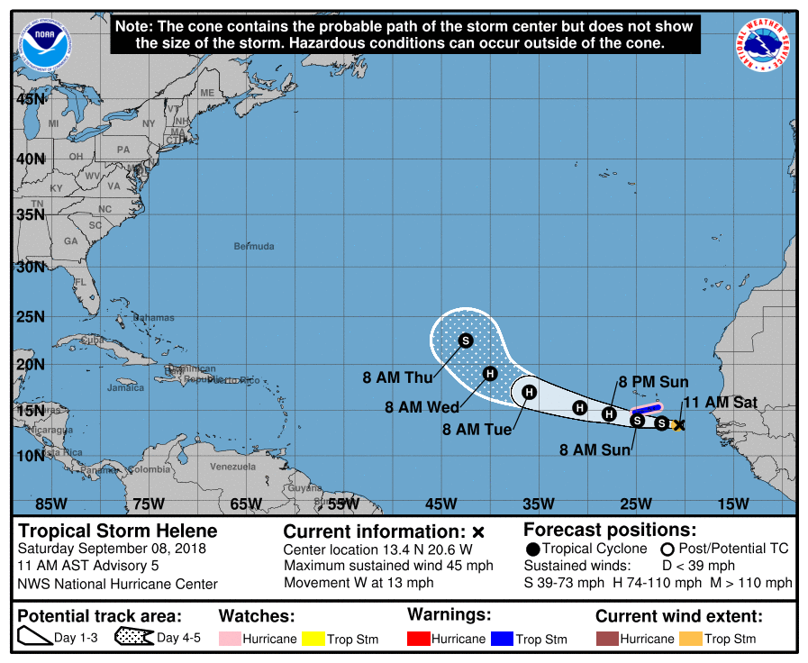
Tropical storm conditions are expected to first reach the warning area tonight or early Sunday (AST) while hurricane conditions are possible in the southernmost Cabo Verde Islands on Sunday, September 9.
Helene is expected to produce total rain accumulations of 76.2 to 127 mm (3 – 5 inches) over the southern Cabo Verde Islands through September 9, with isolated maximum amounts of 203.2 mm (8 inches). This rainfall may produce life-threatening flash floods, NWS warns.
I'm a dedicated researcher, journalist, and editor at The Watchers. With over 20 years of experience in the media industry, I specialize in hard science news, focusing on extreme weather, seismic and volcanic activity, space weather, and astronomy, including near-Earth objects and planetary defense strategies. You can reach me at teo /at/ watchers.news.
may God be with you all