
Aerial footage captures aftermath of major eruptions at Ruang volcano, Indonesia
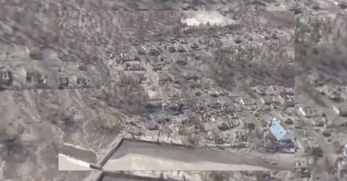
Image credit: PVMBG (stillshot)
On May 5, 2024, Indonesia’s volcanology agency, PVMGB, released aerial footage of the Ruang volcano following a series of powerful eruptions that have dramatically reshaped the landscape and forced nearly 10 000 people to evacuate permanently.
Volcanic activity at Ruang rapidly increased on April 16, when the volcano experienced a series of explosive eruptions that ejected ash as high as 16.7 km (55 000 feet) above sea level. In response, the Alert Level was raised to 4, the highest possible, and the Aviation Color Code to Red.
Initial evacuations saw approximately 800 residents from Ruang Island relocated for safety. However, as the situation worsened, by April 17, the evacuation zone expanded to include at least 11 000 people from both Ruang and the neighboring Tagulandang Island.
Hendra Gunawan, head of Indonesia’s volcanology agency, warned about the threats presented by the volcano — pyroclastic flows, incandescent rocks, and a potential tsunami triggered by parts of the volcano collapsing into the sea.
Infrastructure damage has been extensive, with at least 501 houses and buildings reported damaged. Sam Ratulangi International Airport, located about 100 km (62 miles) SSE of the volcano in Manado, had to close temporarily due to falling ash and debris.
A subsequent eruption on April 29 proved even more powerful, ejecting ash up to an estimated 19.2 km (63 000 feet) into the atmosphere. This eruption covered the Ruang and Tagulandang islands with a thick layer of volcanic ash, leading to significant property damage, including collapsed roofs due to the weight of the ash.
Heavy ashfall prompted further airport closures extending to Gorontalo Province, disrupting regional air travel and complicating logistic efforts for aid and evacuation processes.
The following video of Ruang Island was captured and released by PVMBG on May 5:
[VISUAL GUNUNGAPI RUANG 5 Mei 2024 ]
— PVMBG (@PVMBG_) May 5, 2024
Halo Kawan Mitigasi,
Berikut Visual Gunungapi Ruang di Kabupaten Sitaro, Sulawesi Utara 5 Mei 2024. Saat ini tingkat aktivitas Gunungapi Ruang berada di level IV ( Awas ). pic.twitter.com/m9xqdXcD8s
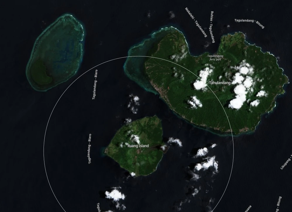
For comparison, see satellite images of the island on March 18 and April 27, 2024:
In light of these ongoing challenges, a cabinet meeting on May 2, led by Lt. Gen. TNI Suharyanto S.Sos., MM of the National Disaster Management Agency (BNPB), focused extensively on evacuation and disaster management strategies.
Current efforts concentrate on the permanent relocation of 9 800 residents living within a 7 km (4.3 miles) from the crater.
I'm a dedicated researcher, journalist, and editor at The Watchers. With over 20 years of experience in the media industry, I specialize in hard science news, focusing on extreme weather, seismic and volcanic activity, space weather, and astronomy, including near-Earth objects and planetary defense strategies. You can reach me at teo /at/ watchers.news.
Commenting rules and guidelines
We value the thoughts and opinions of our readers and welcome healthy discussions on our website. In order to maintain a respectful and positive community, we ask that all commenters follow these rules.