
Super Typhoon “Chaba” slams Okinawa, over 8 000 urged to evacuate Kume Island, Japan
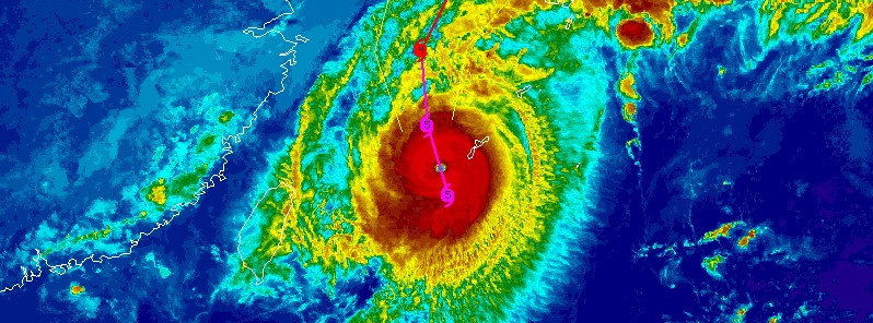
Featured image: Super Typhoon "Chaba" over Okinawa at 11:30 UTC on October 3, 2016. Credit: UW-CIMSS
Typhoon "Chaba" has exploded in intensity during its last hours of approach to the Japanese Okinawa Islands and became a super typhoon. As of 12:00 UTC, Chaba was expected to pass dangerously close or over the Kume Island in Okinawa Prefecture with maximum sustained winds of 268 km/h (166 mph) and gusts to 324 km/h (201 mph).
Over 8 000 people were recommended to evacuate earlier today, Kume Island authorities said in a statement.
Exceptionally strong winds, dangerous storm surge and very heavy rainfall are now affecting the region.
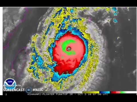
Video courtesy Robert Speta, WestPacWX
Chaba became a Category 5 hurricane equivalent at 06:00 UTC on October 3, with maximum sustained winds of 268 km/h (166 mph) and gusts to 324 km/h (201 mph).
The typhoon is expected to continue intensifying and peak around 18:00 UTC today with maximum sustained winds of 278 km/h (172 mph) and gusts to 333 km/h (207 mph).
It will then start to weaken and have maximum sustained winds near 200 km/h (124 mph) by 18:00 UTC on Tuesday, October 4, when it is expected to start its track between South Korea and Japan.
Japan could see large rainfall totals with the risk of flooding and landslides as Chaba moves along the country.
This is happening while most of the public attention is focused on Hurricane "Matthew," an extremely dangerous hurricane now approaching Haiti and Cuba.
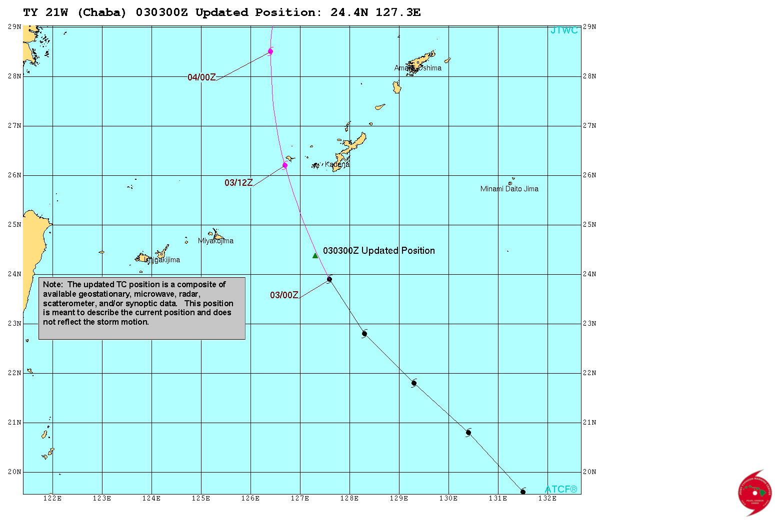
Super Typhoon "Chaba" updated position by JTWC at 03:00 UTC on October 3, 2016
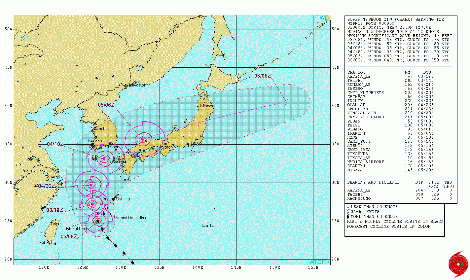
Super Typhoon "Chaba" forecast track by JTWC at 09:00 UTC on October 3, 2016
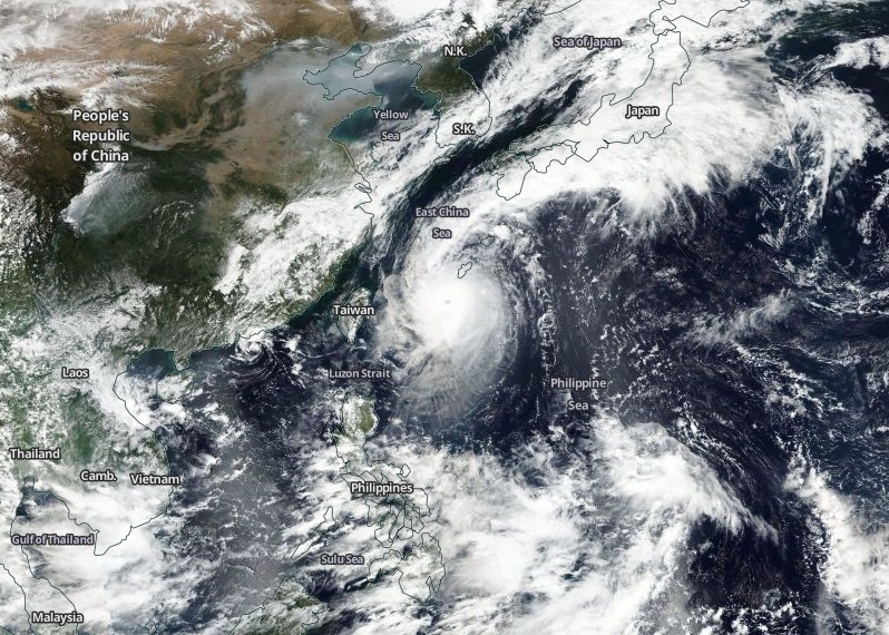
Super Typhoon "Chaba" on October 3, 2016. Credit: NASA/NOAA/DoD Suomi NPP/VIIRS

The Watchers team and our contributors bring the latest on extreme weather, earthquakes, volcanic eruptions, space weather, and all things science. We're all about making sense of the natural world and keeping you informed on what’s happening. Got a tip or a question? Hit us up using the form at newstips!
Published in the last 24 hours
- Cyclone Akvan weakens after landfall near Gopalpur; more than 300 000 evacuated in Odisha, India
- People who hid under an Oklahoma highway overpass from a 1999 tornado lost fingers, ears and noses, and three people died near or under overpasses that day Epicenter
- In January 1862, California’s new governor took a rowboat to his own inauguration, after 45 days of storms had turned the Central Valley into a lake up to 300 miles long Epicenter
- People who stayed put through the 2017 hurricanes were more often the ones with flood insurance, a survey of 2,557 Gulf Coast residents found, and the authors suggest the policy may have made the storm feel less dangerous Epicenter
