
Torrential rains swamp Texas, violent flooding expected to continue

Featured image: Texas under water - October 23, 2015. Image credit: @reedtimmerTVN
North and Central Texas reported heavy flooding through October 23 and 24, 2015. Raging waters overflew roads and caused major traffic disruptions across the affected regions. A Union Pacific train was derailed on October 24, media reported.
Severe rainstorms that have resulted from the combination of moisture rich weather systems situated over the South Central US triggered major floods across the region. As little to no rain has fallen in the area since May, the soil is not capable of absorbing large amounts of precipitation which enhances the flooding.
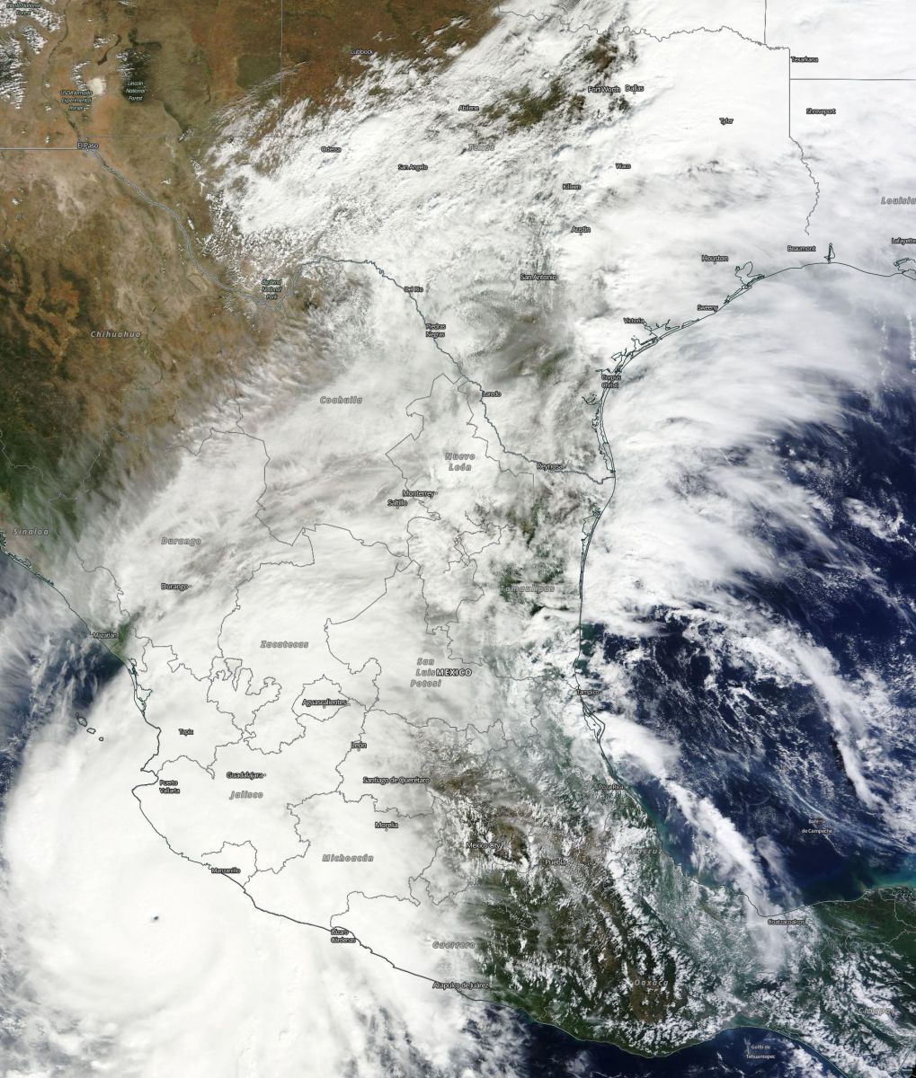
Synoptic situation over South Central US and Mexico, October 23, 2015. Image credit: NASA/Terra MODIS
On October 24, violent flood water derailed a Union Pacific train, and water rescue teams were quickly deployed to recover stranded personnel north of Corsicana, Texas."Our conductor and engineer, once they put the train into emergency stop, they were able to jump free of the locomotive as they saw the water start to rise. They swam to some high ground there. They're wet but in good condition," Union Pacific spokesman Jeff DeGraff stated.
Video credit: Reed Timmer/AccuWeather
Numerous roads were closed and at least 30 water rescues have been performed in Odessa. Dallas streets were completely immersed in water rising up to several meter.
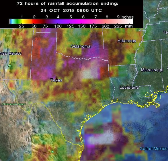
72-hr rainfall accumulation as observed by GPM Core Observatory. Image credit: Google/NASA/JAXA GPM
457.2 mm(18 inches) of rain was reported to accumulate in Corsicana during 24 hours, close to historic amounts measured recently in South Carolina. 511.8 mm (20.15 inches) of precipitation was measured near Powell, 401 mm (15.79 inches) in Malone, 348 mm (13.17 inches) at Cedar Creek Reservoirs while 474.2 mm (18.67 inches) was reported in Grapevine on October 24.
Video credit: Associated Press
Unfortunately, severe rainstorms are yet to come to South Texas, as the cold front is being fed by the moisture of Hurricane "Patricia's" remnants.
Freight train derails in Navarro Co. floodwaters WATCH LIVE: https://t.co/lqzz5eSN3O pic.twitter.com/WU83mHaJKg
— WFAA-TV (@wfaachannel8) October 24, 2015
"As Patricia moves across Mexico, remnant moisture will stream north into Texas. The ex-hurricane will then develop into a non-tropical low when it reaches Texas in the coming days, producing additional heavy rain and coastal flooding," explained Quincy Vagell, weather.com meteorologist.
Moisture from #Patricia feeding into #Texas low over the weekend and early next week! heavy #rain #flooding https://t.co/w4iwrRWQTN
— Mario Picazo (@picazomario) October 24, 2015
Heavy rainfalls accompanied with strong winds are expected to cause up to 1.5 meter (5 feet) tidal rise across the upper Texas Gulf Coast. Texas and Louisiana will continue to experience heavy downpours through October 25, and residents are advised to remain alert as life-threatening flood conditions continue across the affected areas.
Commenting rules and guidelines
We value the thoughts and opinions of our readers and welcome healthy discussions on our website. In order to maintain a respectful and positive community, we ask that all commenters follow these rules.