
Extremely dangerous Hurricane “Patricia” places Mexico on high alert
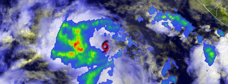
Featured image: NASA's GPM satellite saw that the western side of Tropical Storm Patricia was packing most of the storm's moderate and heavy rainfall, October 21, 2015. Image credit NASA/SSAI/JAXA, Hal Pierce
Extremely dangerous Hurricane "Patricia" is expected to make landfall in Mexico on October 23, 2015, National Hurricane Center (NHC) reported. The system is currently racing toward Mexico while still gaining strength over the warm waters of eastern Pacific. Residents within the watch zone are urged to complete preparations and remain alert.
Patricia, now a full-blown category 4 hurricane, was located about 400 km (250 miles) south of Manzanillo, Mexico and moving west-northwestward at 20 km/h (13 mph) on October 22, 21:00 UTC, according to NHC. The system is packing maximum sustained winds of 215 km/h (130 mph) with gusts reaching 259.3 km/h (161.1 mph) while its central pressure is estimated at 953 hPa.
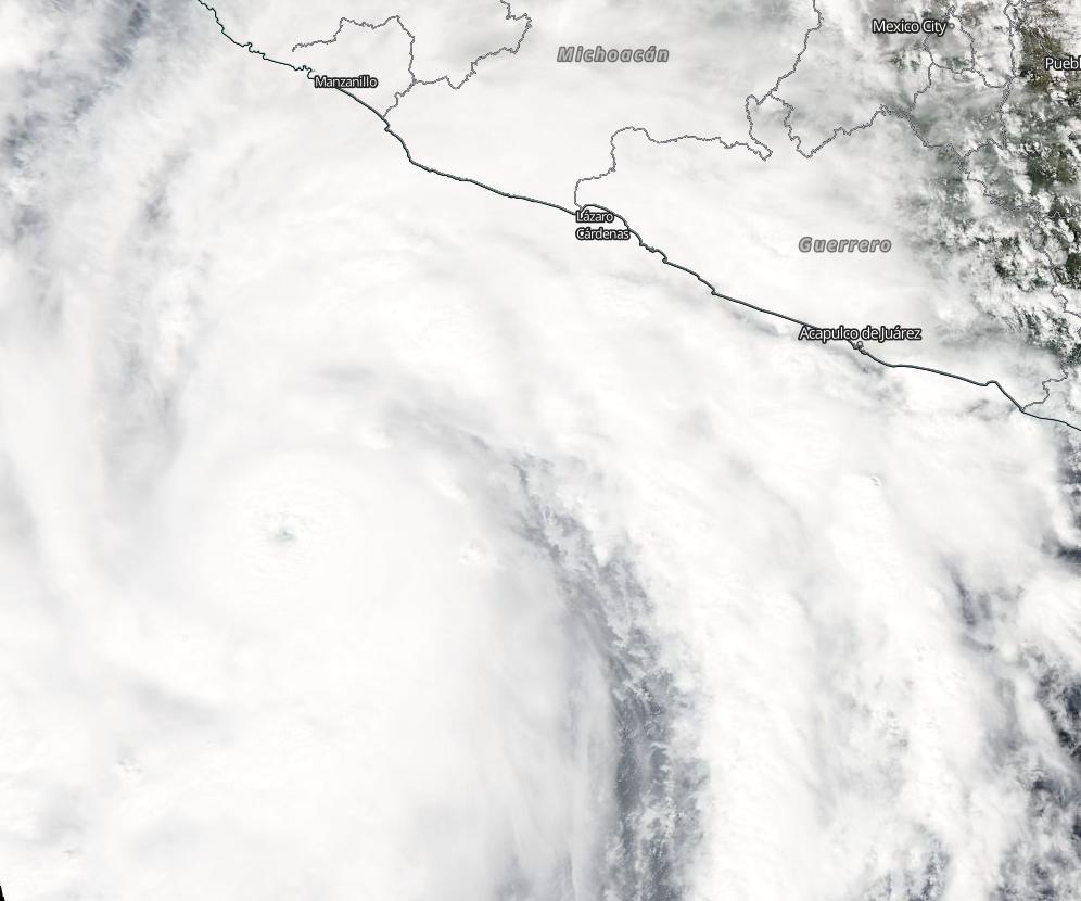
Hurricane "Patricia" approaching the coast of Mexico, October 23, 2015. Image credit: NASA/Aqua MODIS
Winds of hurricane force have spread up to 45 km (30 miles) out from the center while tropical storm force winds expand about 280 km (175 miles) away.
Hurricane "Patricia" is expected to turn northwestward and then north and its eye will make landfall within the hurricane warning zone by the night of October 23, NHC reports. The system will gain some strength by the end of the day and will remain an extremely dangerous hurricane through landfall.
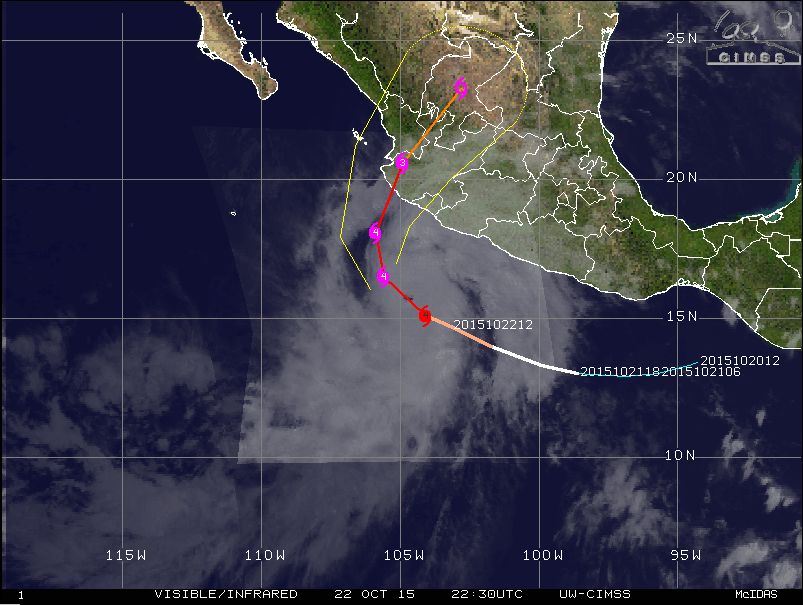
Hurricane "Patricia" track of movement, October 22, 22:30 UTC. Image credit: UW-CIMSS
Hurricane winds will reach the warning zone by the evening of October 23, while winds of tropical force are expected to affect the area even sooner. Strong gusts will make outside preparations difficult and even dangerous, and NHC therefore advises local residents to complete all the preparations as soon as possible.
The system is forecast to produce a total rainfall accumulation between 152.4 and 304.8 mm ( 6 to 12 inches), and the precipitation amount could rise up to 508 mm (20 inches) across the states of Jalisco, Colima, Michoacan and Guerrero. Heavy rainfalls could induce life-threatening flash floods and dangerous mudslides.
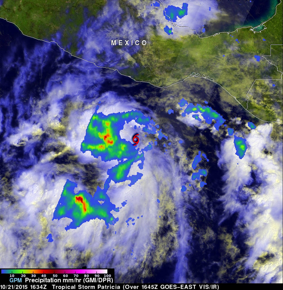
NASA's GPM satellite observed the western side of Tropical Storm Patricia was packing most of the storm's moderate and heavy rainfall, October 21, 2015. Image credit: NASA/SSAI/JAXA, Hal Pierce
A large storm surge is expected to cause strong coastal flooding near and to the right of where the center makes landfall, according to NHC. Large and destructive waves are likely near the coast.
Storm generated swells are already affecting parts of southern coast of Mexico, and will likely induce dangerous surfs and rip currents.
The Government of Mexico has extended the Hurricane Warning north of Cabo Corrientes to San Blas and discontinued the Tropical Storm Watch from east of Lazaro Cardenas to Tecpan De Galeana.
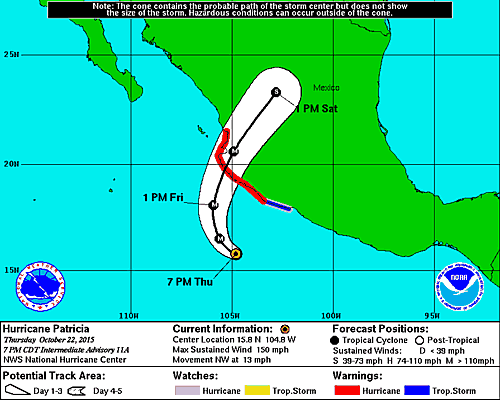
Hurricane "Patricia" 3-day forecast track. Image credit: NWS/NOAA
Currently, a Hurricane Warning is in place for San Blas to Punta San Telmo, while both a Hurricane Watch and a Tropical Storm Warning are valid across the regions east of Punta San Telmo to Lazaro Cardenas, according to NHC.
Citizens are strongly advised to stay alert and make sure all proposed safety measures have been taken.
Commenting rules and guidelines
We value the thoughts and opinions of our readers and welcome healthy discussions on our website. In order to maintain a respectful and positive community, we ask that all commenters follow these rules.