
Tropical Storm “Ela” – central Pacific’s first named storm of the 2015 season
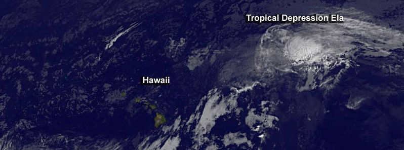
Featured image: Tropical Depression "Ela" on July 10, 2015. Credit: NASA/NOAA GOES Project.
Tropical Depression 4E formed in the eastern Pacific ocean, crossed the 140 W longitude, which separates eastern from central Pacific Ocean, around 03:00 UTC on July 8 and entered the central Pacific Ocean. Early on July 9, this system became Tropical Storm "Ela" – the first named storm of the 2015 central Pacific hurricane season.
AIRS instrument aboard Aqua satellite measured the temperatures of storm's cloud tops using infrared light at 22:29 UTC on July 8. The data showed that wind shear from the southwest was pushing all the strongest thunderstorms with the coldest cloud tops (-52 °C (-63 °F)) to the northeast of the center. Storms that high in the troposphere, the lowest layer of Earth's atmosphere, have the potential to drop heavy rain, but Ela was far from land areas and the rainfall occurred at sea.
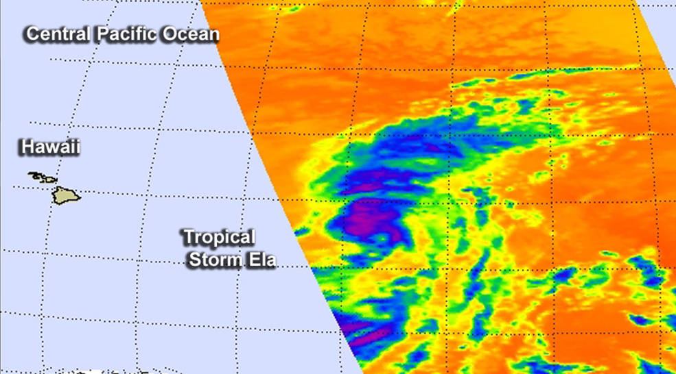
Image credit: NASA Aqua/AIRS – JPL/Ed Olsen.
On July 9 at 15:00 UTC, the center of Tropical Storm "Ela" was located about 940 km (585 miles) east of Hilo, Hawaii, and about 1 230 km (765 miles) east of Honolulu, Hawaii. Its maximum sustained winds were near 65 km/h (40 mph), estimated minimum central pressure was 1 003 hPa. Ela was moving toward the NW near 20 km/h (13 mph).
Hawaii in the middle of a triangle of tropical cyclones
On July 10, NOAA's GOES-West satellite saw that Hawaii is in the middle of a triangle of tropical cyclones. Ela weakened into a post-tropical depression northeast of Hawaii, and the forecast called for the storm to move W toward the islands over the weekend of July 11 and 12 and dissipate.
Newborn Tropical Depression 01C was west of Hawaii, while newborn Tropical Depression 02C was south of the Big Island. Post-Tropical Depression "Ela", however, is the only one expected to affect Hawaii.
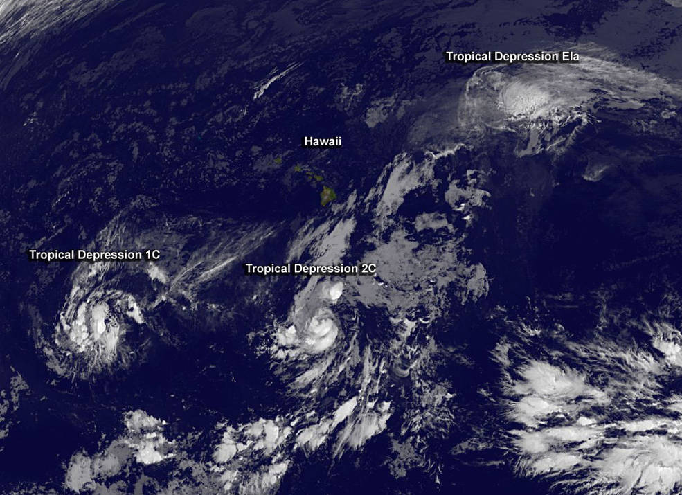
NOAA's GOES-West satellite captured this infrared image of Tropical Depression 1C, TD 2C, and Tropical Depression "Ela" in the central Pacific Ocean at 12:00 UTC on July 10. Credit: NASA/NOAA GOES Project.
NOAA's Central Pacific Hurricane Center (CPHC) noted today that swells from Ela will cause high surf along east facing shores of the main Hawaiian Islands over the next several days.
At 15:00 UTC today, Ela was moving toward the WNW near 15 km/h (9 mph) and this motion is expected to continue with a gradual turn toward the west. Maximum sustained winds were near 55 km/h (35 mph) and weakening is forecast the next two days. The estimated minimum central pressure is 1 008 hPa.
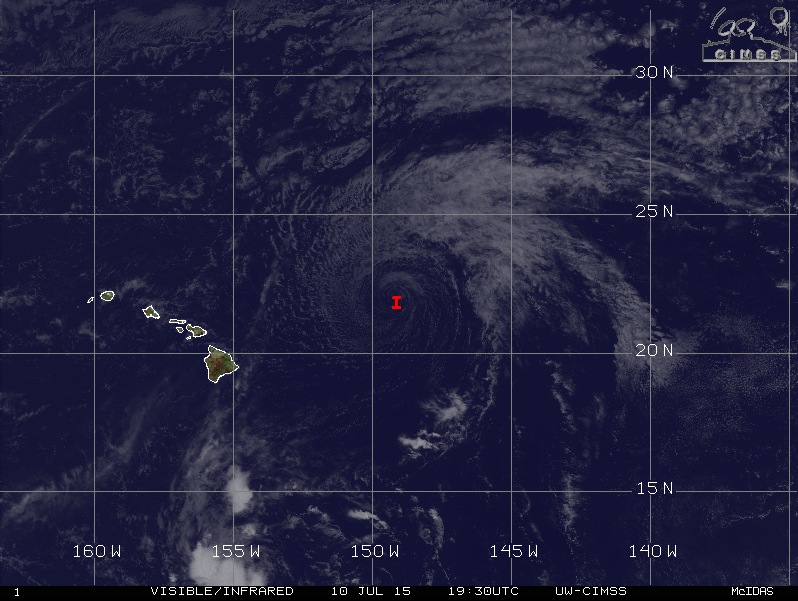
Post-Tropical Depression "Ela" on July 10, 2015. Image credit: UW-CIMSS.
CPHC noted that "Ela will become an increasingly shallow system with the remnant low or circulation center getting caught up in the trade wind flow over the weekend." Ela is forecast to dissipate early Sunday, July 12.
I'm a dedicated researcher, journalist, and editor at The Watchers. With over 20 years of experience in the media industry, I specialize in hard science news, focusing on extreme weather, seismic and volcanic activity, space weather, and astronomy, including near-Earth objects and planetary defense strategies. You can reach me at teo /at/ watchers.news.
Commenting rules and guidelines
We value the thoughts and opinions of our readers and welcome healthy discussions on our website. In order to maintain a respectful and positive community, we ask that all commenters follow these rules.